This website works best with a newer web browser such as Chrome, Firefox, Safari or Microsoft Edge. Internet Explorer is not supported by this website.

Category: Severe convection

Severe weather over northeast Illinois

Severe thunderstorms developed over northeast Illinois late in the afternoon on 9 August, and a series of tornadoes resulted. Storm Reports (from the Storm Prediction Center) are shown below. The mp4 animation above (click here for a large animated gif) shows 1-minute GOES-16 Mesoscale Sector 2 visible imagery (0.64 µm) from... Read More

Severe thunderstorms in northern Minnesota

1–minute Mesoscale Domain Sector GOES-16 (GOES-East) “Red” Visible (0.64 µm) images and “Clean” Infrared Window (10.35 µm) images (above) include time-matched plots of SPC Storm Reports produced by supercell thunderstorms that moved east-southeastward across northern Minnesota during the afternoon and early evening hours on 26 July 2021. Severe reports included a tornado at 2213 UTC and hail as large as to 3.0 inches in diameter... Read More

Severe weather in the central Plains

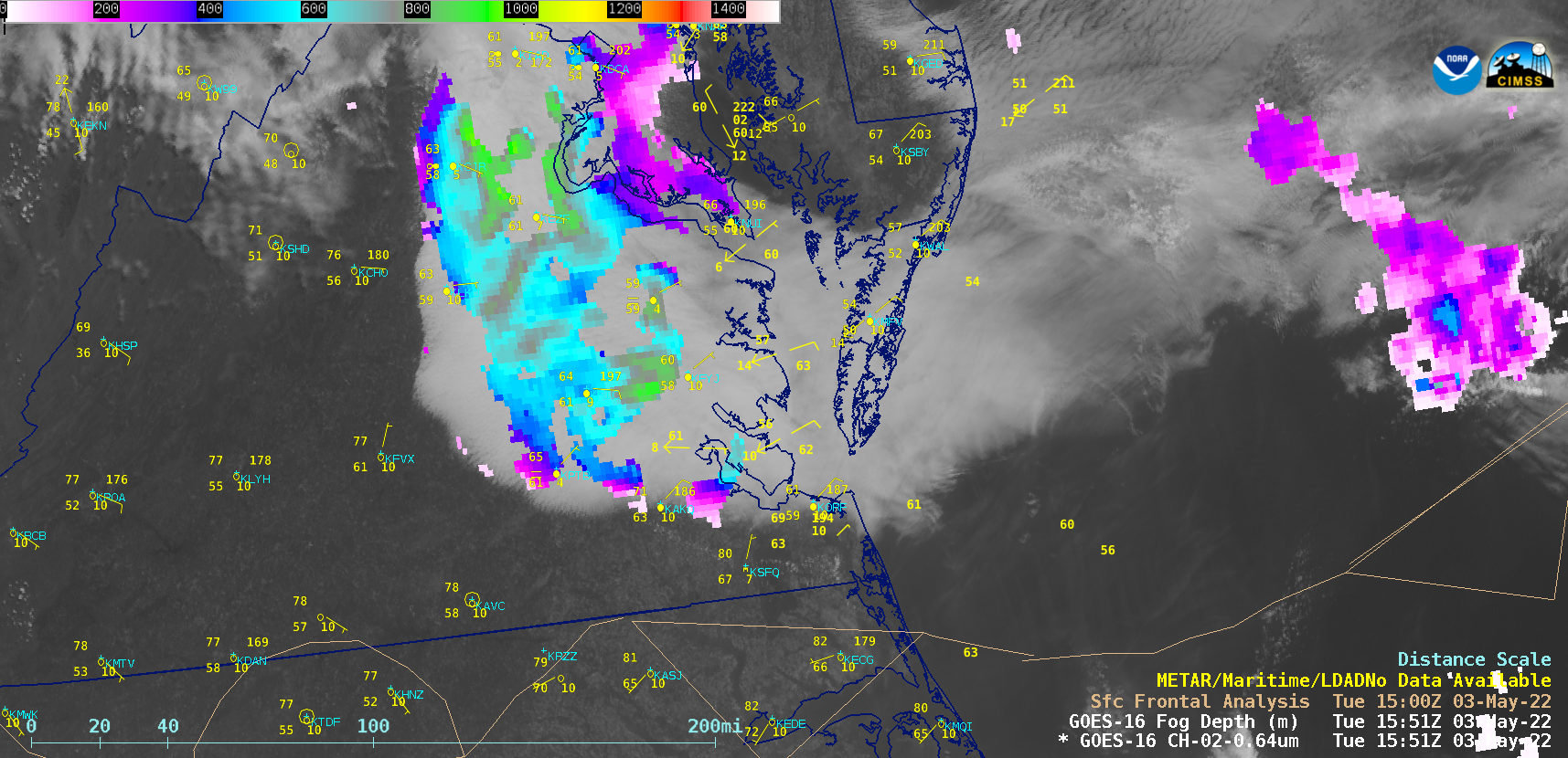
1-minute Mesoscale Domain Sector GOES-16 (GOES-East) “Red” Visible (0.64 µm) images (above) include time-matched plots of SPC Storm Reports — and showed severe thunderstorms across eastern Colorado, western Kansas and far southwestern Nebraska late in the day on 19 June 2021. Numerous pulsing overshooting tops were evident with many of these storms. Wind gusts to 88 mph were reported in KansasThe corresponding 1-minute GOES-16... Read More