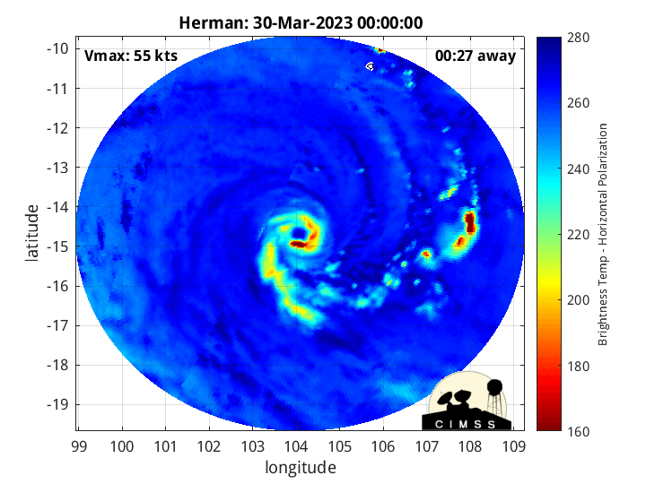
SAR Winds over Cyclone Herman in the south Indian Ocean
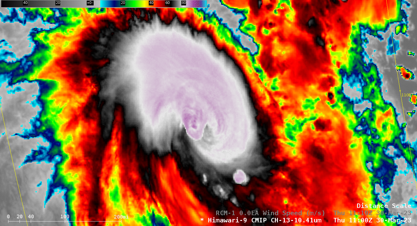
Himawari-9 imagery for the hour surrounding an RCM-1 pass over the center of Severe Tropical Cyclone Herman, below, shows strong convection (with widespread brightness temperatures colder than -85oC — light purple in this enhancement — with isolated pixel values cooler than -90oC — in purple). Peak Synthetic Aperture Radar (SAR) winds from the Radarsat Constellation Mission-1 satellite exceeded 80 m/s! Click here to view the storm track, and text describing the storm, both from this Australian Bureau of Meteorology website. (Here’s the 1-hour animation without the SAR winds).

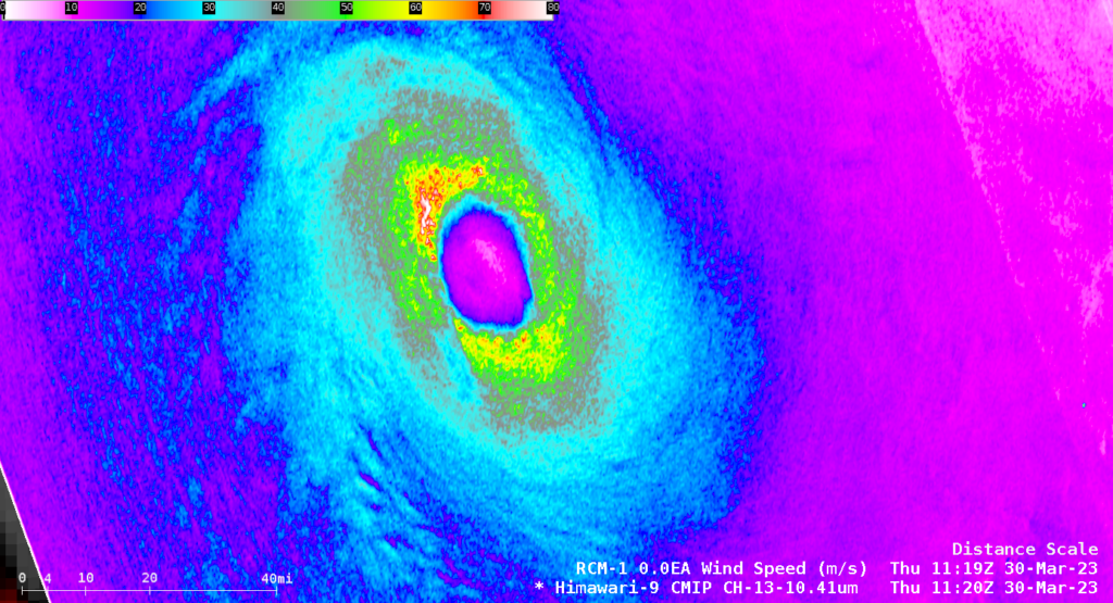
A zoomed-in picture of the SAR wind analysis is shown below. The data can also be viewed at this SAR Tropical Cyclone site specific to Herman (Direct link to image). Strong winds encircle the entire eye.
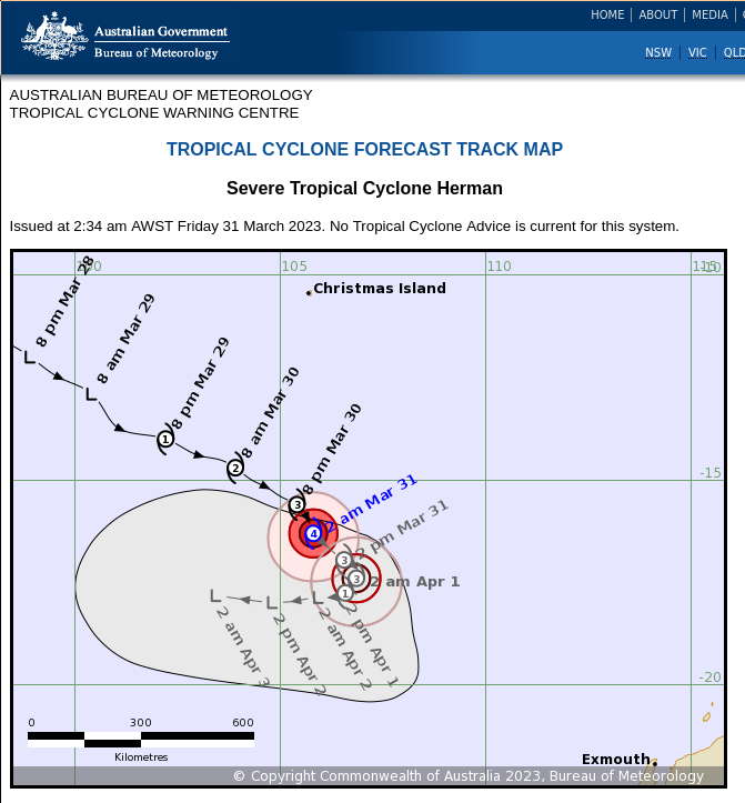
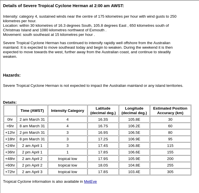
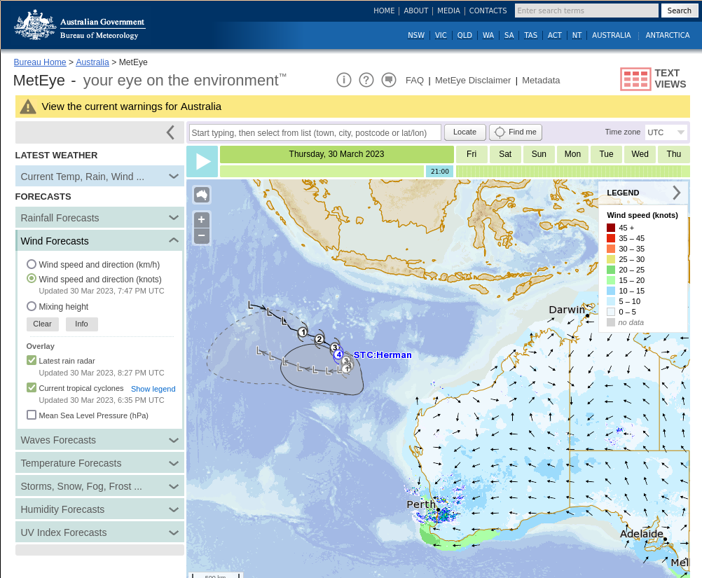
The image below, from the Australian Bureau of Meteorology ‘MetEye‘ website, shows Herman’s track relative to Australia.
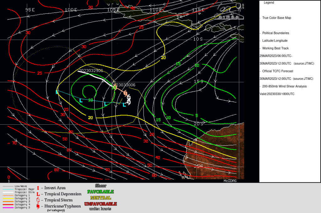
Herman is moving through an atmosphere of low shear, as shown below (image from this site), and is over waters with sea-surface temperatures of 27-28oC (not shown).
The MIMIC-TC animation below (from this site) shows the closing off of the eyewall that accompanied Herman’s rapid intensification
More information on Herman is available at the Joint Typhoon Warning Center. Also, note that the Target Sector from JMA Is over Herman (link).
__________________________________________________________________

JMA Himawari-9 Infrared Window (10.4 µm) images, from 0902 UTC on 30 March to 0132 UTC on 31 March (credit: Scott Bachmeier, CIMSS) [click to play animated GIF | MP4]
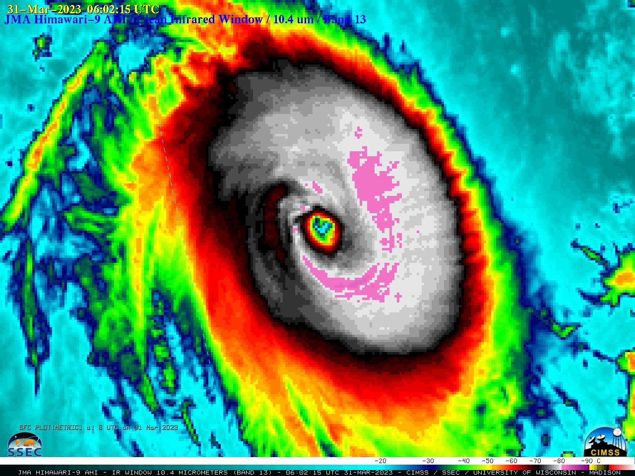
2.5-minute Target Sector Himawari-9 Infrared Window (10.4 µm) images (above) showed Herman as it rapidly intensified to a Category 3 storm, eventually displaying a pinhole eye. Note that the eye exhibited some trochoidal motion (wobble) as the storm moved south-southeastward — a behavior often seen with intense tropical cyclones.
===== 31 March Update =====
JMA Himawari-9 Infrared Window (10.4 µm) images, from 0602 UTC on 31 March to 1707 UTC on 31 March (credit: Scott Bachmeier, CIMSS) [click to play animated GIF | MP4]
Herman continued its remarkable rapid intensification on 31 March, with 2.5-minute Target Sector Himawari-9 Infrared images showing an intermittent open eye persisting past 15 UTC (above).
A Himawari-9 Infrared – Water Vapor Difference product from the CIMSS Tropical Cyclones site (below) displayed large values (shades of red to violet) — indicating that cloud tops within the eyewall were overshooting the tropopause (reference).
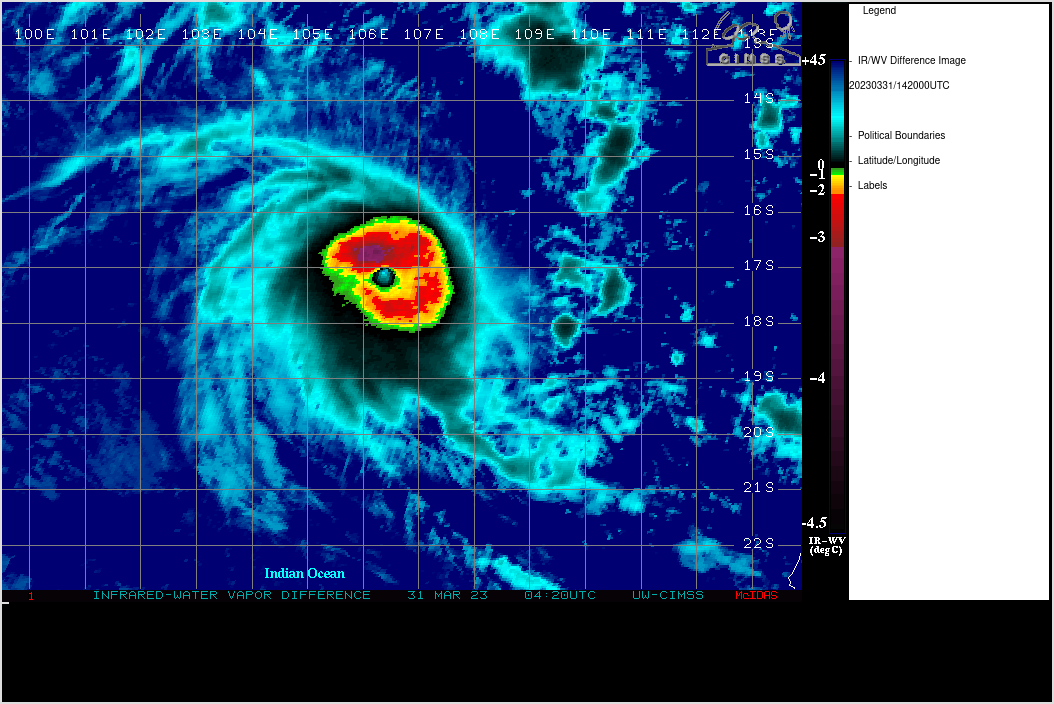
Himawari-9 Infrared – Water Vapor Difference product