Severe Tropical Cyclone Lola in the southwest Pacific
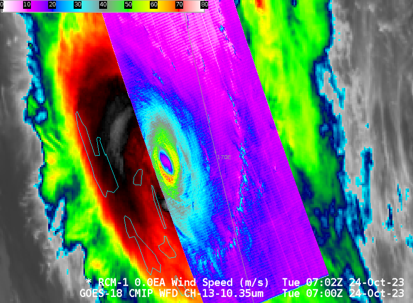
MIMIC Total Precipitable Water fields, above, show the development of Tropical Cyclone Lola near 170oE Longitude. The storm pushed south out of the western Pacific Intertropical Convergence Zone. By 0000 UTC on the 23rd, it began to entrain dry air into its circulation as it approached Vanuatu. In addition to... Read More
