East Pacific Hurricane Beatriz off the coast of Mexico

GOES-18 “Red” Visible (0.64 µm) and “Clean” Infrared Window (10.3 µm) images [click to play animated GIF | MP4]
A DMSP-17 Microwave (85 GHz) image at 1322 UTC (below) from the CIMSS Tropical Cyclones site indicated that the eyewall had not yet completely closed at that time.
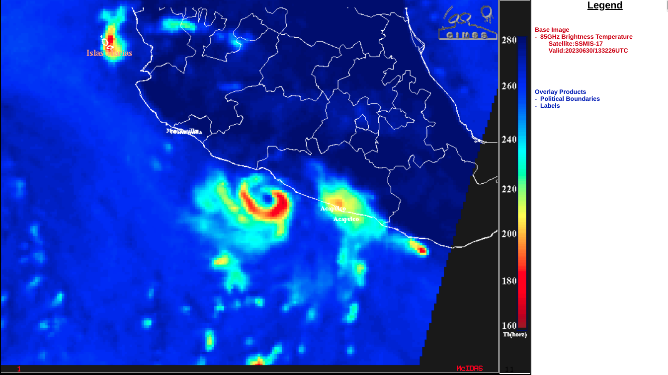
DMSP-17 SSMIS Microwave (85 GHz) image at 1332 UTC [click to enlarge]
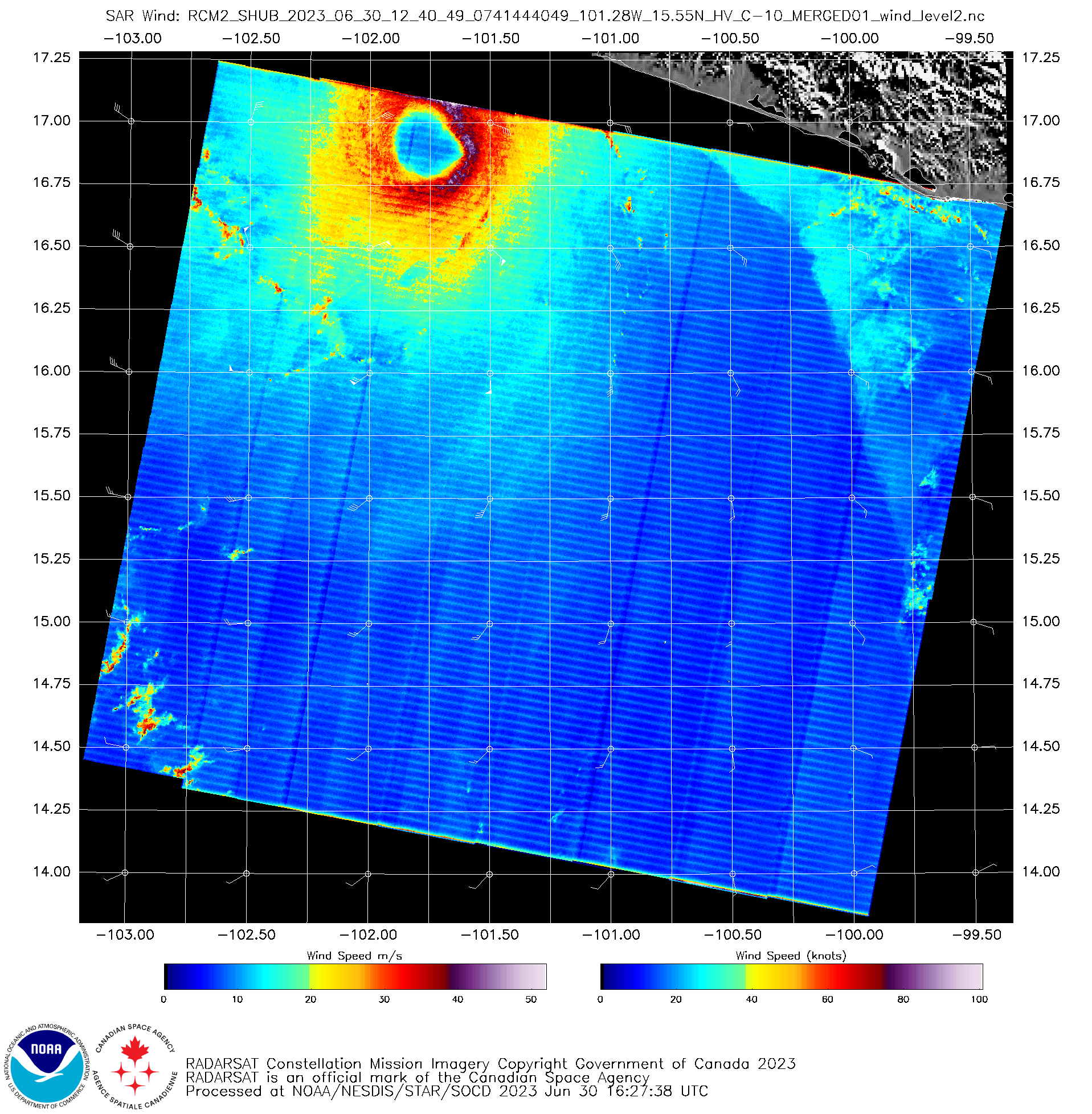
RCM-2 SAR winds at 1240 UTC [click to enlarge]