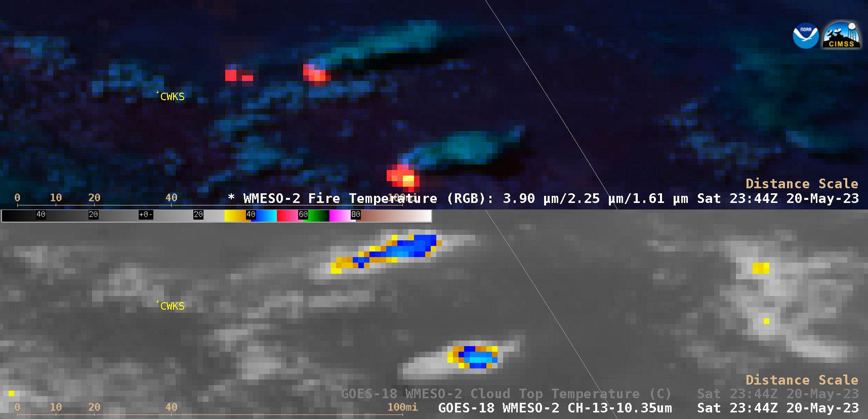
Eruptive period of Popocatépetl in Mexico
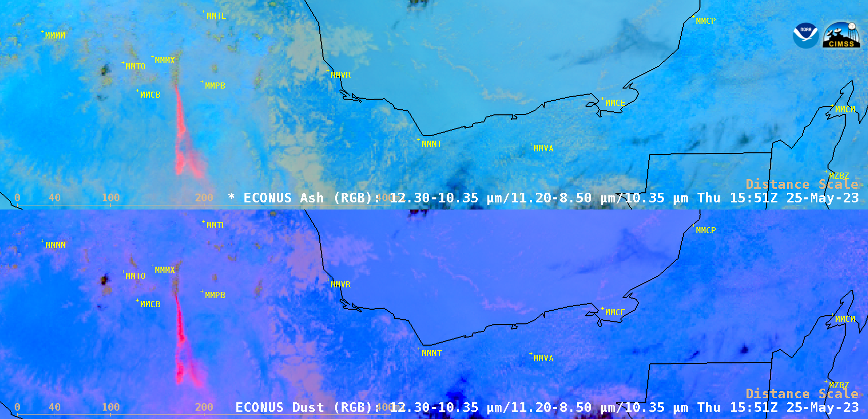
GOES-16 (GOES-East) Ash RGB images and Dust RGB images (above) showed numerous volcanic plumes emanating from Popocatépetl in central Mexico during the 5-day period from 21 May – 25 May 2023. On 21 May, the airport at Puebla (MMPB) was temporarily closed, due to the potential adverse impact of volcanic ash to... Read More