Pyrocumulonimbus clouds in Canada’s Northwest Territories
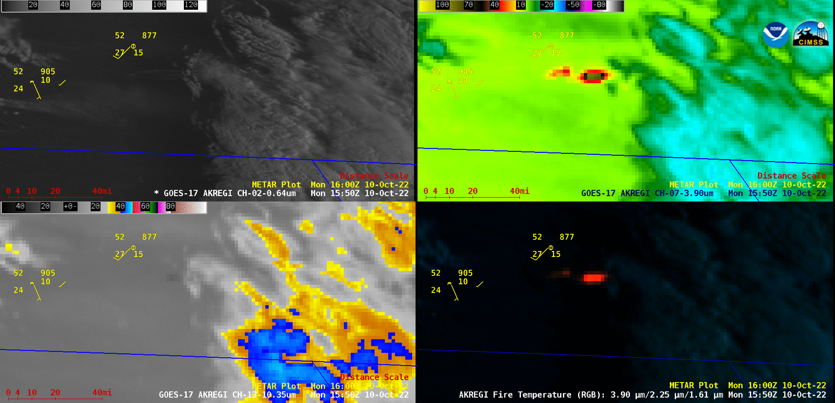
GOES-17 “Red” Visible (0.64 µm, top left), Shortwave Infrared (3.9 µm, top right), “Clean” Infrared Window (10.3 µm, bottom left) and Fire Temperature RGB (bottom right) images [click to play animated GIF | MP4]
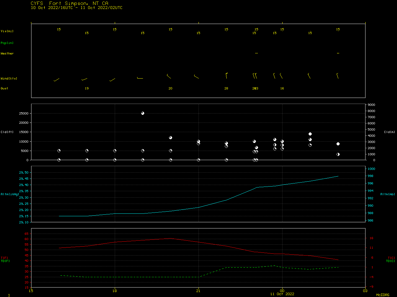
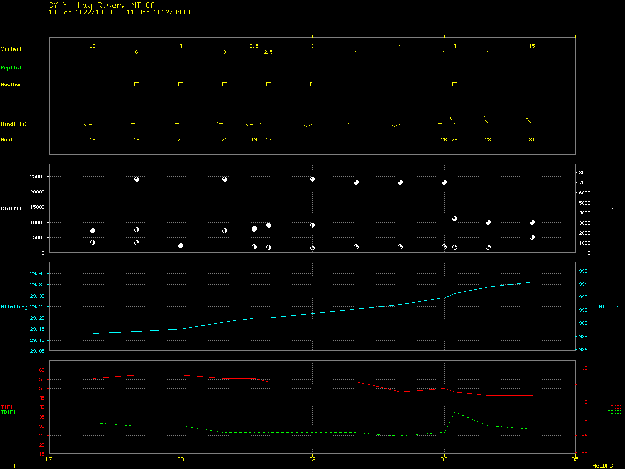
A toggle between Suomi-NPP VIIRS Visible (0.64 µm) images at 1903 and 2042 UTC (below) displayed the large smoke plume that drifted southeastward as far as northern Saskatchewan. About 200 miles southeast of the wildfire source region, this smoke reduced the surface visibility to 3 miles or less at Hay River NT around 21 UTC.
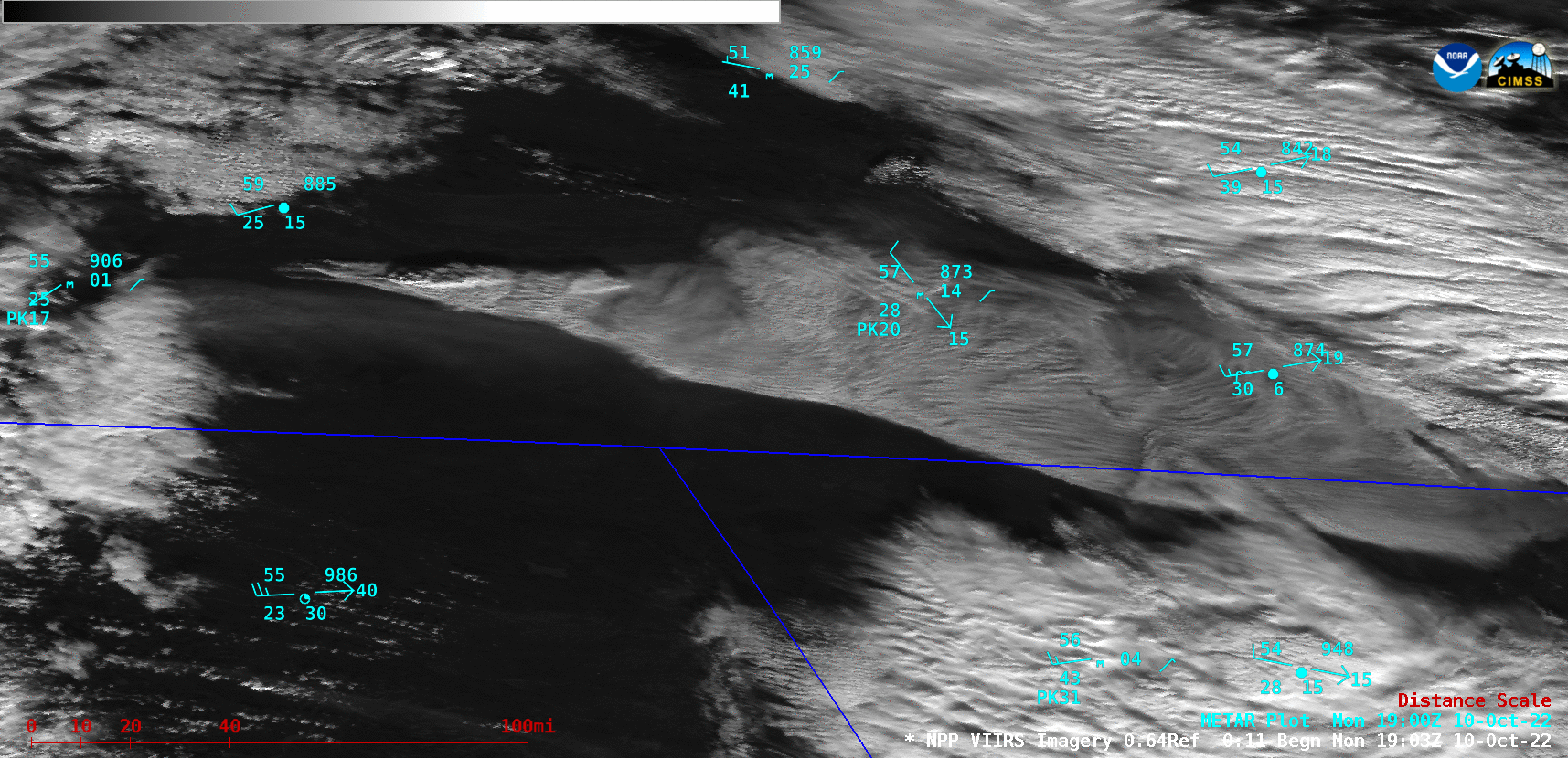
Suomi-NPP VIIRS Visible (0.64 µm) images at 1903 and 2042 UTC [click to enlarge]
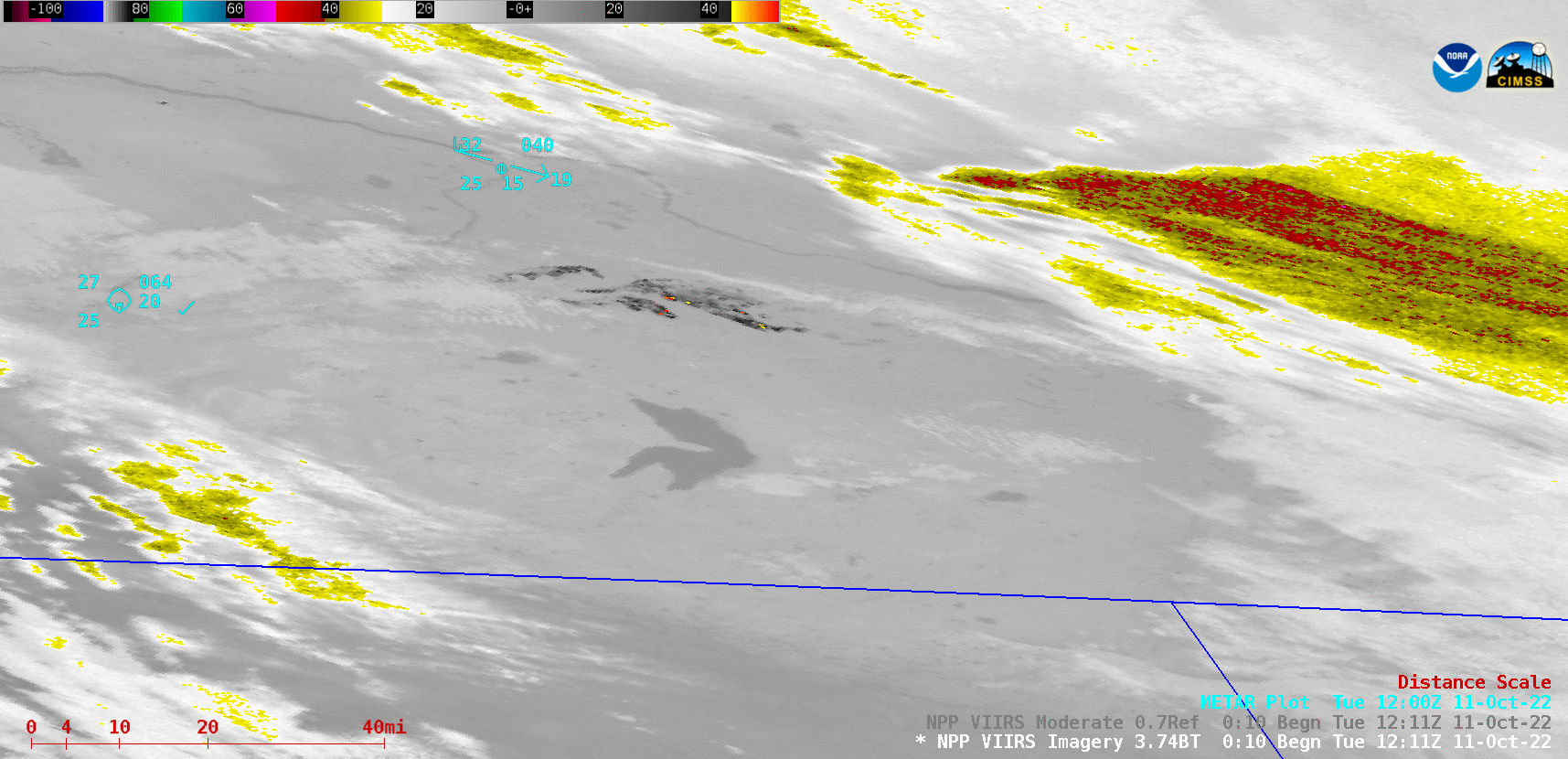
Suomi-NPP VIIRS Shortwave Infrared (3.74 µm) and Day/Night Band (0.7 µm) images at 1211 UTC [click to enlarge]
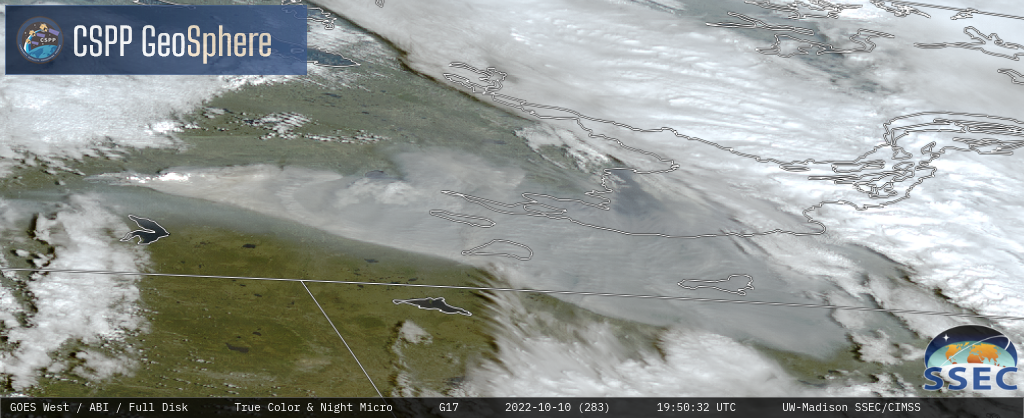
GOES-17 True Color RGB images [click to play MP4 animation]
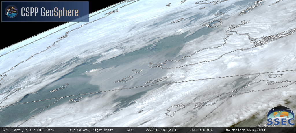
GOES-16 True Color RGB images [click to play MP4 animation]