Blowing dust across the Central Plains

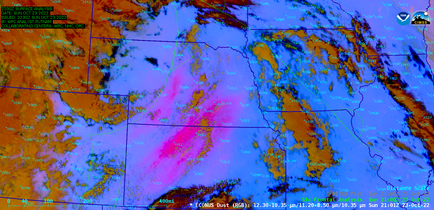
GOES-16 Dust RGB images, with and without plots of hourly surface observations [click to play animated GIF | MP4]
GOES-16 (GOES-East) Dust RGB images (above) highlighted large plumes of blowing dust (brighter shades of pink) — lofted by strong southwesterly winds (gusting in excess of 60 mph) ahead of an approaching cold front — across parts of the Central Plains on 23 October 2022. This blowing dust resulted in surface visibility values as low as 1 mile at locations such as Liberal KS and Burlington CO. The source region of the largest dust plume was western Kansas, an area experiencing exceptional to extreme drought conditions (according to the US Drought Monitor site).
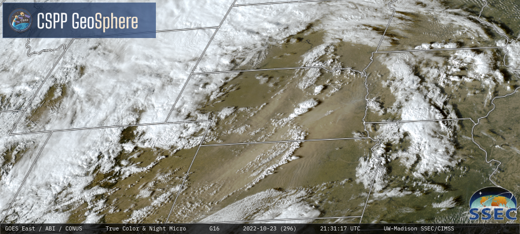
GOES-16 True Color RGB and Nighttime Microphysics RGB images from the CSPP GeoSphere site (below) showed this blowing dust as lighter shades of tan during the daytime and varying shades of pink during the nighttime. Dust was transported as far northeastward as southern Minnesota and far western Wisconsin by 04 UTC on 24 October; dust briefly reduced the visibility to 4 miles at Sioux City IA and 6 miles at Yankton SD.
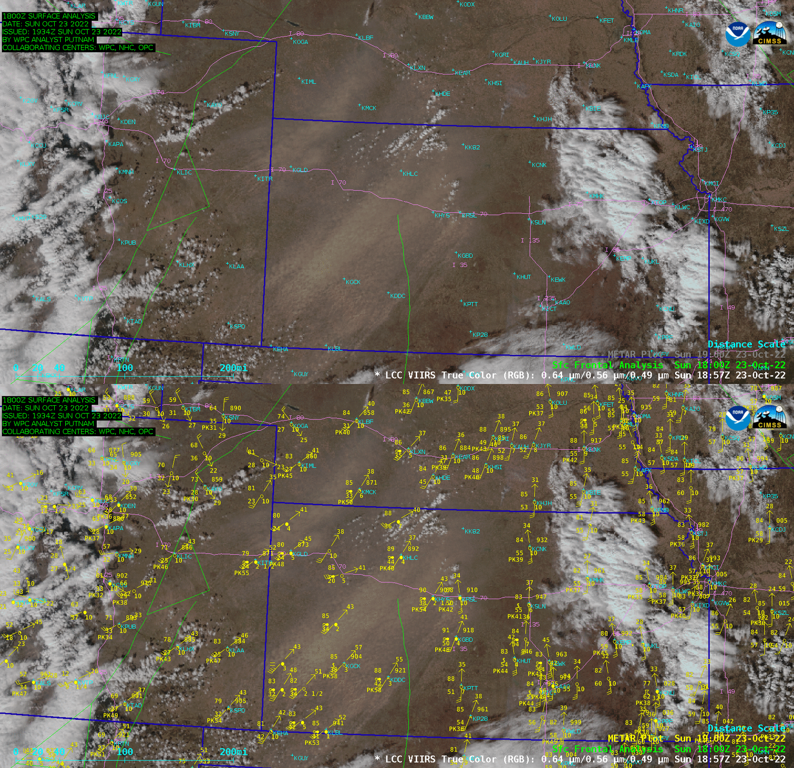
A NOAA-20 VIIRS True Color RGB image valid at 1904 UTC (below) indicated that this blowing dust likely affected travel along Interstate 70 across far eastern Colorado and western Kansas — with visibility restrictions to 2.5 miles and wind gusts of 54-55 knots (62-63 mph) at that particular time.

NOAA-20 VIIRS True Color RGB image valid at 1904 UTC, with and without plots of surface observations [click to enlarge]


