Lake effect convection over southern Lake Michigan
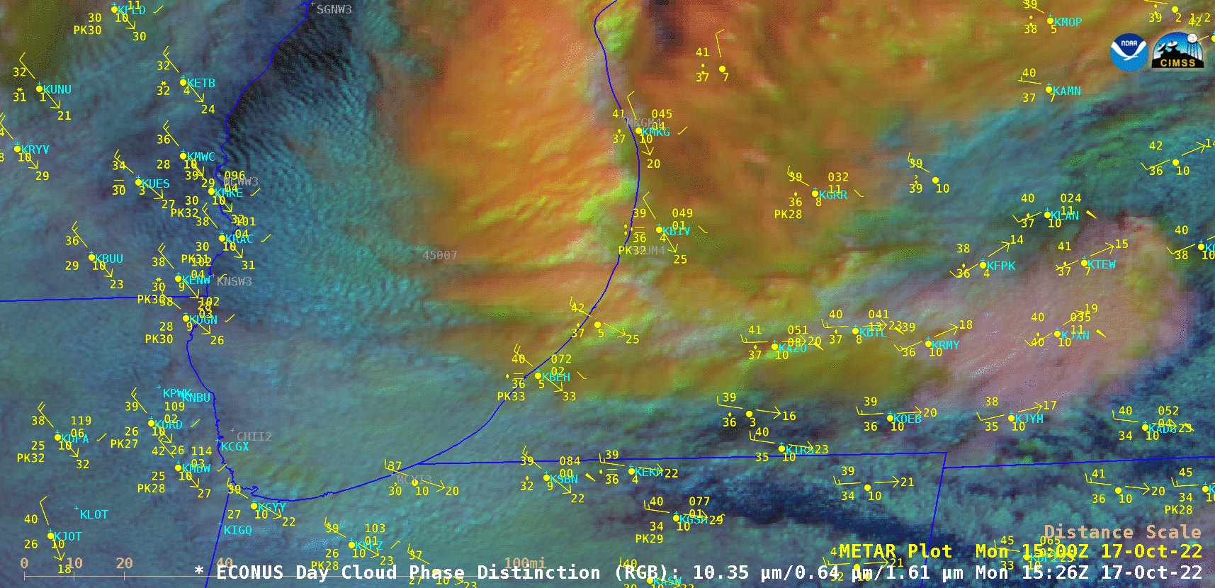
GOES-16 Day Cloud Phase Distinction RGB images [click to play animation | MP4]
The GOES-16 Day Cloud Phase Distinction RGB image at 1831 UTC (below) includes cursor readouts of associated Cloud Top Phase and Cloud Top Height derived products at a point near the center of the offshore convection. Qualitative interpretation of RGB color hues can be somewhat difficult or misleading at times — this method of Level 2 derived product display ensures a more accurate analysis of RGB image features. For example, the cloud top at the cursor location shown below exhibited a 10.3 µm infrared brightness temperature of -43.05ºC at a height of 26,766 feet, ensuring Ice as the cloud top phase.
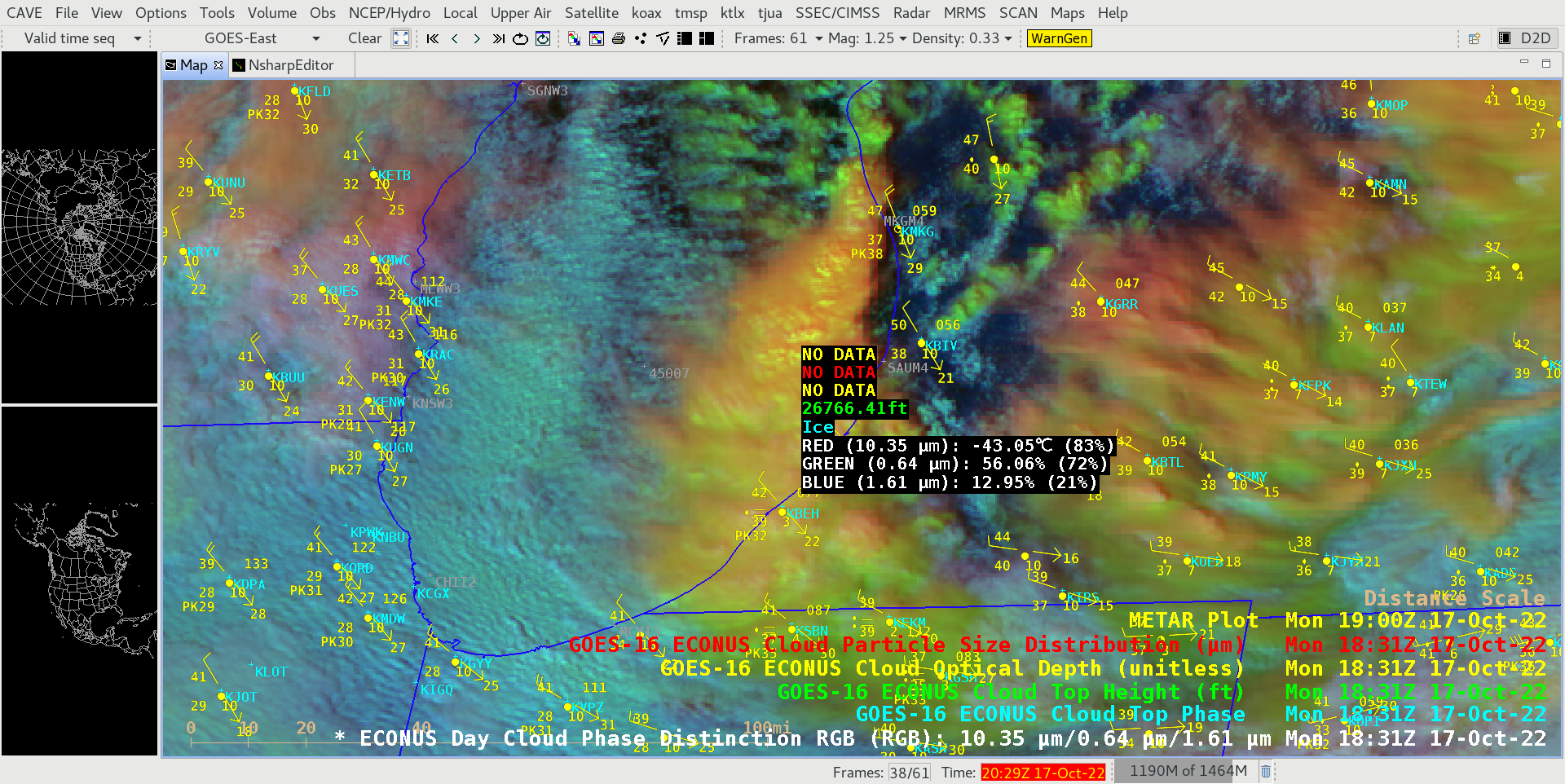
GOES-16 Day Cloud Phase Distinction RGB image at 1831 UTC, with cursor readouts of associated Cloud Top Phase and Cloud Top Height derived products [click to enlarge]