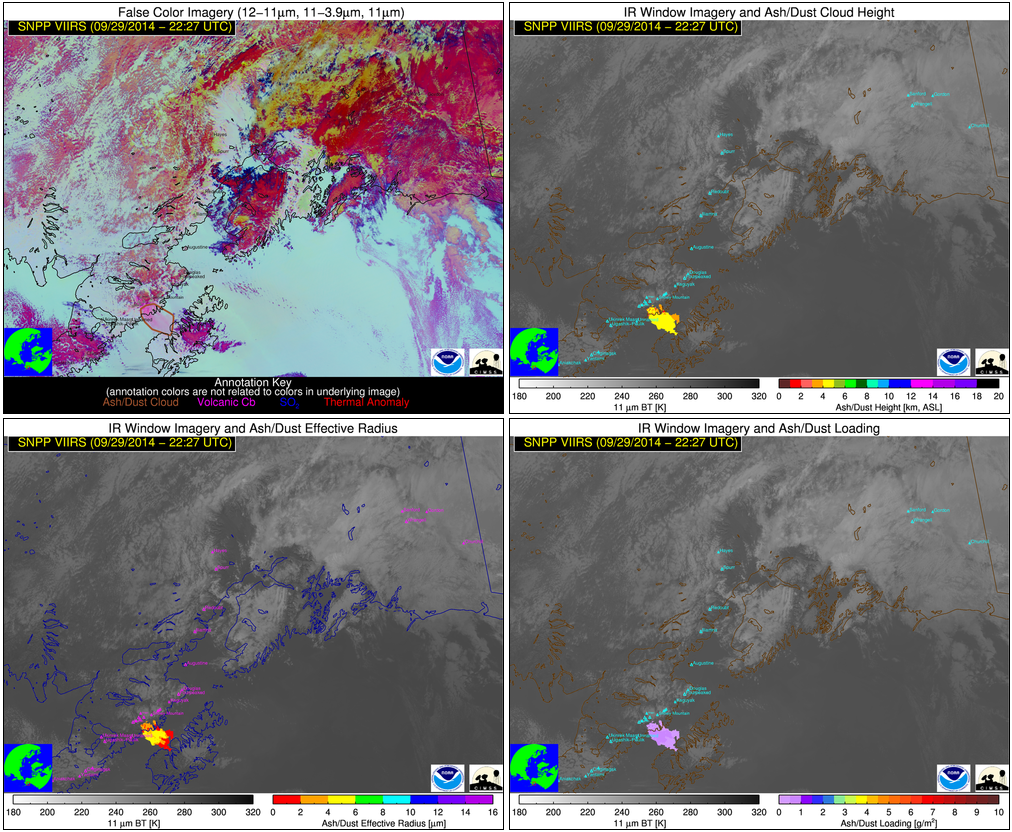
Airborne glacial silt from the Copper River Valley in Alaska
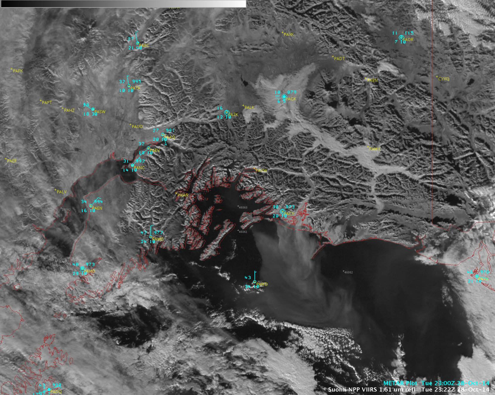
McIDAS images of GOES-15 0.63 µm visible channel data (above; click image to play animation) showed the hazy signature of airborne glacial silt drifting southward out of the Copper River valley and over the adjacent waters of the Gulf of Alaska on 28 October 2014. The strong winds lofting the... Read More