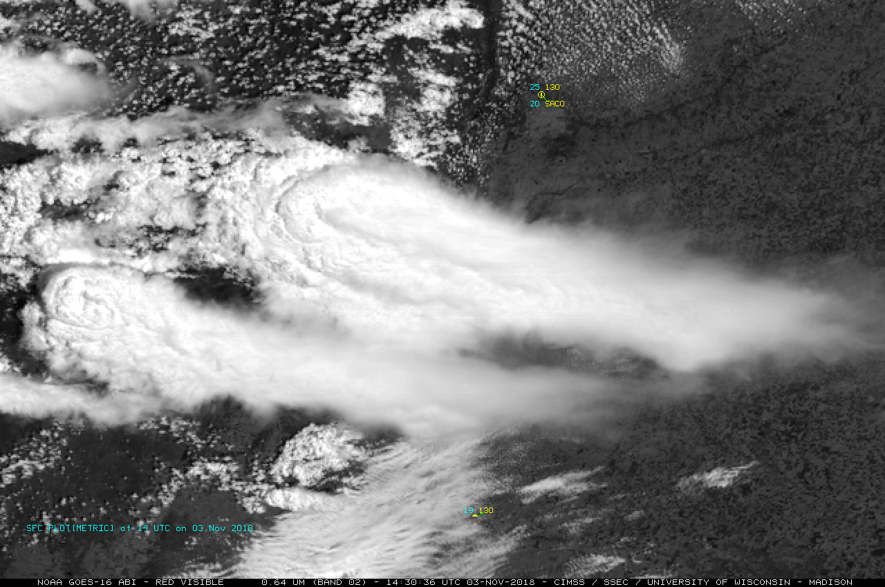
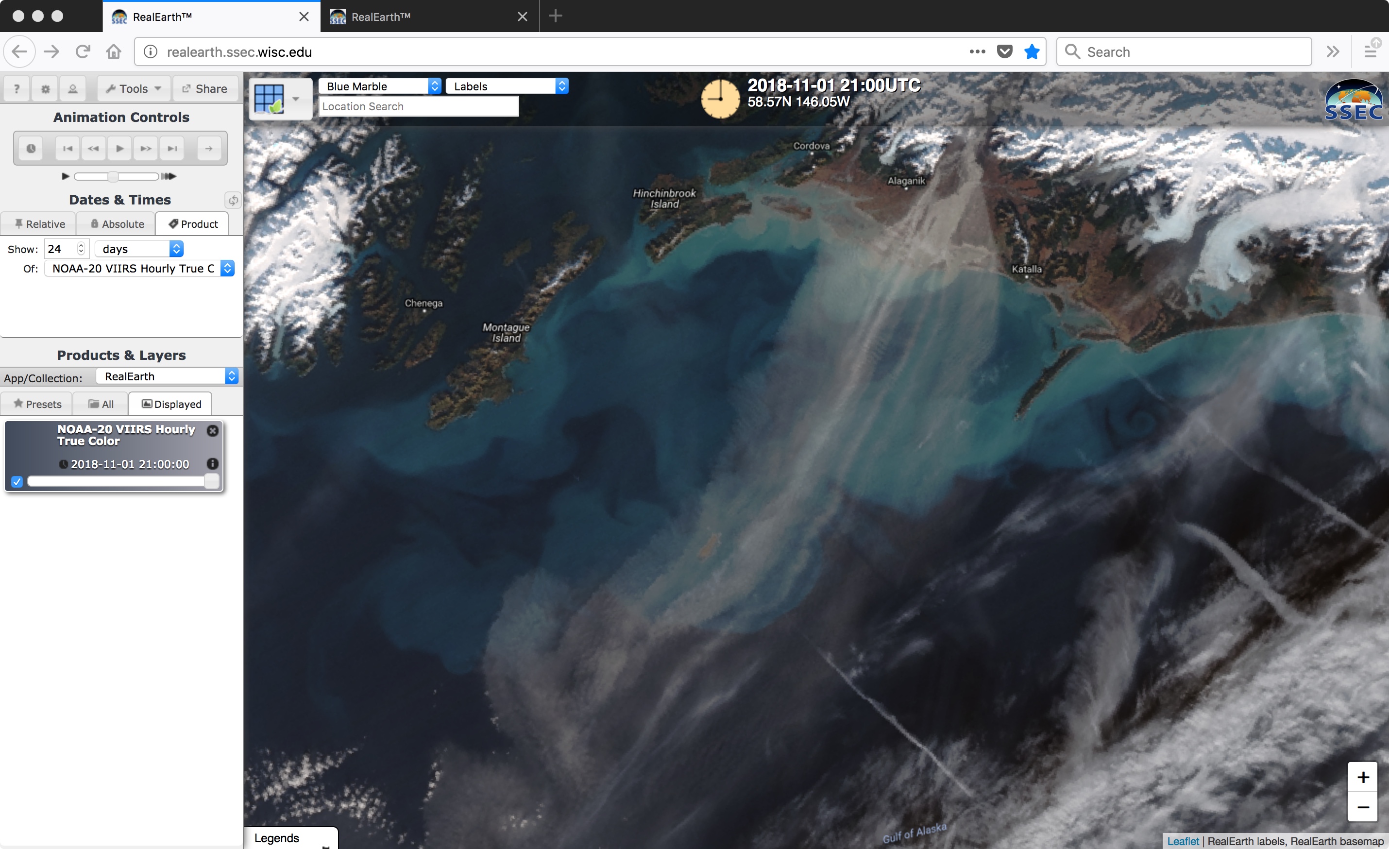
Blowing dust in the Arabian Sea
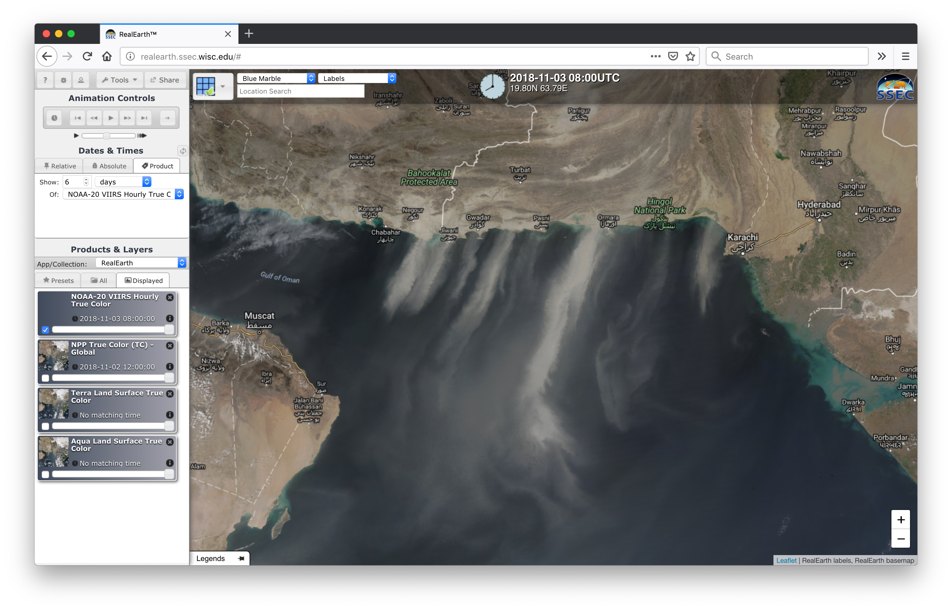
Strong winds across southern Iran and Pakistan were lofting plumes of blowing sand/dust offshore over the Gulf of Oman and the Arabian Sea during 01 November, 02 November and 03 November 2018 — a sequence of daily composites of True Color Red-Green-Blue (RGB) images from Terra MODIS, Aqua MODIS and... Read More