

Satellite-based AI products in Northern Plains convection

Lightning dashboard for Bismarck Airport, North Dakota.
Lightning dashboard for Bismarck Airport, North Dakota.
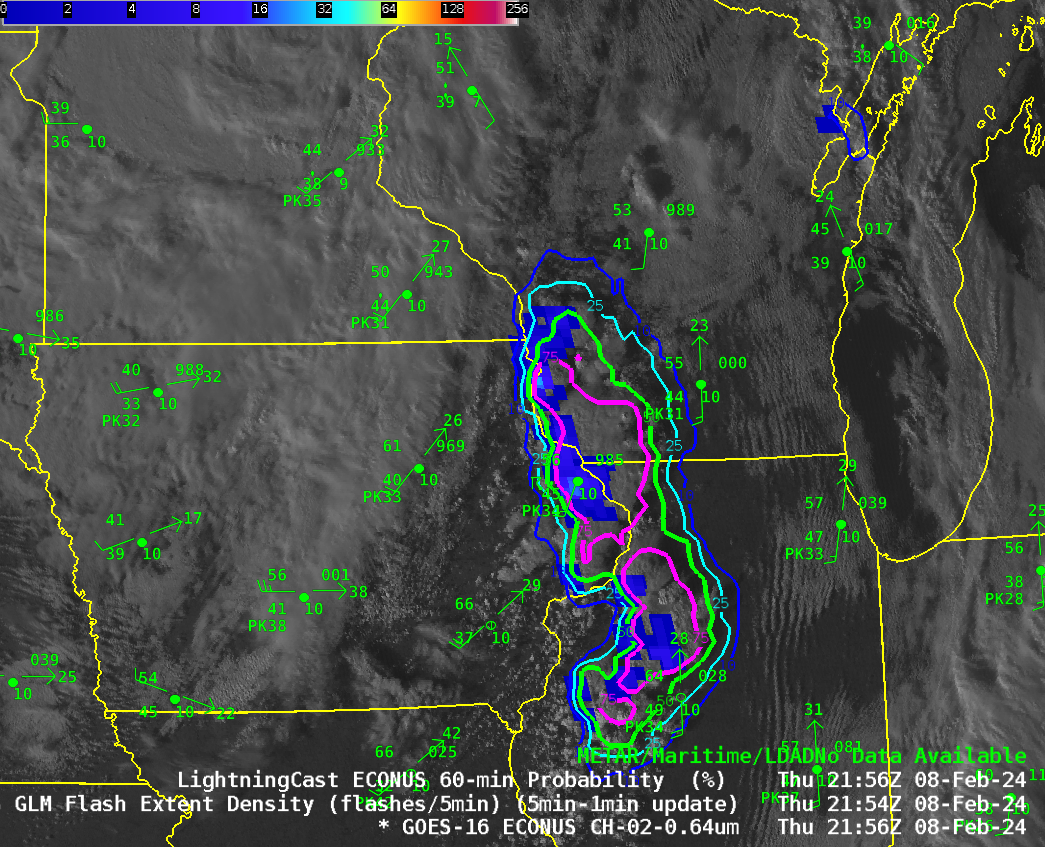
The Storm Prediction Center placed portions of the upper Midwest United States in a marginal risk of severe weather on 8 February 2024 and issued two mesoscale discussion on the thunderstorm development, one at 2053 UTC, one at 2345 UTC. The graphic from the 2053 UTC MD is shown below. The animation above shows clean window infrared imagery overlain by the Level... Read More
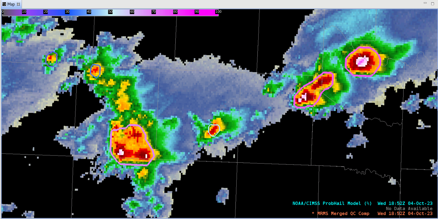
The North Texas panhandle is experiencing severe weather on October 4, 2023. Animation 1 shows Radar reflectivity in tight areas of convection across the panhandle. The GOES Day Cloud Phase Distinction RGB shown in Animation 2 confirms convection, showing overshooting tops becoming wispy ice clouds (appearing orange in the RGB).An enhanced risk of convection... Read More
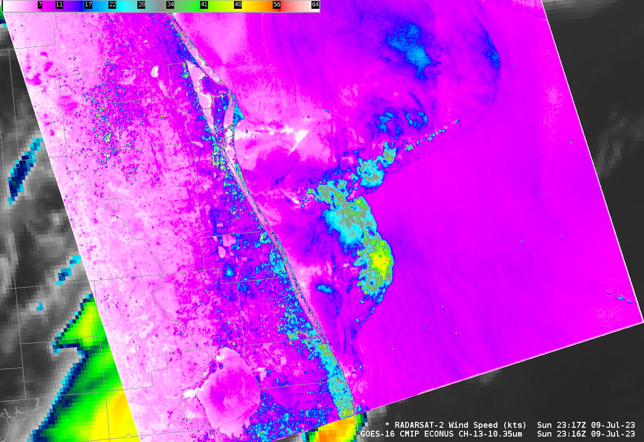
GOES-16 Visible (Band 2, 0.64 µm) and Infrared (Band 13, 10.3 µm) imagery at 2316 UTC on 9 July 2023, above, show cloud-top features commonly associated with intense convection off the east coast of Florida, to the southeast of Cape Canaveral. RADARSAT-2 overflew this region at the same time, and... Read More

