Lightning on the Laramie Mountains
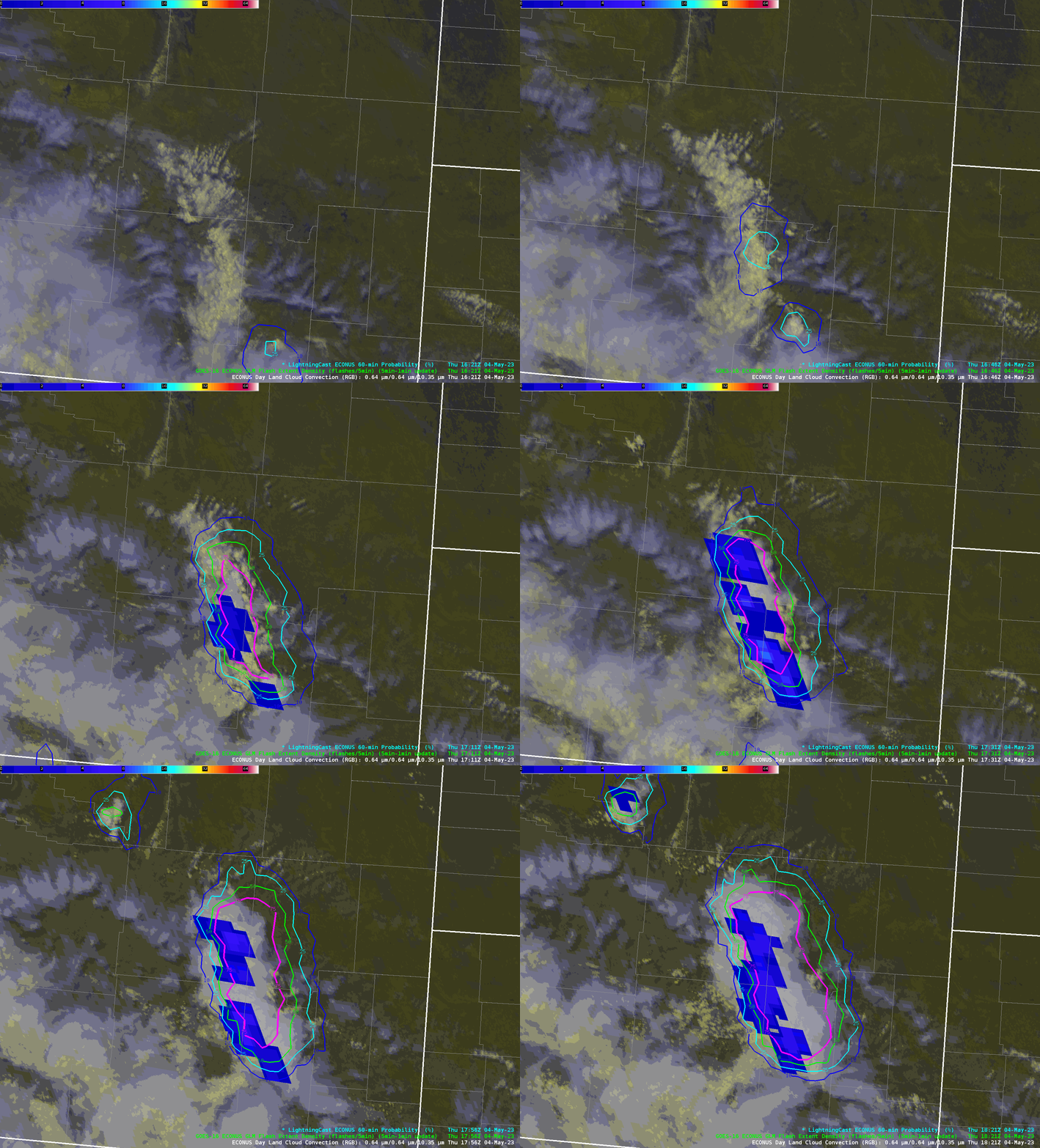
A long-wave diffluent trough centered over California and Nevada was helping to force benign convection along the Laramie Mountains, which run roughly from Laramie to Casper, Wyoming.
The ProbSevere LightningCast model, which uses AI and GOES-R data to predict the probability of lightning in the next hour, was able to highlight this convection before the first flashes occurred. Lead time to the initial flashes ranged from 10 to 30 minutes, measured from the 25% probability of lightning contour.

One interesting feature in this animation is the packing of the probability contours. The storms are moving generally from south to north. The contours are much more packed along the south and west edges of the region of convection (i.e., where convection is moving away from), while they are more diffuse along the north and east edges (i.e., where the convection is moving towards. This indicates that the model is (at least in part) accounting for the motion of the storms in the next hour. LightningCast expects the storms to move north, which is what they are indeed doing. This was a very surprising result, since LightningCast was trained with samples that used only one snapshot or timestamp of satellite data.
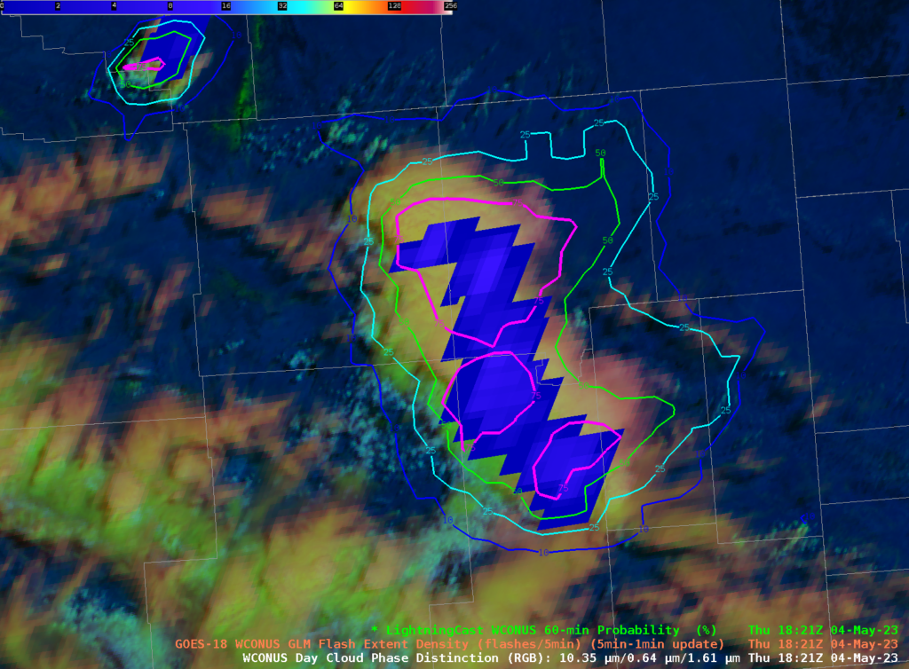
From GOES-West (GOES-18) in Figure 2, we can see the same effect, though perhaps not as pronounced. But keep in mind the satellite viewing geometry is much different in Wyoming from GOES-East versus GOES-West. And while next-hour motion of storms is not always well predicted, it is nevertheless encouraging that LightningCast is able to discern motion at times from only one snapshot of data. Forecasters often look at animations of satellite data to make nowcasts, and we believe that training the model with “videos” of data rather than images will further enhance its ability to project lightning threats in the near future. One downside is that this greatly increases the complexity and computational cost to create such a model. However, recent developments in AI/ML modeling show that training with video imagery (and predicting video imagery) is becoming more feasible.


