A new tool for monitoring lightning
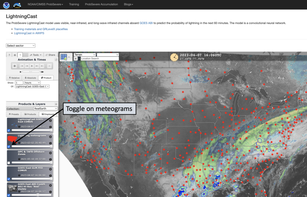
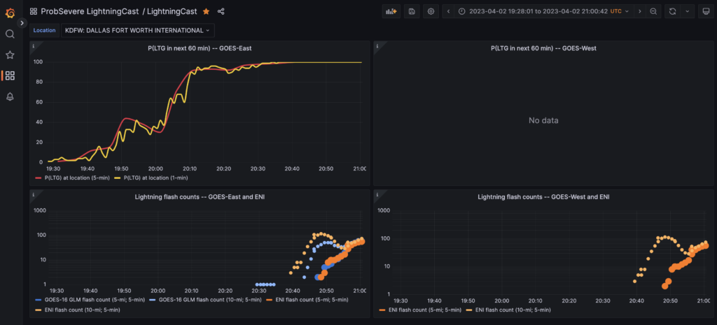
The NOAA/CIMSS ProbSevere team created a tool to help forecasters monitor the time tendency of lightning potential at a static point. The static points in the map below are mostly civilian airports and army airfields throughout the U.S. From the ProbSevere LightningCast website, a user can toggle on the “Lightning meteograms” layer from the menu on the left (Figure 1). The user can then click a location (red dots) and finally click the link in the pop-up window. This will bring up a new website with different time series (Figure 2 [static link]).

From this page, a user can quickly see how the probability of lightning has been changing (computed by LightningCast), as well as the observed lightning tendencies from GOES-East and GOES-West GLM, and Earth Networks Inc™. LightningCast probabilities are computed on the 5-minute and 1-minute scans for both GOES-East and GOES-West (when applicable). The 1-min scans will be displayed when the location is covered by a mesoscale sector. Users can change the location of meteograms (top left) as well as the time frame (top right). Data from recent days will be archived. The flash rates from GLM and ENI are aggregated within 5- and 10-mile radii of the location and within the previous 5 minutes.

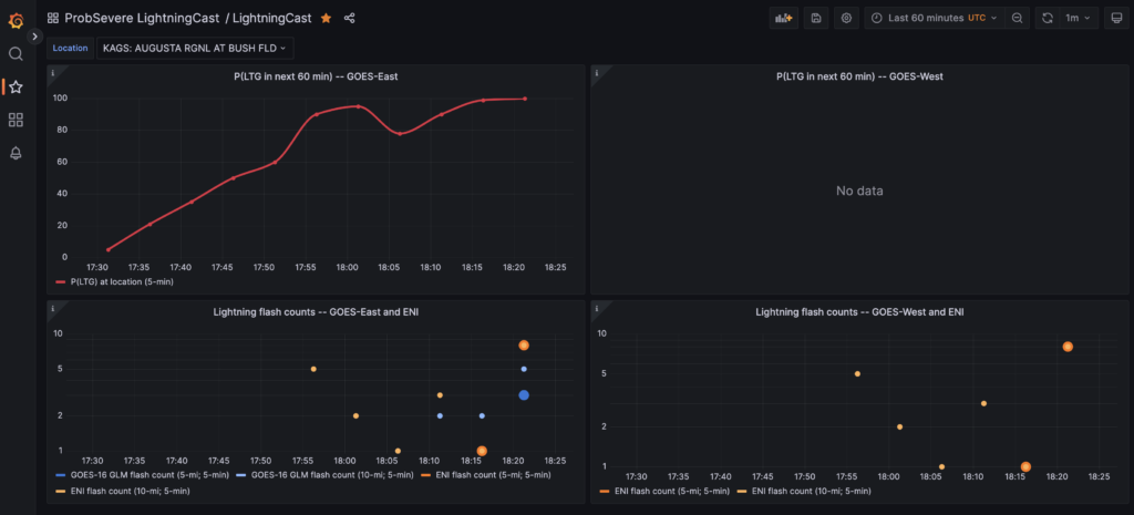
Forecasters can use this to monitor lightning for aviation purposes or nearby large outdoor events. For instance, forecasters are surely monitoring for lightning at the Masters Golf Tournament in Augusta, GA today. LightningCast probabilities have been steadily increasing for nearly an hour, and lightning was observed within 5 miles of Augusta Regional airfield (Figure 3). Augusta Regional is about 10 miles southwest of Augusta National Golf Course.


