Using NUCAPS soundings to nowcast convective evolution
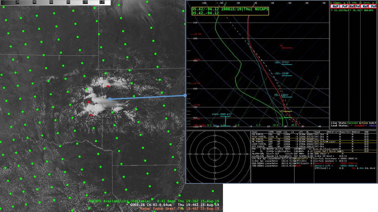
GOES-16 Visible Imagery, above (Click to animate), shows shower/thundershower development over eastern Oklahoma moving into Arkansas. At the end of the animation, 1946 UTC, NUCAPS Sounding profiles from 1926 UTC are shown, and they’re shown below too.The time 1946 UTC is about the earliest you could hope to have NUCAPS... Read More
