Ground blizzard in North Dakota and Minnesota
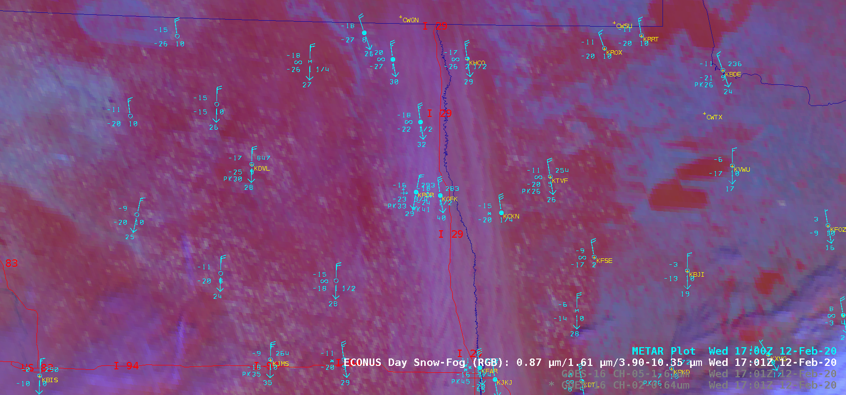
GOES-16 (GOES-East) Air Mass RGB images (above) displayed the characteristic pale yellow hues associated with cold arctic air that was moving southward behind a deep area of low pressure centered over Hudson Bay and northern Quebec, Canada on 12 February 2020.A sequence of GOES-16 “Red” Visible (0.64 µm), Near-Infrared “Snow/Ice” (1.61 µm) and Day Snow-Fog RGB images (below)... Read More