Tropical Storm Epsilon in the Atlantic
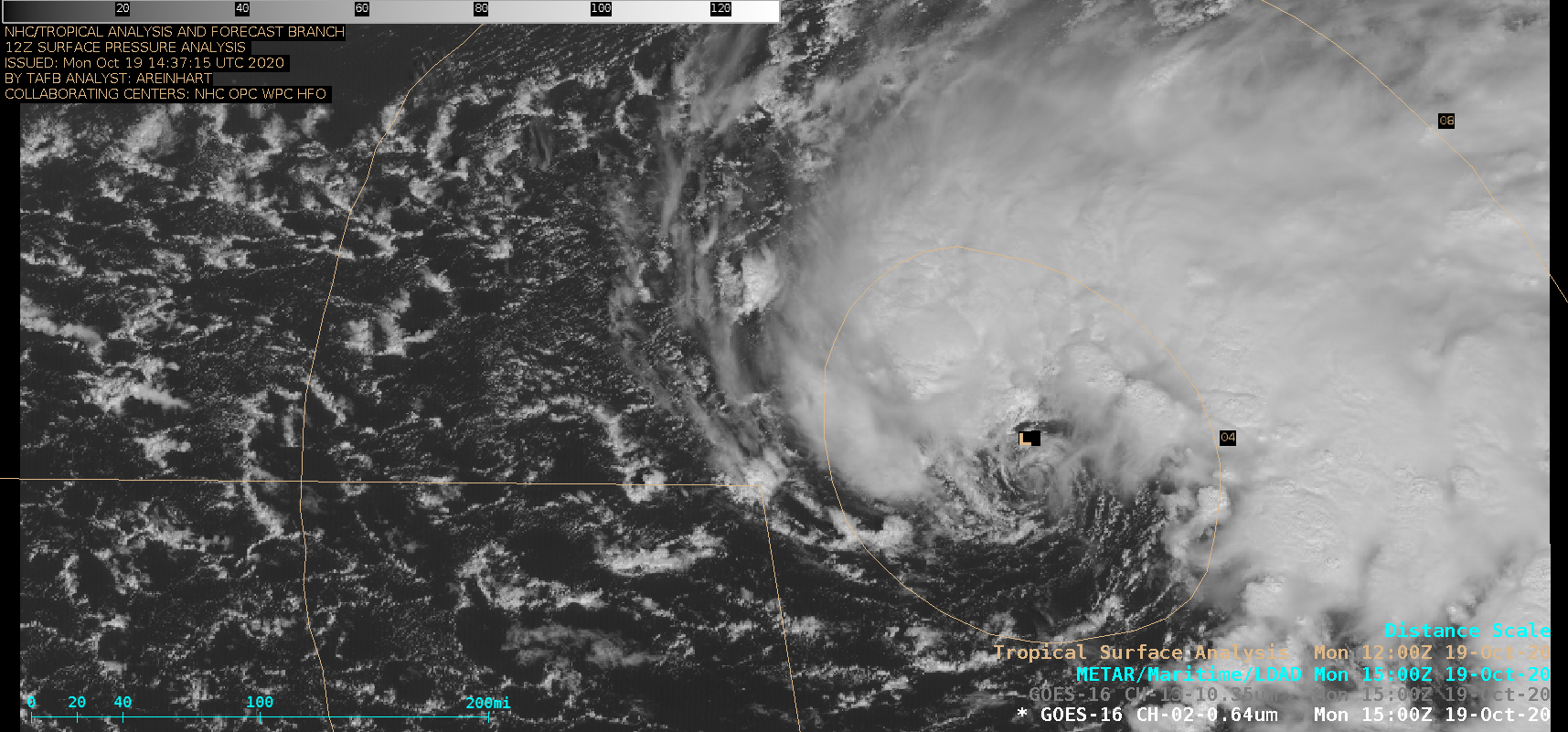
1-minute Mesoscale Domain Sector GOES-16 (GOES-East) “Red” Visible (0.64 µm) and “Clean” Infrared Window (10.35 µm) images (above) showed Tropical Depression 27 as further intensified to become Tropical Storm Epsilon at 15 UTC on 19 October 2020. While the low-level circulation (LLC) generally remained exposed during that time, deep convection was increasing around the LLC (including a small convective burst near the... Read More