This website works best with a newer web browser such as Chrome, Firefox, Safari or Microsoft Edge. Internet Explorer is not supported by this website.

Category: NOAA-20

Super Typhoon Goni in the West Pacific Ocean

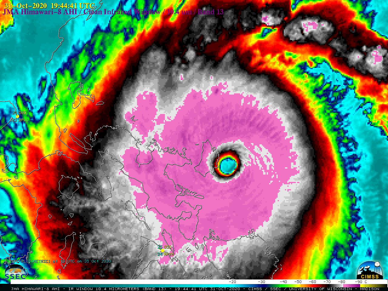
2.5-minute rapid scan JMA Himawari-8 “Red” Visible (0.64 µm) images (above) showed Category 5 Super Typhoon Goni in the West Pacific Ocean on 30 October 2020. The images revealed a very small “pinhole eye”, surface mesovortices within the eye and a trochoidal motion — all characteristics of a tropical cyclone... Read More

Multiple pyrocumulonimbus clouds produced by the East Troublesome Fire in Colorado

1-minute Mesoscale Domain Sector GOES-16 (GOES-East) “Red” Visible (0.64 µm), Shortwave Infrared (3.9 µm), “Clean” Infrared Window (10.35 µm) and Fire Temperature Red-Green-Blue (RGB) images (above) showed a period of extreme behavior of the East Troublesome Fire in Colorado around and just after sunset on 21 October 2020. This rapidly-growing wildfire produced a series of pyrocumulonimbus (pyroCb) clouds — the coldest pyroCb cloud-top 10.35 µm infrared brightness temperatures... Read More

NUCAPS Sounding profiles surrounding Colorado’s East Troublesome Fire

The East Troublesome Fire in Colorado expanded greatly on 21 October (click here for more information), and produced pyrocumulus clouds.  NOAA-20 overflew the fire at around 1930 UTC (linked-to overpass map from this site) on 21 October, and NUCAPS profiles, shown above, diagnosed the stability of the mid- and upper-troposphere.  The toggle below between the NOAA-20 VIIRS Visible (0.64 µm) and Infrared (11.45 µm) imagery and NUCAPS Sounding availability... Read More