This website works best with a newer web browser such as Chrome, Firefox, Safari or Microsoft Edge. Internet Explorer is not supported by this website.

Category: MTSAT

Typhoon Neoguri threatens Okinawa

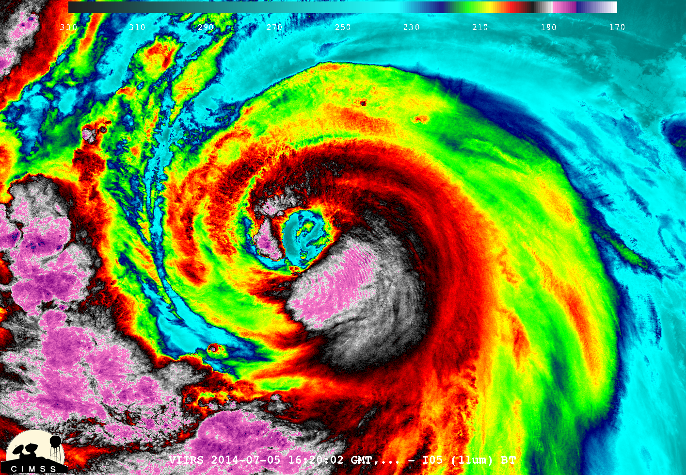
Typhoon Neoguri is forecast to move west of Okinawa later today. The visible images above, from COMS-1 (left) and MTSAT-2 (right) show the storm at around 0800 UTC on 7 July 2014. A distinct eye filled with low-level clouds is apparent.Magnified views of the storm center (above; click image to... Read More

Severe Tropical Cyclone Ita

McIDAS images of MTSAT-2 10.8 µm IR channel data (above; click image to play animation) showed the development of a distinct eye associated with Intense Cyclone Ita (23P) as it moved southwestward across the Coral Sea toward the coast of Queensland, Australia on 10-11 April 2014. Cyclone Ita exhibited a... Read More