Cyclone Gillian in the Indian Ocean
McIDAS images of MTSAT-2 10.8 µm IR channel data (above; click image to play animation) showed the southward motion of Cyclone Gillian as it intensified over the far eastern Indian Ocean to Category 5 intensity on 23 March 2014 (Joint Typhoon Warning Center advisory). A Category 5 tropical cyclone in the Southern Hemisphere (and in the Indian Ocean basin) is a relatively rare event.
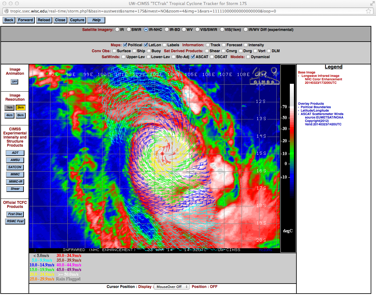
An MTSAT-2 IR image from the CIMSS Tropical Cyclones site with an overlay of Metop ASCAT surface scatterometer winds at 14:20 UTC (below) showed the tight radius of high winds around the center of circulation.
MTSAT-2 0.675 µm visible channel images (below; click image to play animation) revealed the formation of a well-defined eye on 23 March.
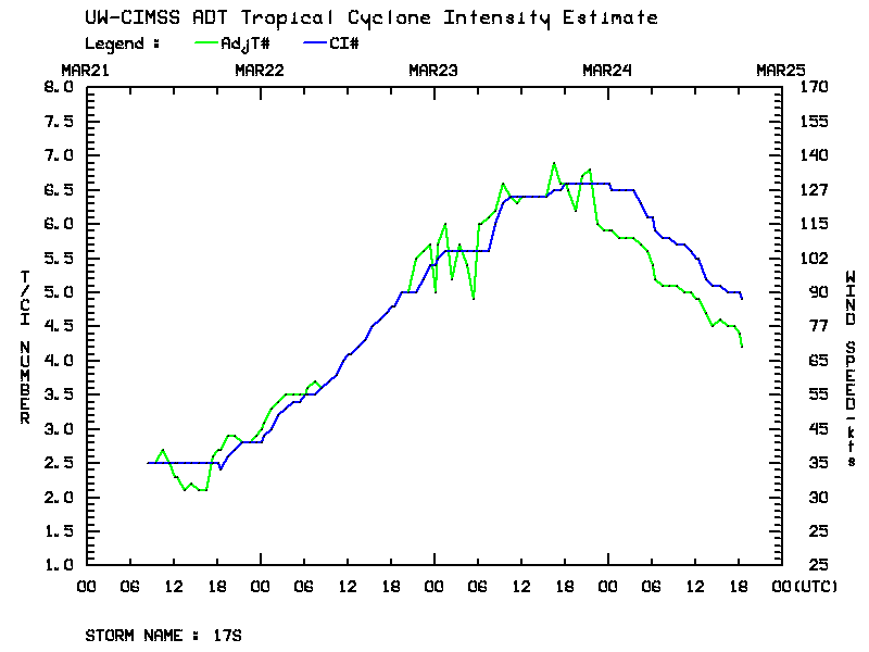
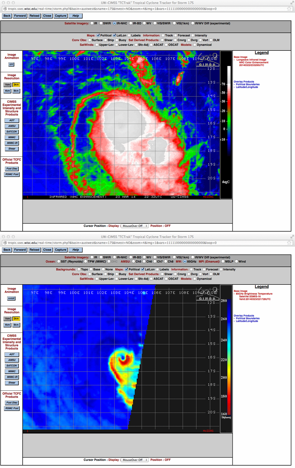
A plot of the Advanced Dvorak Technique (ADT) satellite-based intensity estimate (below) showed the period of rapid intensification on 23 March, with tropcial cyclone Gillian reaching its peak intensity late on 23 March.A comparison of MTSAT-2 10.8 µm IR channel data and DMSP SSMIS-16 85 GHz microwave brightness temperature data (below) demonstrated the ability of microwave imagery to show important storm details (such as the closed eyewall, and curved spiral bands) that might be obscured by clouds on conventional IR images.
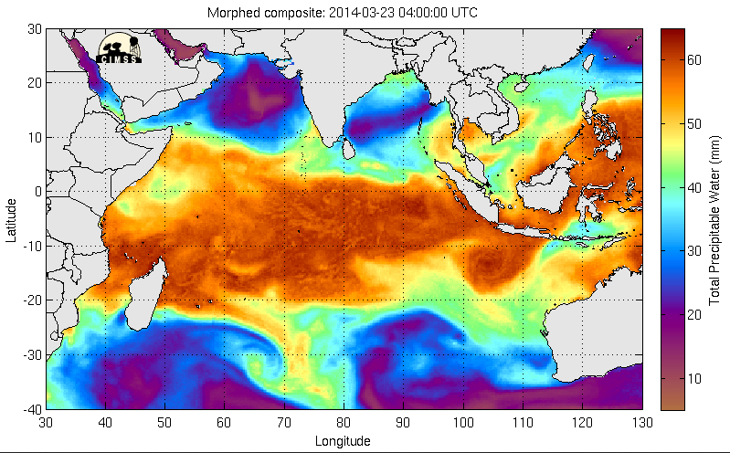
The MIMIC Total Precipitable Water (TPW) product (below; click image to play animation) showed the circulation of high TPW values as Cyclone Gillian began to move southward from Indonesia on 21 March. As the tropical cyclone began to encounter an environment of increasing vertical wind shear poleward of about 20º S latitude, the storm began to rapidly decrease in intensity — and on 26 March Gillian was downgraded to a tropical low.


