Typhoon Neoguri threatens Okinawa
Typhoon Neoguri is forecast to move west of Okinawa later today. The visible images above, from COMS-1 (left) and MTSAT-2 (right) show the storm at around 0800 UTC on 7 July 2014. A distinct eye filled with low-level clouds is apparent.
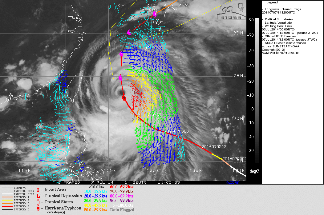
Magnified views of the storm center (above; click image to play animation; also available as an MP4 movie file) revealed the presence of mesovortices within the eye of Neoguri. The more frequent imaging schedule of COMS-1 (generally every 15 minutes, compared to every 30 minutes with MTSAT-2) allowed the cyclonic circulation of the mesovortices to be more easily identified. Another curious feature seen on the early morning visible imagery was a northwest-to-southeast oriented “cloud cliff” shadow just north of the eye, which was cast by the taller clouds of an eyewall convective burst just to the east. This same signature was seen again on the following morning, in nearly the same location relative to the eye (MTSAT-2 visible/IR image comparison).ASCAT winds from METOP-B (above) show the structure of the typhoon, with 70-knot winds indicated. The Sea Surface Temperature (SST) image (taken from the CIMSS Tropical Cyclones site) also shows the extreme warmth of the western Pacific Ocean.
Infrared imagery from the past 24 hours show a decline in the satellite structure of the storm. Cold cloud tops have eroded from the northern and western quadrants of the storm, and a circular ring of cold cloud tops around the eye is no longer apparent.
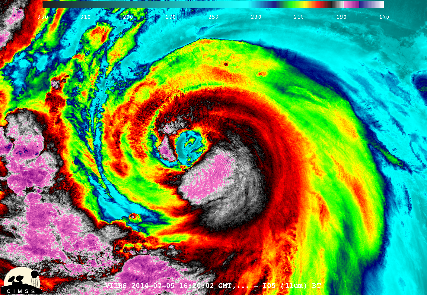
Suomi NPP overflew the storm on Saturday 5 July at 1620 UTC. The color-enhanced VIIRS 11.45 IR image, above (courtesy William Straka, SSEC/CIMSS), shows very cold cloud tops (185 K) southeast of a developing eye.


