Rapid intensification of Super Typhoon Surigae
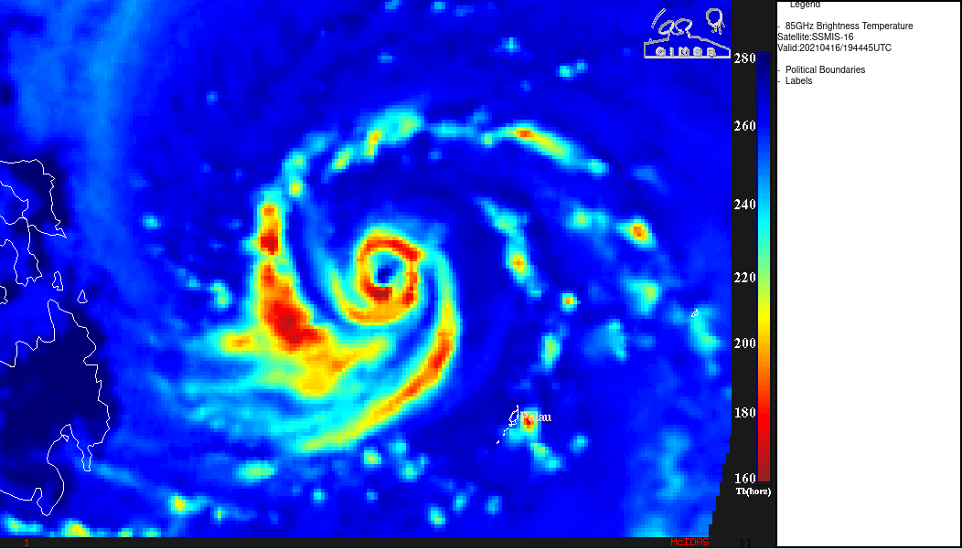
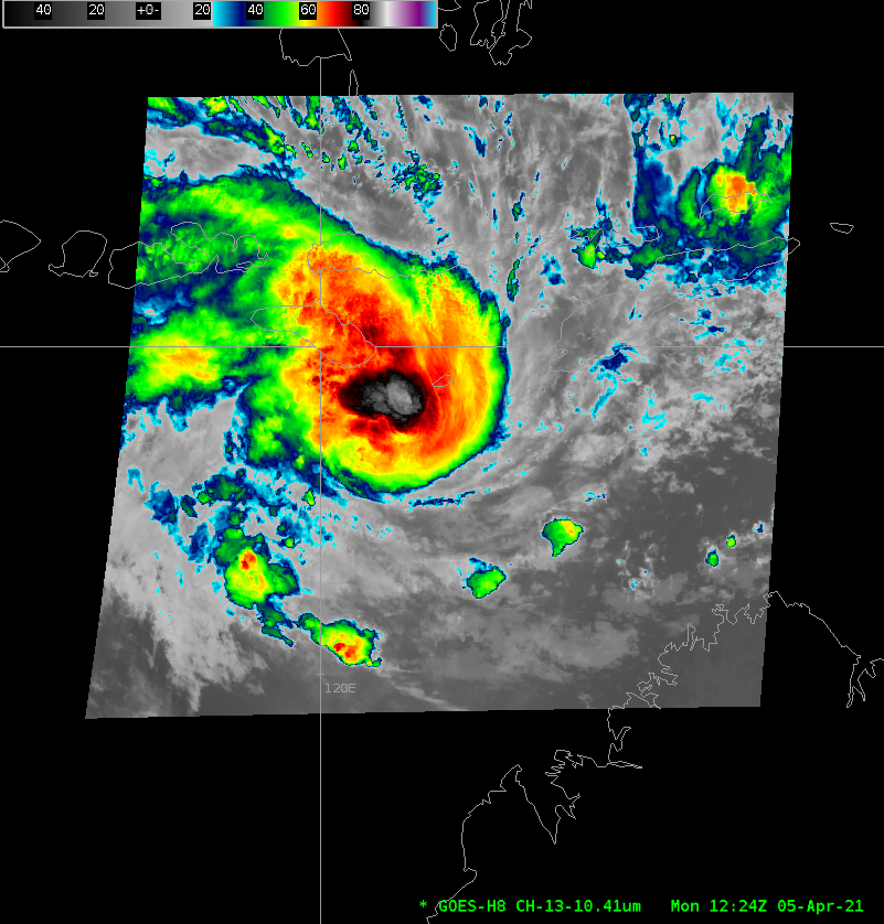
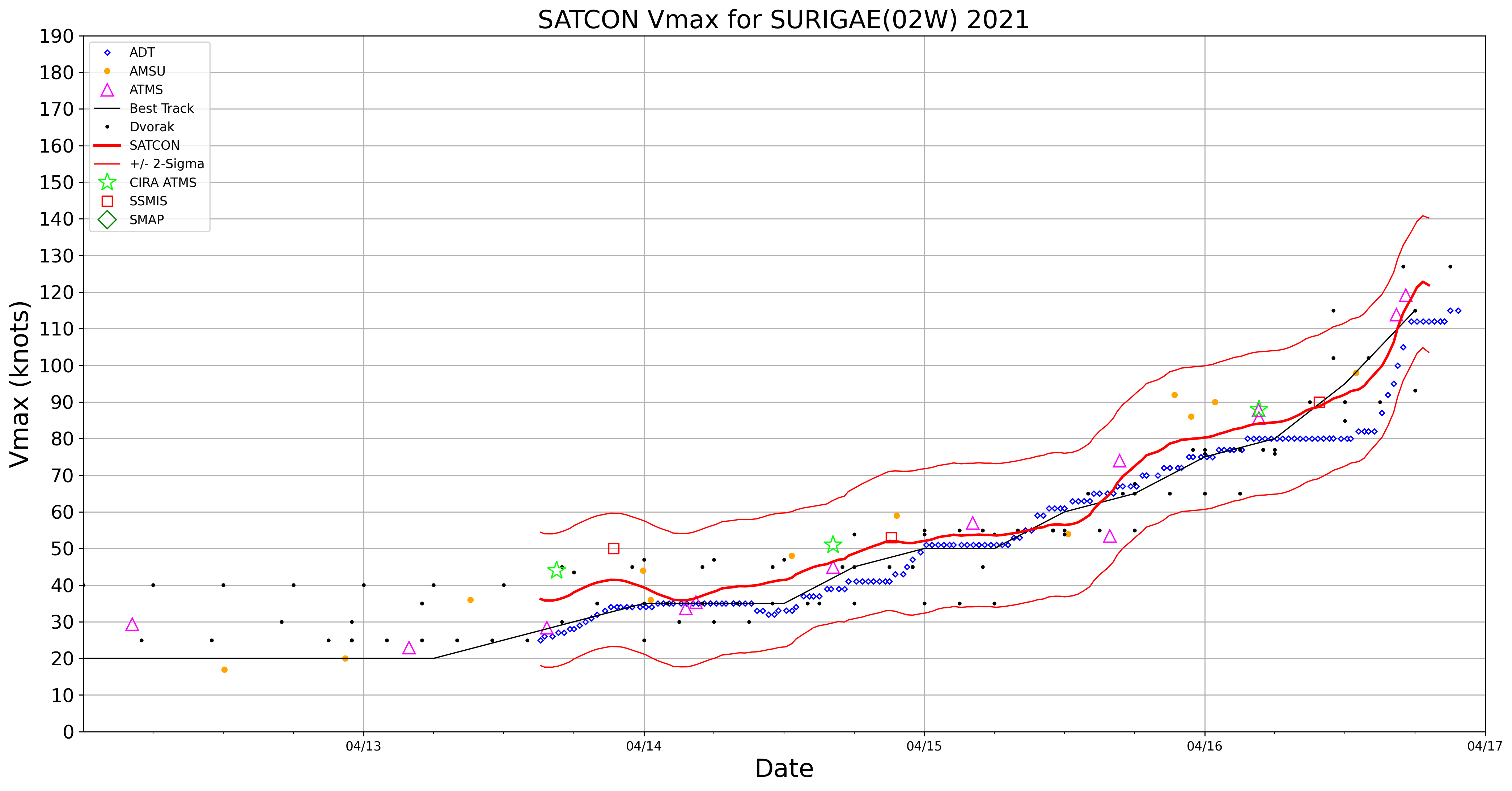
2.5-minute interval rapid scan JMA Himawari-8 Infrared Window (10.4 µm) images (above) showed Typhoon Surigae undergoing rapid intensification (ADT | SATCON) to become a Category 4 storm as of 18 UTC on 16 April 2021.A DMSP-16 SSMIS Microwave (85 GHz) image from the CIMSS Tropical Cyclones site (below) displayed a well-defined eye, with distinct spiral... Read More
