Kona Low flooding event in Hawai’i
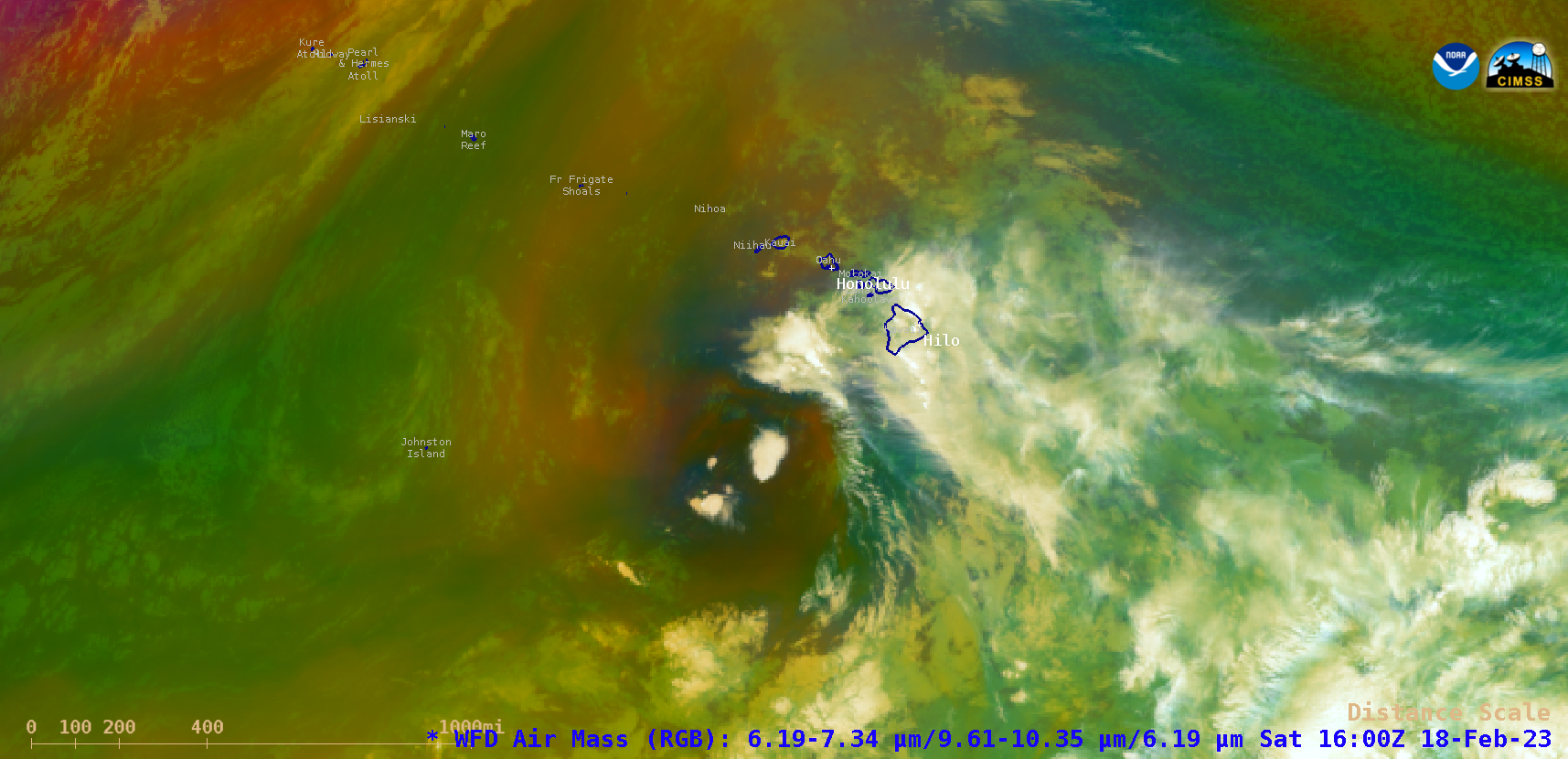
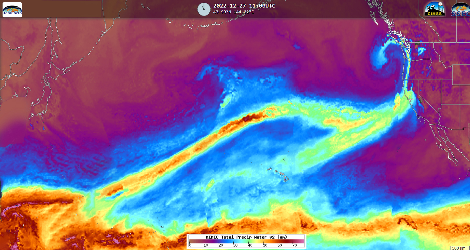
GOES-18 (GOES-West) Air Mass RGB images during the 15-19 February 2023 period (above) displayed the migration of a Kona Low from north of the main Hawaiian Island chain on 15 February toward Johnston Island on 19 February. The MIMIC Total Precipitable Water product (below) showed that the circulation of this Kona Low helped to draw... Read More
