Flash flooding across parts of Hawai’i
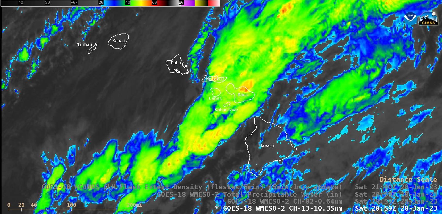
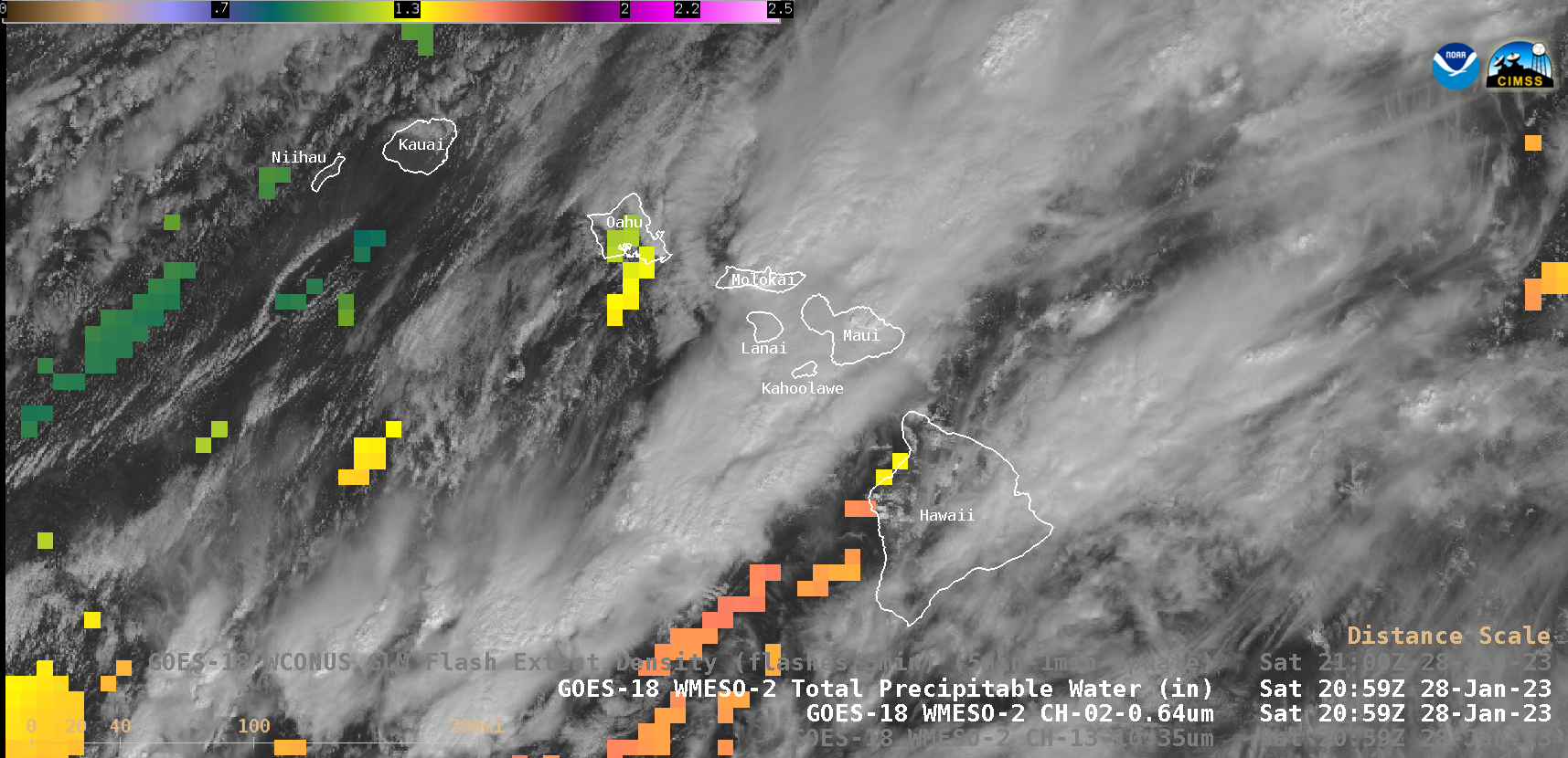
1-minute Mesoscale Domain Sector GOES-18 (GOES-West) “Clean” Infrared images (above) showed convection — which was focused along a quasi-stationary surface trough axis — that was producing periods of moderate to heavy rainfall across parts of Hawai’i on 28 January 2023. Numerous Flash Flood Warnings were issued by NWS Honolulu during this time, frequently for the island of Maui (where the storms appeared to be back-building at times).During the daytime hours, 1-minute GOES-18 “Red” Visible images (below) also displayed the Total Precipitable Water (TPW) derived product (in cloud-free areas) — with TPW values as high as 1.5-1.6 inches in the vicinity of the surface trough axis.
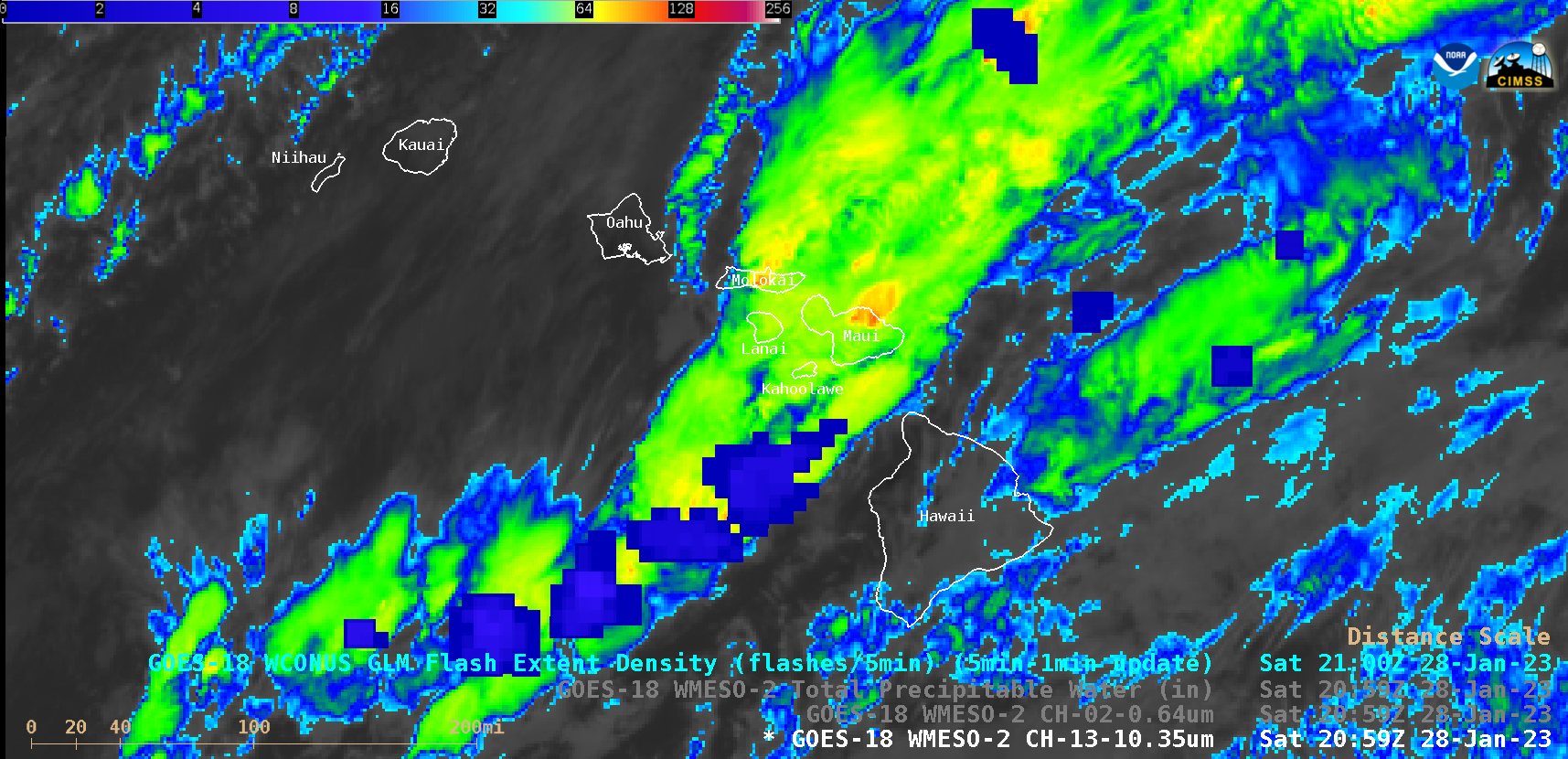
GOES-18 “Clean” Infrared Window images which included an overlay of GLM Flash Extent Density (below) showed that these storms produced occasional lighting over the Big Island, Maui and Moloka’i.
GOES-18 “Clean” Infrared Window images, with an overlay of GLM Flash Extent Density [click to play MP4 animation]

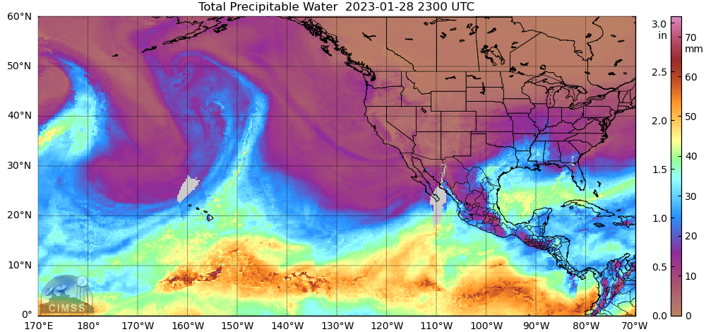
MIMIC-TPW product during the 27-28 January period [click to play animated GIF | MP4]


