NOAA/STAR snow products associated with a midwestern snowstorm

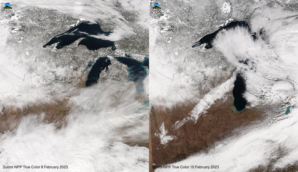
A modest snow storm affected southern/central Wisconsin on 9 February (WFO ARX story), depositing 6-12″ of snow in a band from northeast Iowa to central Lake Michigan, as shown above: the snowfall caused an obvious change in the Suomi NPP imagery between 08 February and 10 February 2023, shown above using imagery taken from the VIIRS Today website. (A similar before/after pair of images using GOES-16 data is below).

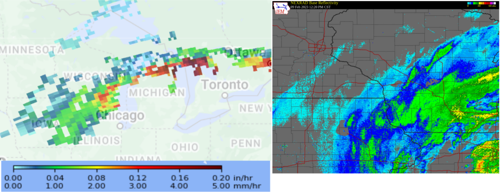
A variety of NOAA/STAR snowfall products gave information about this snowstorm during and after its passage through the midwest. The image below shows the Snowfall rate (data source) over Wisconsin and Michigan at 1816 UTC on 9 February (derived from ATMS data on NOAA-20), and a NEXRAD radar image (from the ‘radar’ tab here) over Wisconsin at about the same time. There is very good agreement between the two representations of falling precipitation over Wisconsin!

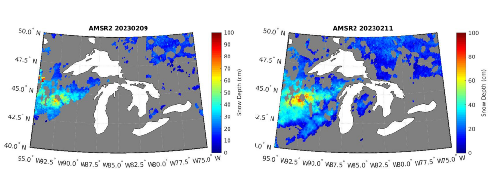
The NOAA/STAR cryosphere team developed AMSR-2 snow products using data from JAXA’s GCOM-W polar orbiter. The snowdepth product, below, shows the change in snowdepth over Wisconsin between 9 February (left) and 11 February (right). The deepest diagnosed snow on 11 February in the new snow band is about 35 cm (around 13″).

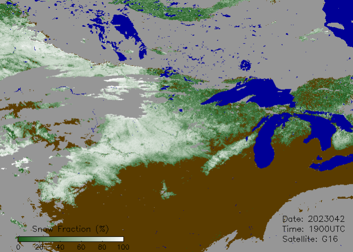
The GOES-16 Fractional Snow Cover product, below, from 1900 UTC on 11 February 2023, shows the snow band as well.

Thanks to Yinghui Liu, NOAA/STAR at CIMSS, and Huan Meng, NOAA/STAR in College Park, for imagery for this blog post. Thanks also to Peter Romanov, CUNY/CREST, for contributions.

