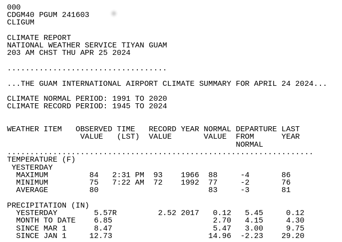
Record Daily Rainfall on Guam
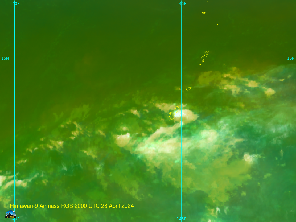
An extended dry period over the Marianas Islands was broken (at least temporarily) on 24 April when training thunderstorms dropped more than 5 inches of rain at the Guam airport. The US Drought Monitor data for the Marianas is shown below. Guam and Saipan both show extreme drought. Before the rain on 24 April, Guam year-to-date rains were 50% of normal.... Read More
