Air France Flight #447: did weather play a role in the accident?
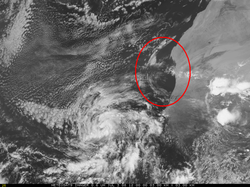
An Air France Airbus A330-200 — Flight #447 en route from Rio de Janeiro, Brazil to Paris, France — crashed in the tropical Atlantic Ocean on 01 June 2009 (surface analysis). Shortly after the last radio contact about 350 miles (565 km) northeast of Natal, Brazil... Read More
