Tropical Storm Bertha, and Desert Southwest Heat
![]()
As noted in the previous Blog entry, Tropical Storm Bertha became the Atlantic Basin’s second tropical storm on 03 July 2008. Apparently, Bertha set a new record for the furthest east named storm formation in the tropics (classified as south of 23.5N) prior to 1 August since 1950. It became classified as a tropical storm at 24.7W which easily beat the old record set by Anna in 1969 (36.0 W).
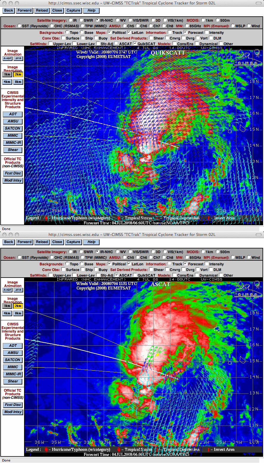
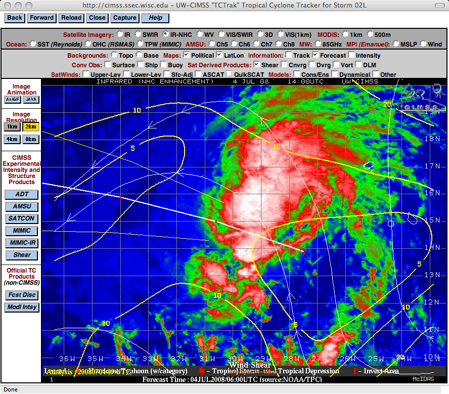
Meteosat-9 IR images with overlays of QuikSCAT and ASCAT satellite winds (above) from the CIMSS Tropical Cyclones site on following day (04 July 2008) showed some bursts of convection around the tropical cyclone, and verified the presence of tropical storm force winds. The CIMSS wind shear product (below) indicated that Bertha existed in an environment of low wind shear, which was favorable for continued intensification.
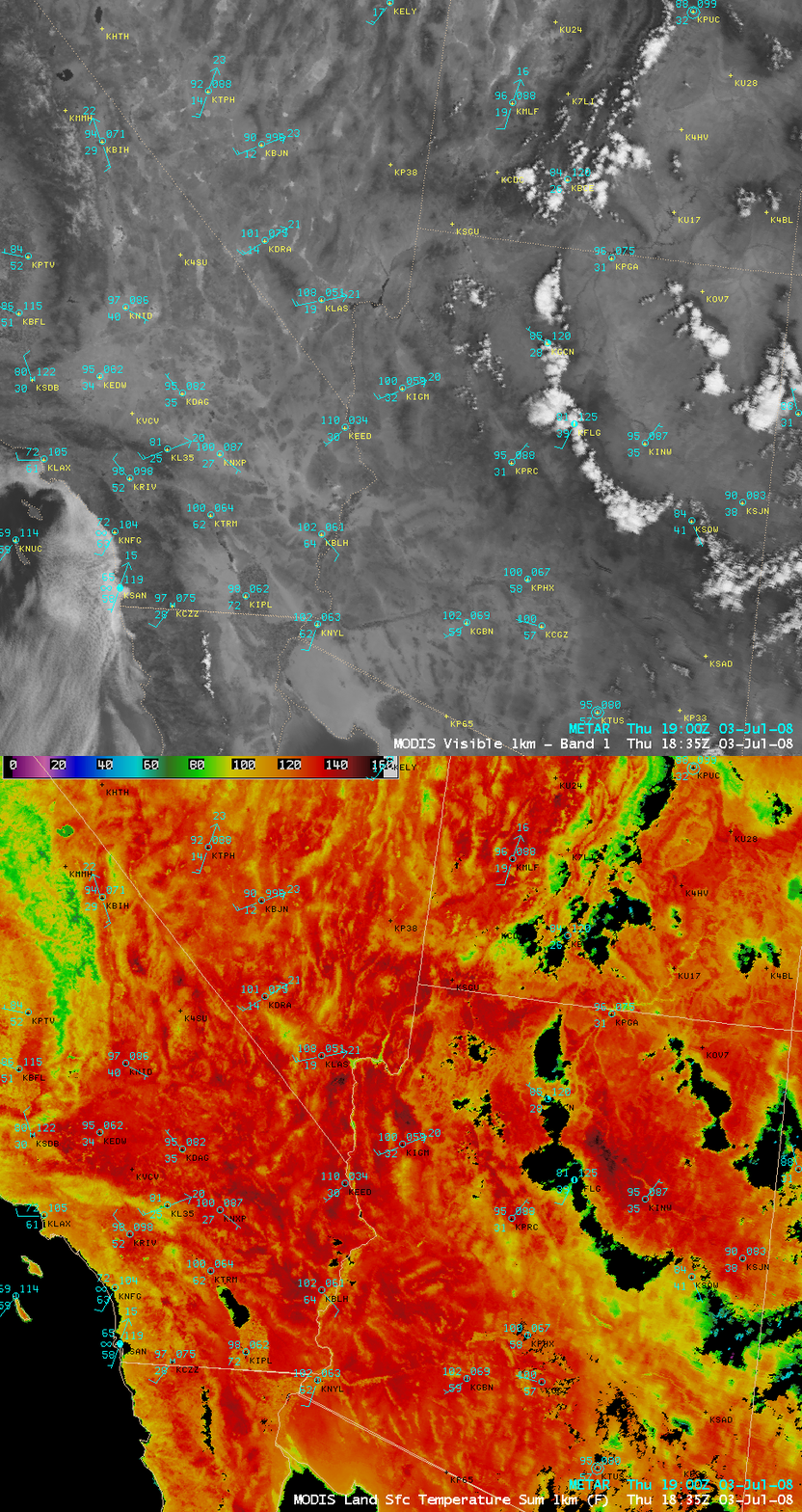
Meanwhile, on the previous day (03 July 2008), the afternoon MODIS visible image and Land Surface Temperature product (below) showed mostly cloud-free conditions and very hot surface temperatures across much of the Desert Southwest region of the United States. Death Valley in California reached a high temperature of 122º F, the hottest day so far this summer season (121º F had been reached at that location a few times in June 2008); other high temperatures in the region that day included 118º F at Bullhead City, Arizona and 115º F at Laughlin, Nevada. While the MODIS LST values were generally about 20-30º F higher than the actual air temperatures that were measured in instrument shelters about 5 feet off the ground — the highest LST values seen on this day were near 150º F (darker red colors) in parts of California, Nevada, and Arizona — the LST product is still useful for depicting where the hottest areas might be (since the coverage of stations that report air temperature over any given region might be somewhat sparse).


