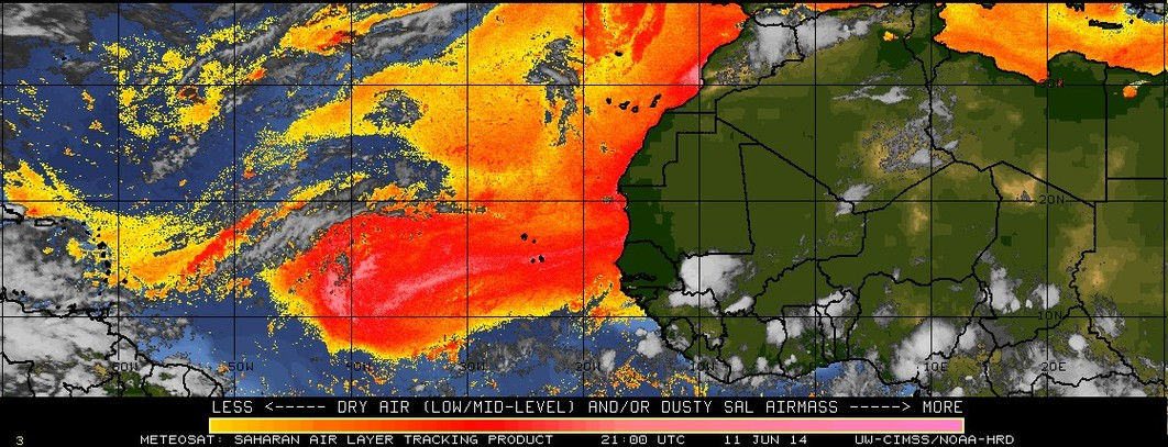
Saharan Air Layer dust over the Gulf of Mexico
McIDAS images of GOES-13 0.63 µm visible channel data on 20 June 2014 (above; click image to play animation; also available as an MP4 movie file) and on 21 June 2014 (below;... Read More
McIDAS images of GOES-13 0.63 µm visible channel data on 20 June 2014 (above; click image to play animation; also available as an MP4 movie file) and on 21 June 2014 (below;... Read More
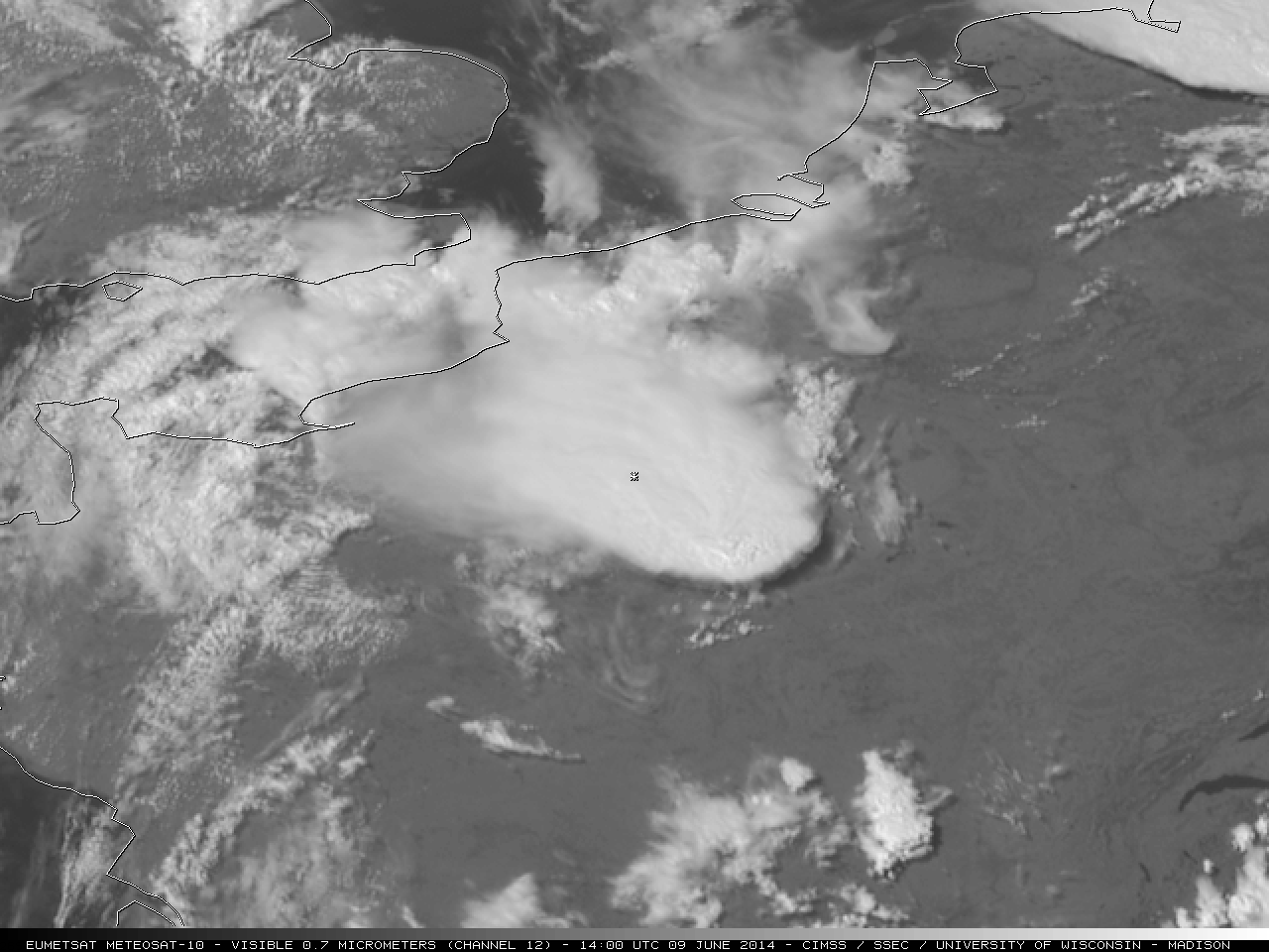
Severe thunderstorms developed over parts of France on 09 June 2014, some of which produced very large hail (photos). EUMETSAT Meteosat-10 1-km resolution 0.7 µm visible channel images (above; click image to play animation; also available as an MP4 movie file) and 3-km... Read More
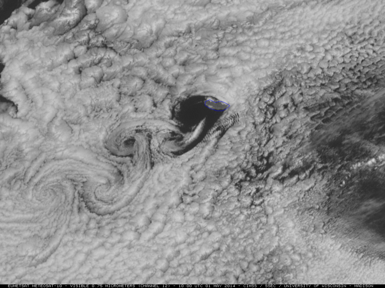
McIDAS images of EUMETSAT Meteosat-10 0.75 µm visible channel data (above; click image to play animation) showed a beautiful example of a von Kármán vortex street downwind of Madeira Island on 01 May 2014. Northeasterly winds in the marine boundary layer were perturbed by... Read More
Twitter follower @PedroCFernandez alerted us to an interesting case of mesovortices (original Spanish language blog post | Google translate version) which developed within the circulation of a strong mid-latitude cyclone over the northeastern Atlantic Ocean (moving toward the British Isles)... Read More
