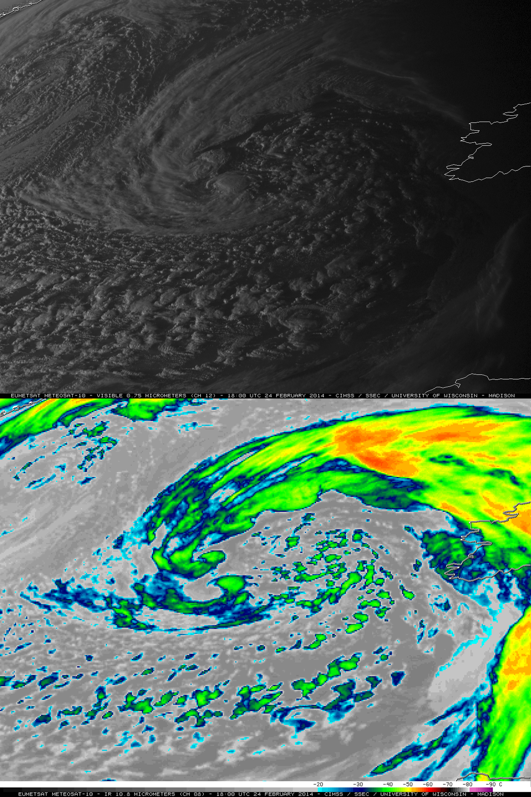
Mesovortices within a mid-latitude cyclone
Twitter follower @PedroCFernandez alerted us to an interesting case of mesovortices (original Spanish language blog post | Google translate version) which developed within the circulation of a strong mid-latitude cyclone over the northeastern Atlantic Ocean (moving toward the British Isles) on 24-25 February 2014. McIDAS images of EUMETSAT Meteosat-10 daytime 0.75 µm high resolution visible channel and night-time 10.8 µm IR channel data (above; click to play animation) revealed the series of mesovortices that spun up along the “bent-back” occluded frontal boundary (surface analyses); this storm was producing hurricane force winds during the 12-18 UTC period on 24 February, according to the NWS Ocean Prediction Center. Mesovortex cloud-top IR brightness temperatures were around -40º C (green color enhancement), indicating significant vertical development of the cloud structure associated with these features.
A comparison of the 18:00 UTC Meteosat-10 visible and IR images (above) showed two well-developed mesovortices at that time: #1, located southwest of the storm center, and #2, located west of the storm center;Â a new mesovortex #3 was just in the process of forming to the northwest of the storm center (below).


