20 injured, with 12 hospitalized after a lightning strike at Lake Murray in South Carolina
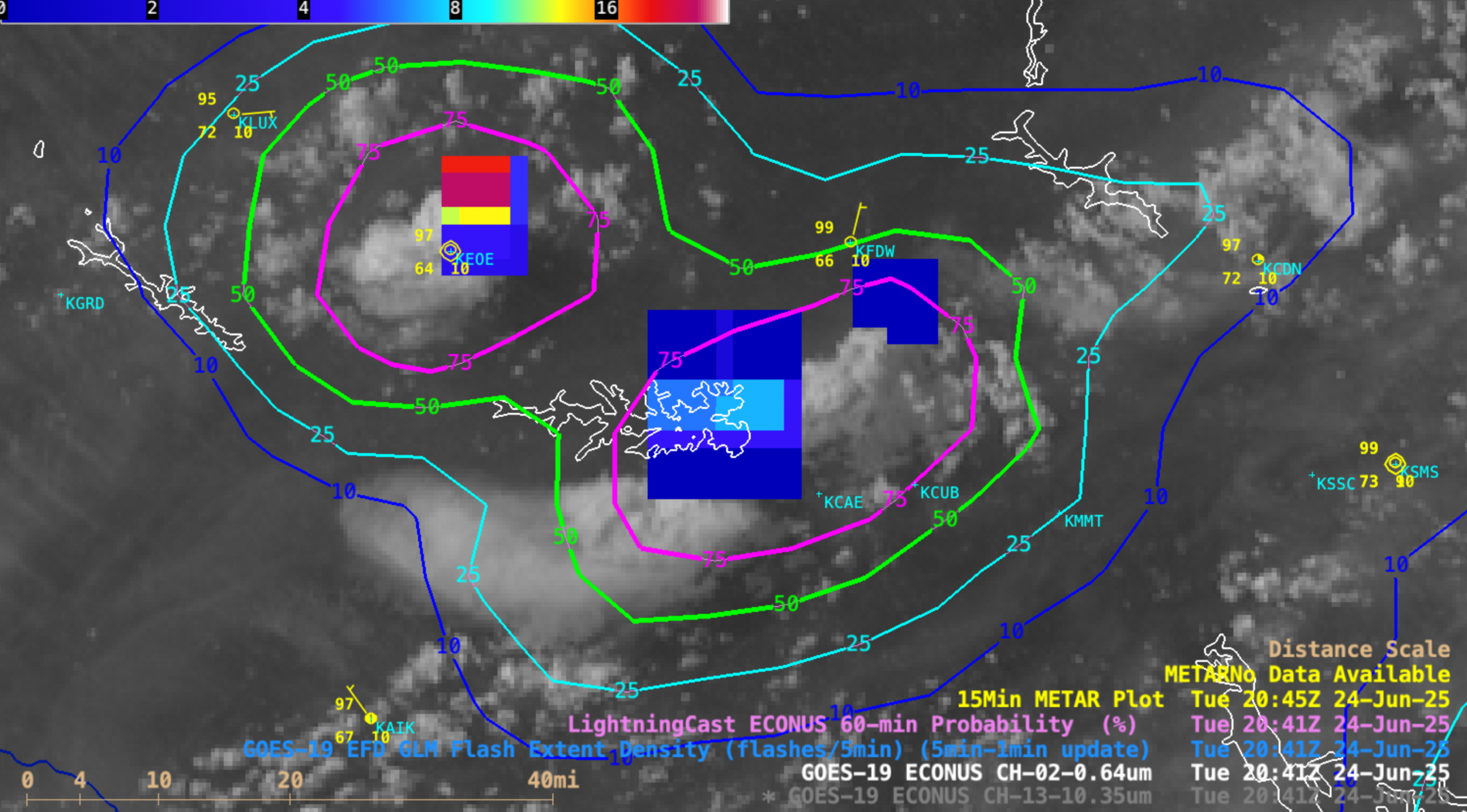
5-minute CONUS Sector GOES-19 (GOES-East) Visible images with an overlay of GLM Flash Extent Density (FED) and contours of LightningCast Probability (above) showed two isolated thunderstorms which passed over the eastern portion of Lake Murray (located in central South Carolina, just northwest of Columbia KCAE) during the late afternoon hours on... Read More
