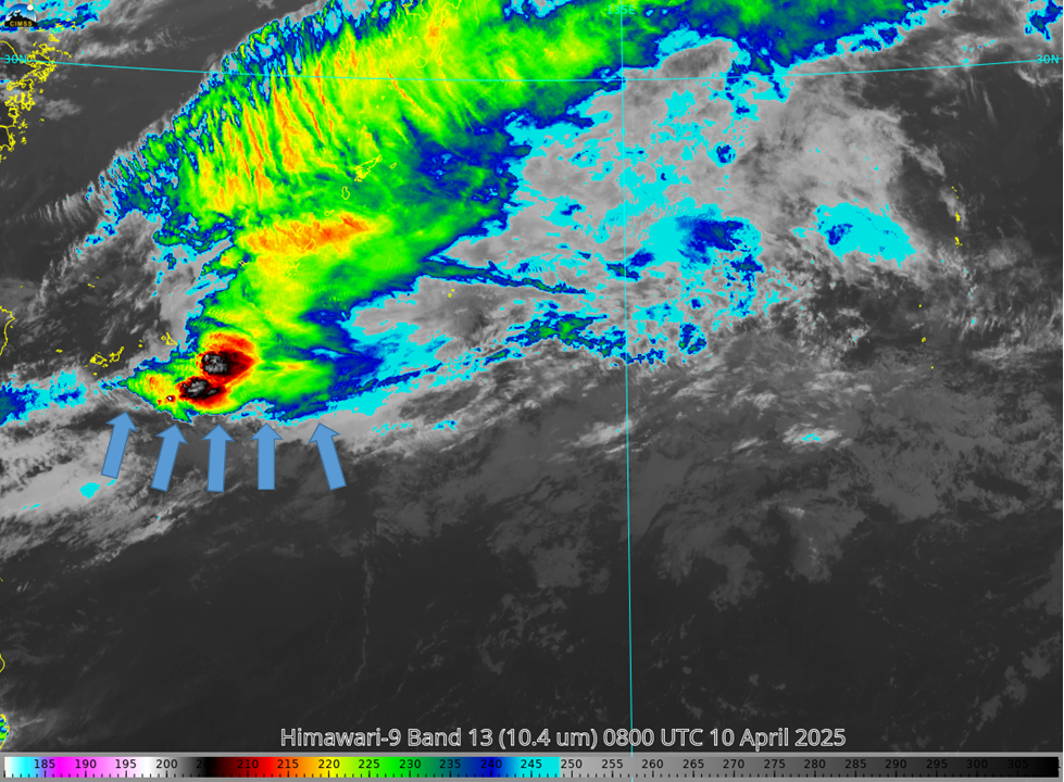
This website works best with a newer web browser such as Chrome, Firefox, Safari or Microsoft Edge. Internet Explorer is not supported by this website.

Category: LightningCast

Heavy Rain and lightning over American Samoa

National Weather Service Pago Pago Facebook posts on 11 December describe an atmosphere primed for heavy rain and lightning, the latter Facebook also shown below. Band 13 animation, above, shows persistent deep convection over the Samoan Islands. The convection develops and drifts southward.MIMIC Total Precipitable Water over the south Pacific shows... Read More

Lake effect rain downwind of Lake Erie and Lake Ontario

5-minute GOES-16 (GOES-East) Day Cloud Phase Distinction RGB images with overlays of GLM Flash Extent Density, LightningCast Probability and Buoy/METAR reports (above) showed glaciating (brighter shades of green) and glaciated (pale shades of yellow) cloud bands streaming eastward and southeastward off Lake Ontario and Lake Erie on 08 October 2023. Some of these cloud bands were producing lake effect... Read More

LightningCast probabilities in the cool season

Seasonably cool Fall-like temperatures overspread the western Great Lakes and northern Plains on 5 October. The animation above shows the Day Cloud Phase Distinction overlain with LightningCast probability from 1321-1721 UTC on 5 October (that is, 8:21-12:21 CDT). SPC on this day was anticipating general thunder over northern Minnesota. Given that,... Read More