Fire at a Jim Beam bourbon warehouse in Kentucky
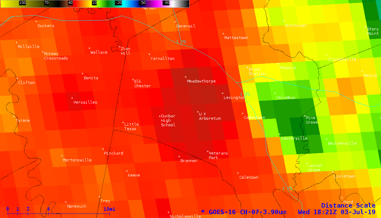
GOES-16 (GOES-East) Near-Infrared “Snow/Ice” (1.61 µm), Near-Infrared “Cloud Particle Size” (2.24 µm) and Shortwave Infrared (3.9 µm) images (above) revealed nighttime thermal signatures of a fire at a Jim Beam bourbon warehouse in Versailles, Kentucky on 03 July 2019. The fire reportedly began to burn around 0330 UTC (11:30 PM... Read More