Large hail in Texas
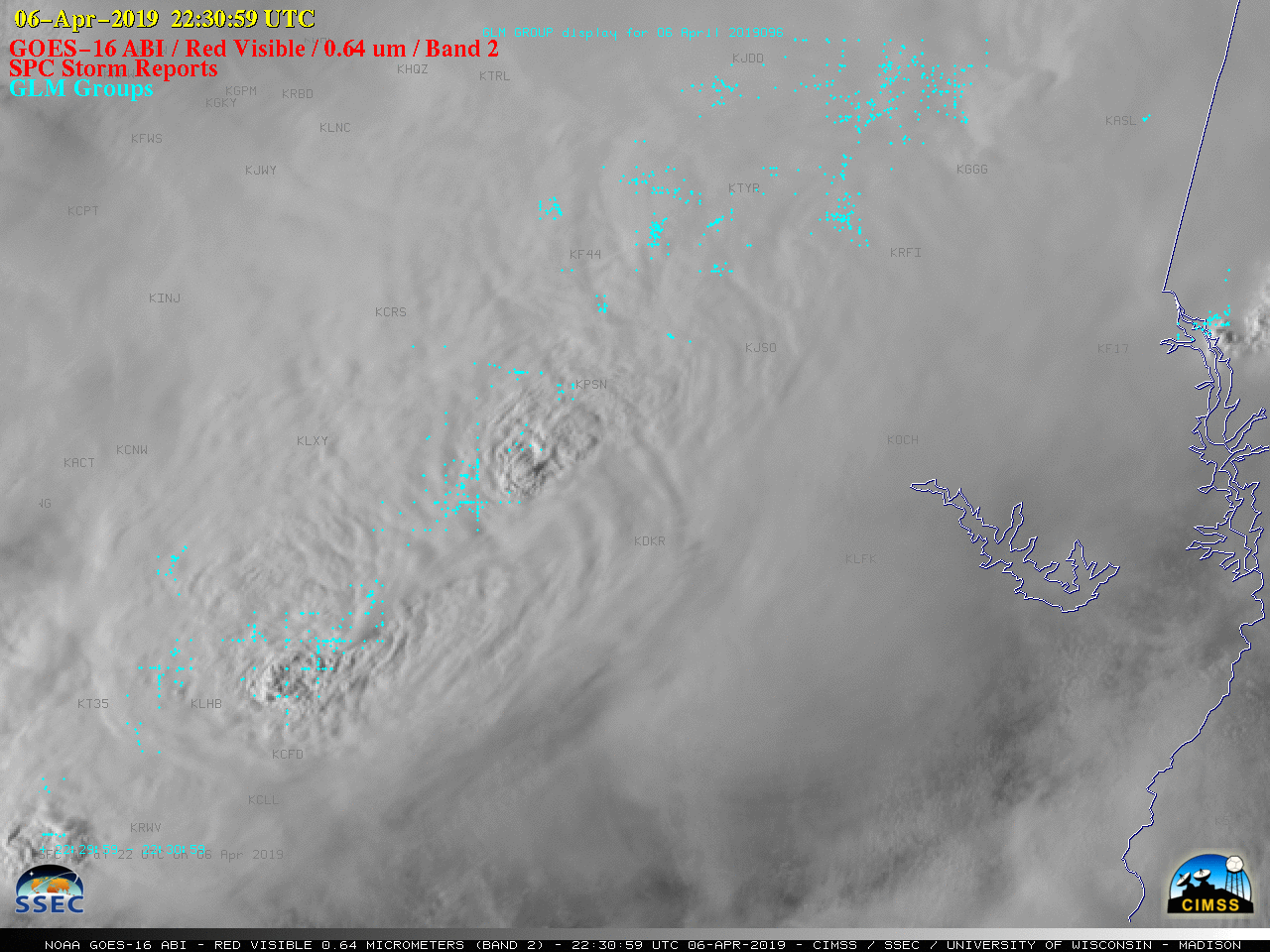
GOES-16 “Red” Visible (0.64 µm) images, with GLM Groups plotted in cyan and SPC storm reports plotted in red [click to play animation | MP4]
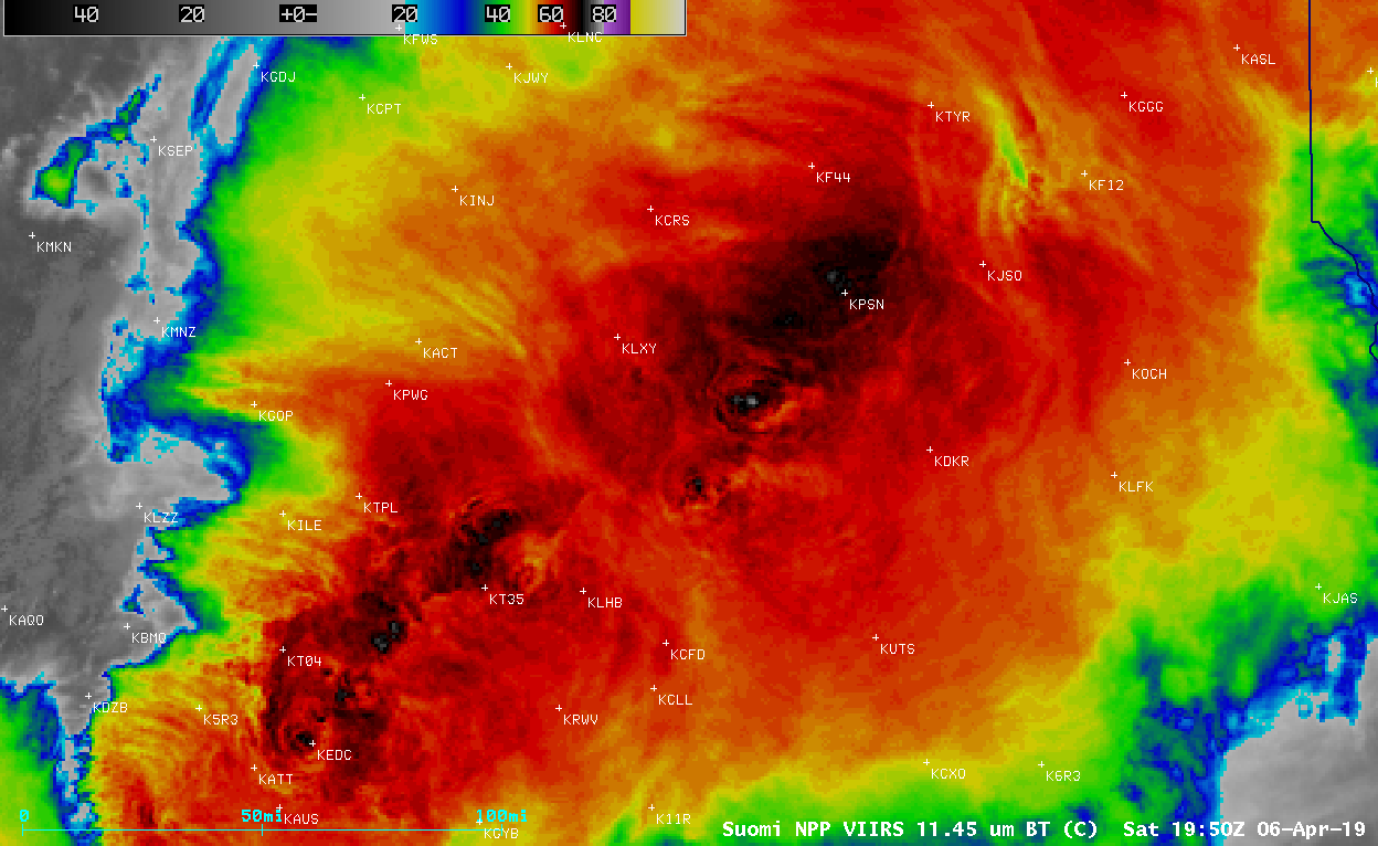
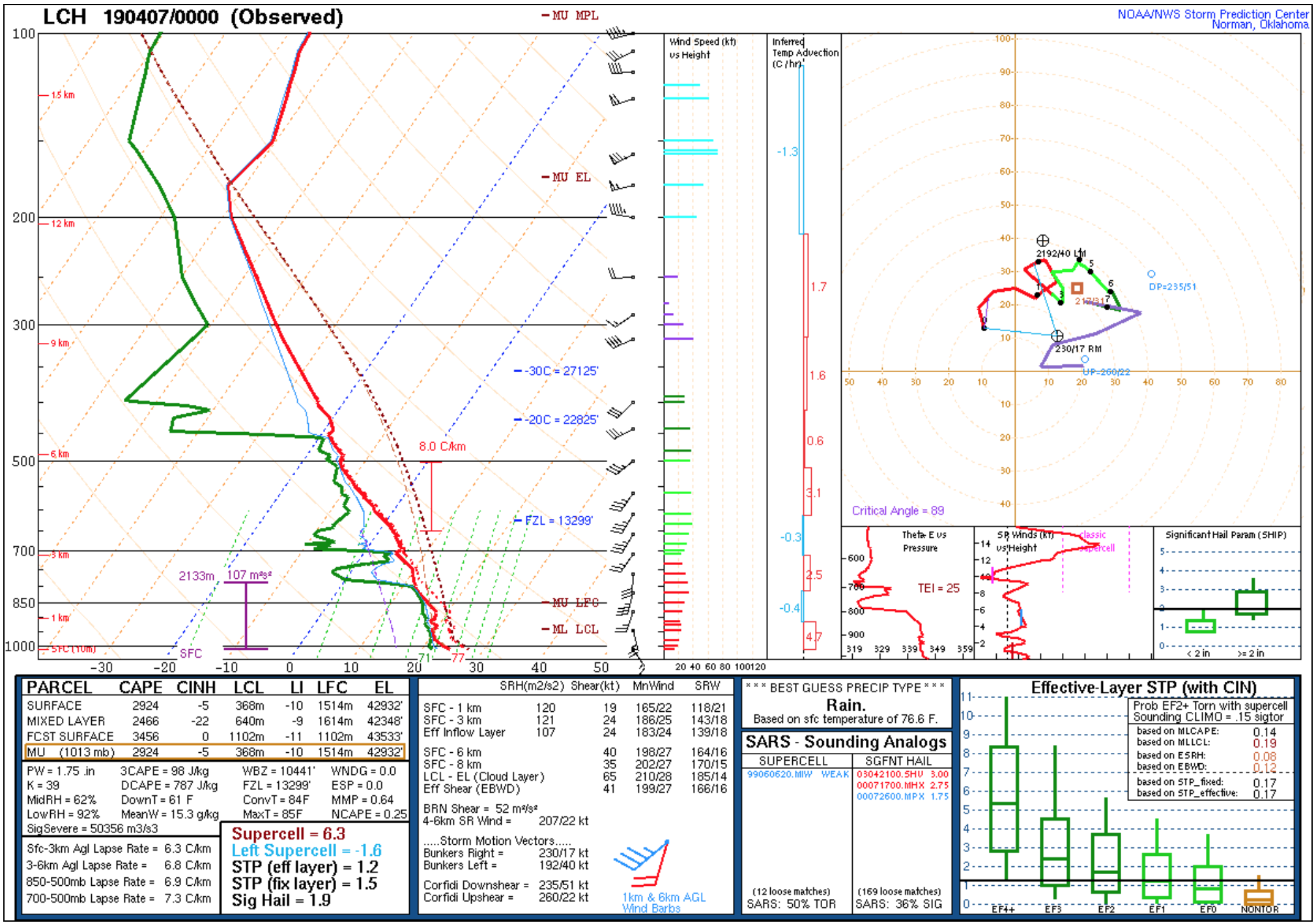
The corresponding GOES-16 “Clean” Infrared Window (10.3 µm) images (below) showed that cloud-top infrared brightness temperatures associated with the strongest overshooting tops were around -70ºC (dark black enhancement). Earlier that afternoon, a higher spatial resolution Suomi NPP VIIRS Infrared Window (11.45 µm) image at 1950 UTC showed brightness temperatures as cold as -77ºC just northeast of where 2.0-inch diameter hail was reported at Marquez — located approximately midway between station identifiers KLHB and KPSN — at 2015 UTC. Assuming the 00 UTC Lake Charles sounding was representative of the air mass these storms were developing in, the -77ºC temperature would be at an altitude over 1 km higher than the Most Unstable parcel’s Equilibrium Level.
![GOES-16 "Clean" Infrared Window (10.3 µm) images, with GLM Groups plotted in beige and SPC storm reports plotted in cyan [click to play animation | MP4]](https://cimss.ssec.wisc.edu/satellite-blog/wp-content/uploads/sites/5/2019/04/190406_goes16_infrared_glmGroups_spcStormReports_TX_anim.gif)
GOES-16 “Clean” Infrared Window (10.3 µm) images, with GLM Groups plotted in beige and SPC storm reports plotted in cyan [click to play animation | MP4]
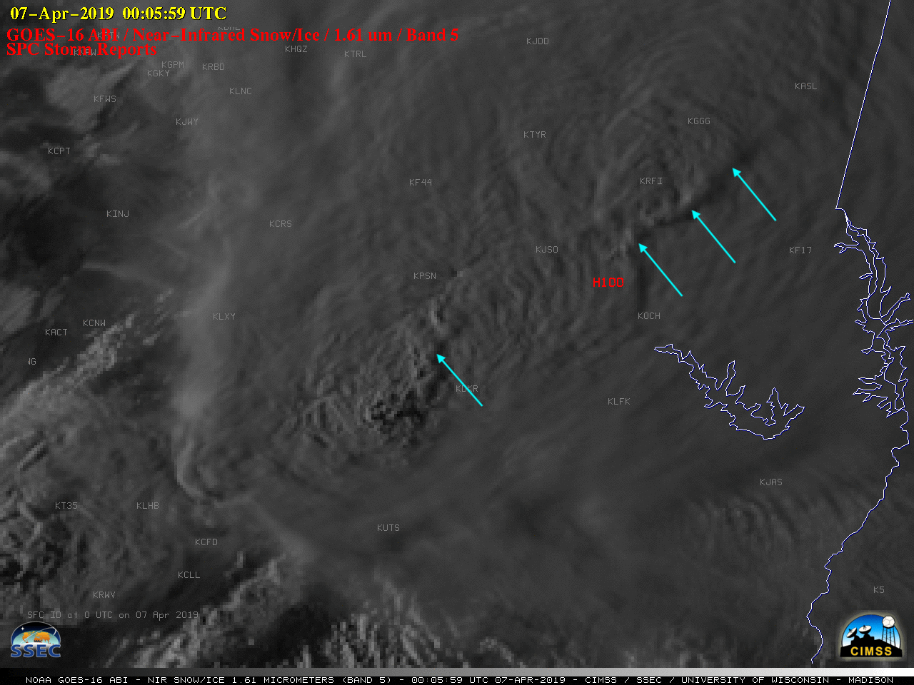
![GOES-16 Near-Infrared "Snow/Ice" (1.61 µm) images, with SPC storm reports plotted in red [click to play animation | MP4]](https://cimss.ssec.wisc.edu/satellite-blog/wp-content/uploads/sites/5/2019/04/190406_goes16_snowIce_spcStormReports_TX_anim.gif)
GOES-16 Near-Infrared “Snow/Ice” (1.61 µm) images, with SPC storm reports plotted in red [click to play animation | MP4]
![GOES-16 All Sky Total Precipitable Water (TPW) images [click to play animation]](https://cimss.ssec.wisc.edu/satellite-blog/wp-content/uploads/sites/5/2019/04/190406_2256utc_goes16_tpw_allsky.png)
GOES-16 All Sky Total Precipitable Water (TPW) product [click to play animation]
![GOES-16 All Sky Convective Available Potential Energy (CAPE) product [click to play animation]](https://cimss.ssec.wisc.edu/satellite-blog/wp-content/uploads/sites/5/2019/04/190406_2256utc_goes16_cape_allsky.png)
GOES-16 All Sky Convective Available Potential Energy (CAPE) product [click to play animation]