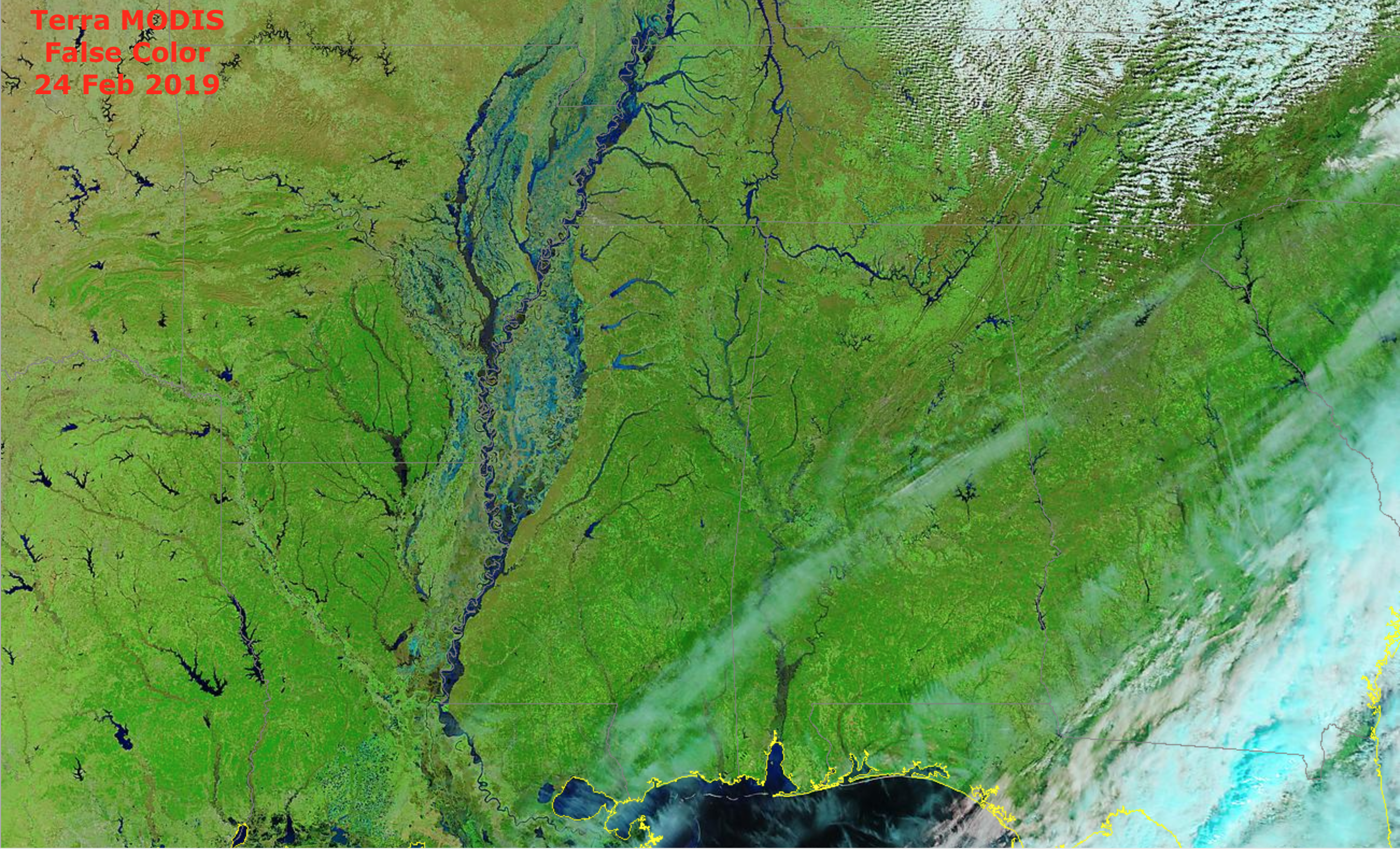
River flooding in the Lower Mississippi and Tennessee River Valley

A toggle between Observed Precipitation and Percent of Normal Precipitation for the 30-day period ending at 12 UTC on 24 February 2019 (above) showed a large area that received 10-15 inches of rainfall — which was 200-400% of normal — across the Lower Mississippi River and Tennessee River Valleys.A before/after... Read More


