Atmospheric river events bring heavy precipitation to California
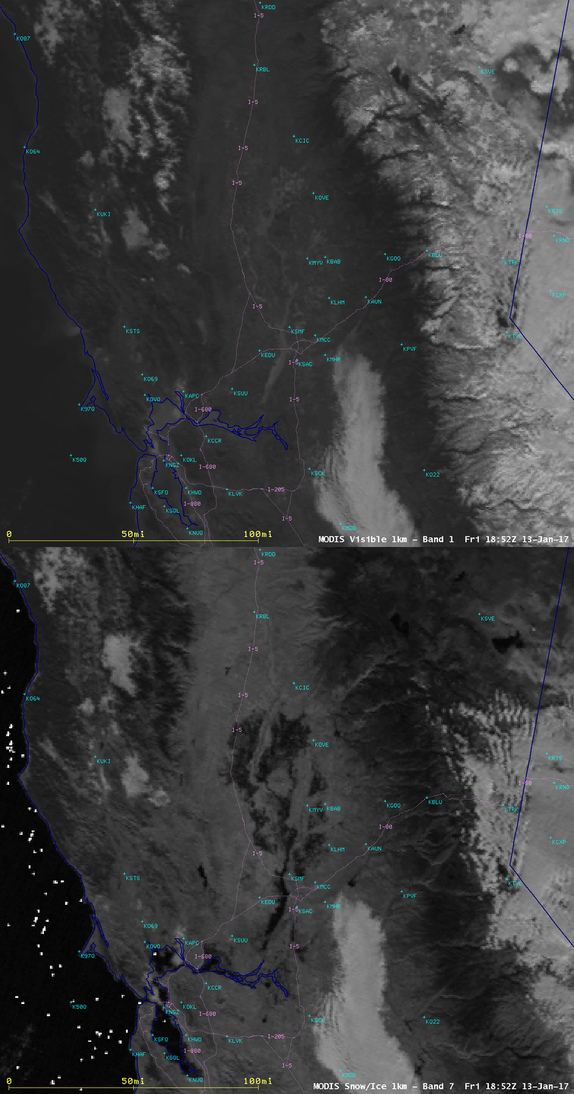
A series of 3 atmospheric river events brought heavy rainfall and heavy snowfall to much of California during the first 10 days of January 2017 (NWS San Francisco/Monterey | WeatherMatrix blog). Hourly images of the MIMIC Total Precipitable Water product (above; also available as a 33 Mbyte animated GIF) showed the second and third of these atmospheric river events during the 06 January – 11 January 2017 period, which were responsible for the bulk of the heavy precipitation; these 2 events appear to have drawn moisture northeastward from the Intertropical Convergence Zone (ITCZ).. A relatively cloud-free day on 13 January provided a good view of the Sacramento Valley and San Francisco Bay regions. A comparison of Terra MODIS Visible (0.65 µm) and Near-Infrared “Snow/Ice” (2.1 µm) images (above) showed that snow cover in the higher terrain of the Coastal Ranges and the Sierra Nevada appeared darker in the Snow/Ice band image (since snow and ice are strong absorbers of radiation at the 2.1 µm wavelength) — but water is an even stronger absorber, and therefore appeared even darker (which allowed the areas of flooding along the Sacramento River and its tributaries to be easily identified). A similar type of 1.6 µm Near-Infrared “Snow/Ice” Band imagery will be available from the ABI instrument on the GOES-R series, beginning with GOES-16.Better detail of the flooded areas of the Sacramento River and its tributaries was seen in 250-meter resolution false-color Red/Green/Blue (RGB) imagery from the MODIS Today site — water appears as darker shades of blue, while snow appears as shades of cyan (in contrast to supercooled water droplet clouds, which appear as shades of white). In the corresponding MODIS true-color image, rivers and bays with high amounts of turbidity (tan shades) were evident; the offshore flow of sediment from a few rivers could also be seen.


![MIMIC Total Precipatable Water product [click to play MP4 animation]](https://cimss.ssec.wisc.edu/satellite-blog/wp-content/uploads/sites/5/2017/01/comp20170108.200000_tpw.png)

![Terra MODIS true-color and false-color RGB images [click to enlarge]](https://cimss.ssec.wisc.edu/satellite-blog/wp-content/uploads/sites/5/2017/01/170113_modis_truecolor_falsecolor_Sacramento_Valley_CA_flooding_zoom_anim.gif)