This website works best with a newer web browser such as Chrome, Firefox, Safari or Microsoft Edge. Internet Explorer is not supported by this website.

Category: Himawari-8

Super Typhoon Mangkhut makes landfall in the Philippines

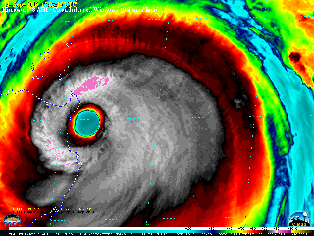
Himawari-8 Infrared Window (10.4 µm) images (above) showed Super Typhoon Mangkhut making landfall as a Category 5 intensity storm over the far northern portion of Luzon in the Philippines just after 17 UTC on 14 September 2018 (1 am local time on 15 September). The eye quickly deteriorated and became cloud-filled... Read More

Super Typhoon Jebi

West Pacific Typhoon Jebi underwent a period of very rapid intensification on 30 August 2018 (ADT | SATCON), reaching Category 5 Super Typhoon intensity. Himawari-8 rapid-scan (2.5 minute interval) “Clean” Infrared Window (10.4 µm) images (above) showed that Jebi began to exhibit an annular appearance with a nearly symmetric eyewall... Read More

Hurricane Lane

NOAA-20 VIIRS Day/Night Band (0.7 µm) and Infrared Window (11.45 µm) images (above; courtesy of William Straka, CIMSS) showed the eye of Hurricane Lane in the central Pacific Ocean at 1208 UTC on 22 August 2018, a few hours after it reached Category 5 intensity (SATCON). Surface mesovortices were evident within... Read More

Typhoon Soulik in the northwest Pacific Ocean

Typhoon Soulik, south of Japan and moving westward, has acquired a very large eye — almost 100 miles across! Himawari-8 imagery, above (courtesy JMA), shows the evolution and enlargement of the eye between 0900 and 1400 UTC on 20 August 2018.GCOM, Suomi NPP and NOAA-20 all passed over Soulik between... Read More