Super Typhoon Mangkhut makes landfall in the Philippines
Himawari-8 Infrared Window (10.4 µm) images [click to play MP4 animation | Animated GIF]
The MIMIC-TC morphed microwave product (below) indicated that Mangkhut was in the process of completing an eyewall replacement cycle shortly before making landfall.
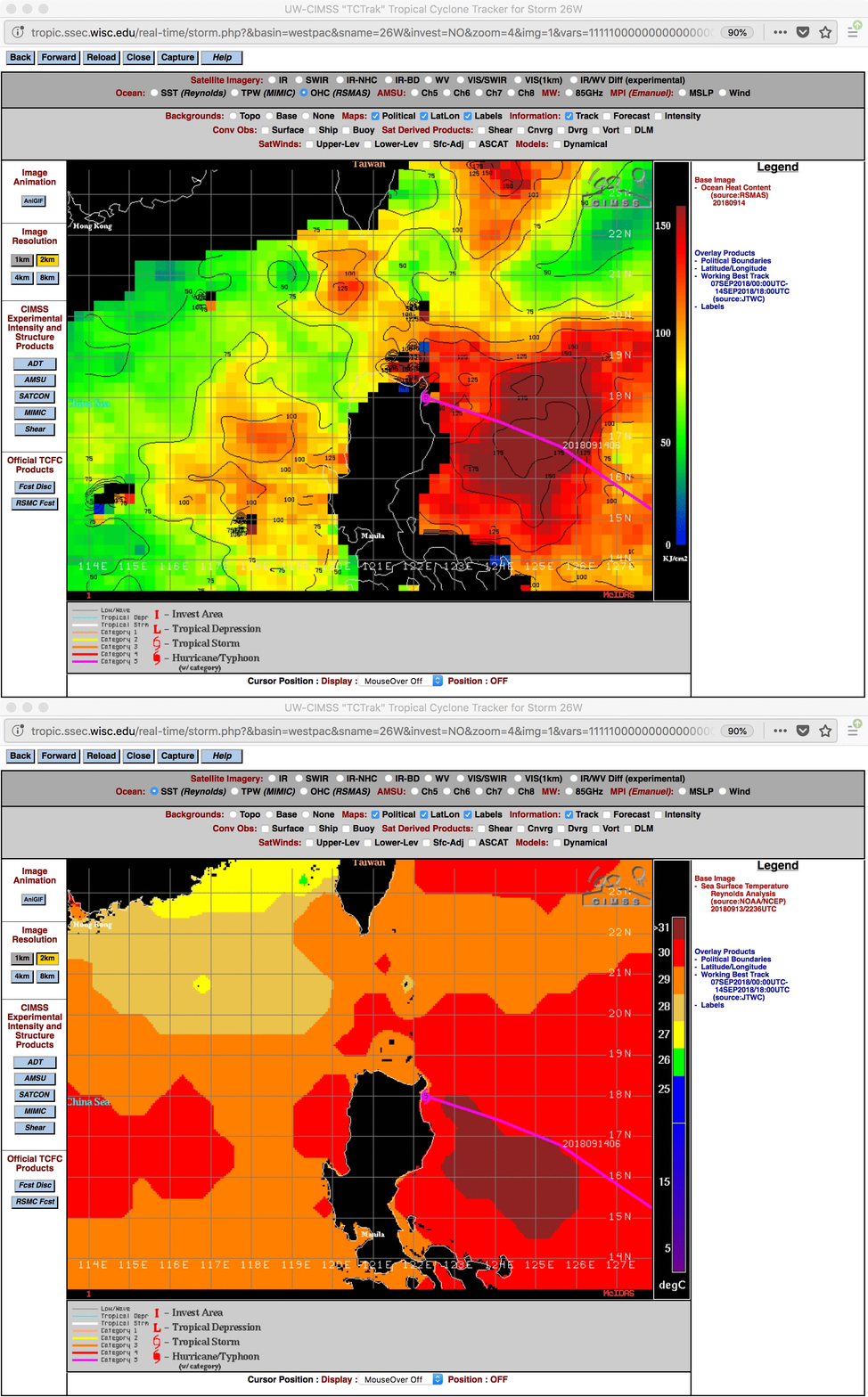
westernMIMIC-TC morphed microwave product [click to enlarge]Mangkhut moved over waters of the western Philippine Sea having high values of Ocean Heat Content and Sea Surface Temperature during the final day preceding landfall (below).


