This website works best with a newer web browser such as Chrome, Firefox, Safari or Microsoft Edge. Internet Explorer is not supported by this website.

Category: Himawari-8

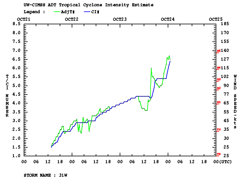
Super Typhoon Yutu makes landfall on Tinian and Saipan

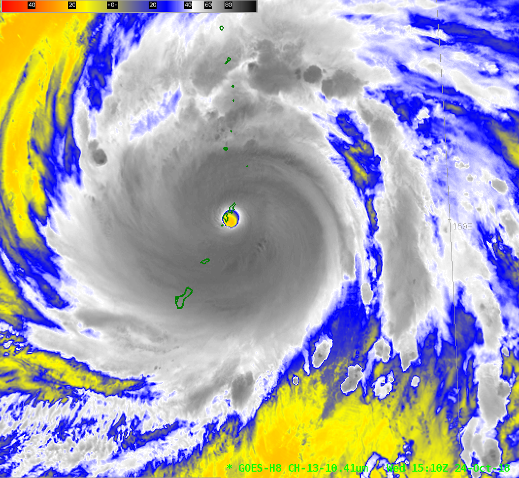
Himawari-8 Clean Window Infrared (10.41 µm) imagery shows Super Typhoon Yutu poised to hit Tinian and Saipan in the Marianas Islands, to the northeast of Guam. The 0900 UTC Advisory from the Joint Typhoon Warning Center shows a storm with sustained winds of 145 knots, with strengthening forecast. JMA estimates... Read More

West Pacific Typhoon Yutu

Rapid-scan (2.5-minute interval) Himawari-8 “Clean” Infrared Window (10.4 µm) images (above) showed the formation of a well-defined eye as Typhoon Yutu rapidly intensified from a Category 2 to a Category 4 storm  (ADT | SATCON) east of Guam on 23 October 2018. Cloud-top infrared brightness temperatures were -90ºC or colder... Read More

Hurricane Walaka

GOES-15 (GOES-West) Infrared Window (10.7 µm) images (above) showed the formation of a well-defined eye of Hurricane Walaka during a period of rapid intensification (ADT | SATCON) from 0000-2330 UTC on 01 October 2018; Walaka was classified a Category 5 hurricane as of the 02 October 00 UTC advisory. Walaka was moving... Read More

West Pacific Super Typhoon Trami

Himawari-8 “Clean” Infrared Window (10.4 µm) images (above) showed Typhoon Trami at Category 4 intensity during the 23-24 September 2018 period. The typhoon was going through an eyewall replacement cycle during this time — as seen on the MIMIC-TC product — which halted the period of rapid intensification that began early... Read More