Subtropical Storm Debby
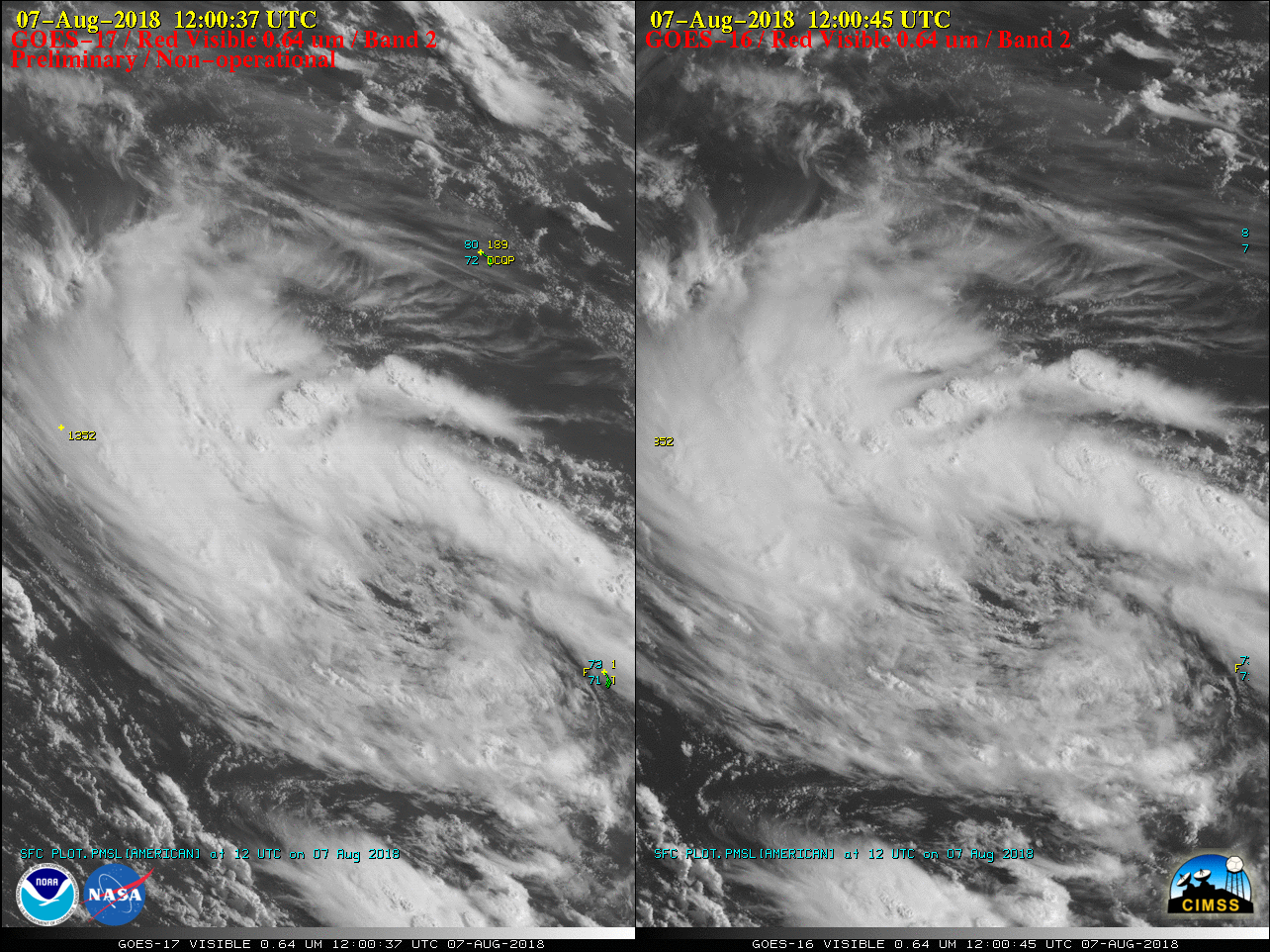
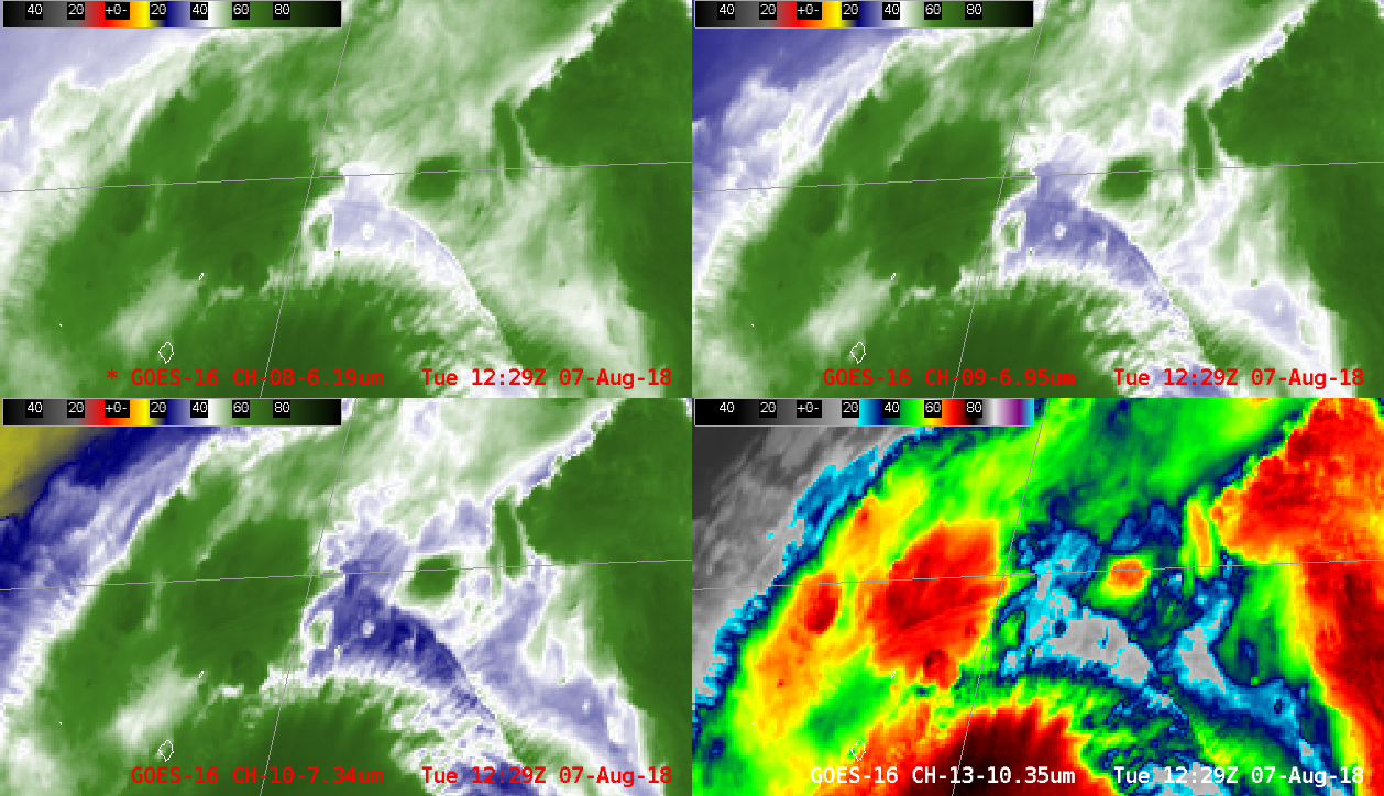
* GOES-17 images shown here are preliminary and non-operational *“Red” Visible (0.64 µm) images from GOES-17 and GOES-16 (above) showed the circulation and convective banding associated with Subtropical Storm Debby in the Atlantic Ocean on 07 August 2018.Deep-layer wind shear analysis from the CIMSS Tropical Cyclones site (below) indicated that Debby was in an environment... Read More