This website works best with a newer web browser such as Chrome, Firefox, Safari or Microsoft Edge. Internet Explorer is not supported by this website.

Category: GOES-16

30-second images of severe thunderstorms along the Gulf Coast of Florida

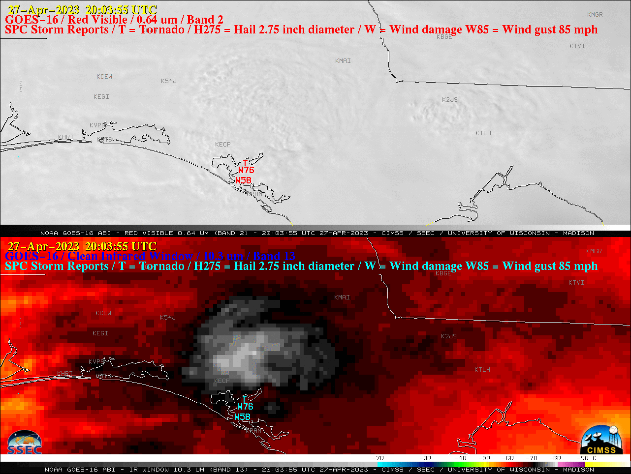
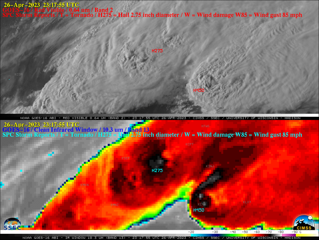
Overlapping 1-minute Mesoscale Domain Sectors provided GOES-16 (GOES-East) “Red” Visible (0.64 µm) and “Clean” Infrared Window (10.3 µm) images at 30-second intervals (above), which included plots of time-matched (+/- 3 minutes) SPC Storm Reports — showing thunderstorms that produced a few tornadoes, hail as large as 1.75 inches in diameter and wind gusts to 76 mph across... Read More

SAR data views of the North Wall of the Gulf Stream

Sentinel-1A’s overpass just east of North Carolina right after sunset on 23 April 2023, above, shows a sharp delineation in wind speeds, with wind speeds at the western edge of the SAR winds dropping from around 8-9 knots (cyan enhancement) to 2-3 knots (magenta enhancement). The animation below includes the... Read More