This website works best with a newer web browser such as Chrome, Firefox, Safari or Microsoft Edge. Internet Explorer is not supported by this website.

Category: GOES-13

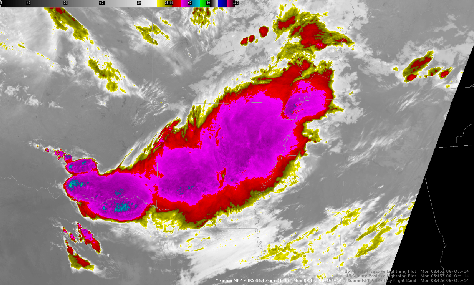
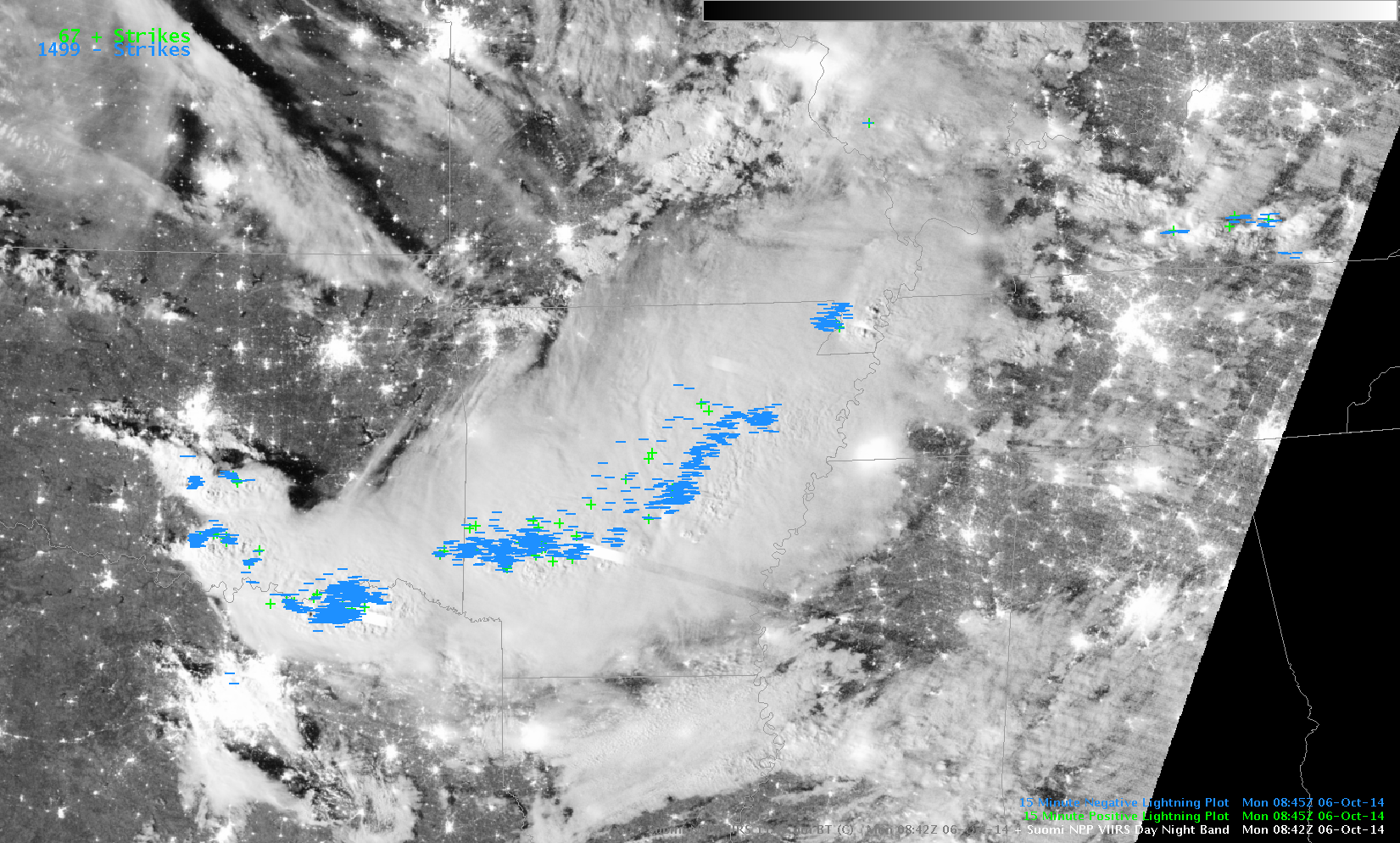
Mesoscale Convective System over the Southern Plains

The Suomi NPP VIIRS image toggle, above, from the pre-dawn hours (3:42 am local time) on 6 October 2014 shows a 0.7 µm Day/Night Band image and an 11.45 µm Infrared image, along with observations of postive and negative lightning strikes. With ample illumination by moonlight, the “visible image at night” Day/Night Band image highlighted areas of convective overshooting tops, but also included... Read More

Tropical Invest 97L in the western Atlantic Ocean

Tropical Invest 97L formed near Bermuda during the pre-dawn hours on 29 September 2014. After sunrise, AWIPS II images of GOES-13 0.63 µm visible channel data (above; click image to play animation) revealed a well-defined low-level circulation spinning just to the west of Bermuda. It is interesting to note that... Read More

Co-registration Issues on GOES-13

Previous posts on this blog (and elsewhere) have detailed the co-registration misalignment that exists between the 3.9 µm and 10.7 µm channels on the GOES-13 Imager. Because of this diurnally-varying co-registration error, a 3.9 µm pixel may be offset to the right or left of a 10.7 µm pixel; if this... Read More