Mesoscale Convective System over the Southern Plains

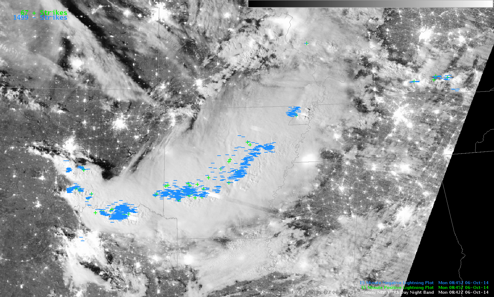
Suomi NPP VIIRS Day/Night Band (0.70 µm), Infrared Imagery (11.45 µm) and Day/Night Band imagery with lightning strikes at 0842 UTC on 6 October 2014 (click to animate)
The Suomi NPP VIIRS image toggle, above, from the pre-dawn hours (3:42 am local time) on 6 October 2014 shows a 0.7 µm Day/Night Band image and an 11.45 µm Infrared image, along with observations of postive and negative lightning strikes. With ample illumination by moonlight, the “visible image at night” Day/Night Band image highlighted areas of convective overshooting tops, but also included bright horizontal stripes that are associated with intense lightning activity; after scanning a particularly bright area of lightning in Arkansas, this image also showed a darker “post-saturation recovery” stripe downscan (to the southeast), which stretched from central Arkansas into Mississippi. This vigorous convective system dropped southeastward from Oklahoma towards the Gulf of Mexico, eventually becoming a Quasi-Linear Convective System (QLCS) which produced hail and wind damage (with one fatality) across parts of northeastern Texas and far northwestern Louisiana (SPC storm reports).
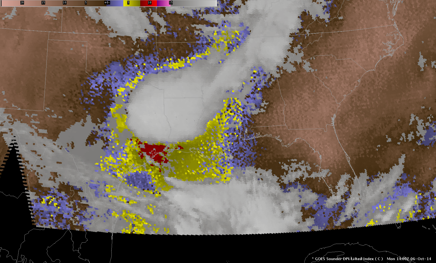
The southward-dropping Mesoscale Convective System followed a channel of unstable air as diagnosed by the GOES Sounder, above. Note that the Lifted Index values were smaller (less instability) along the path that the system had moved. Total Precipitable water was also enhanced in that corridor, suggesting a region where moisture return from the Gulf of Mexico was ongoing and concentrated.
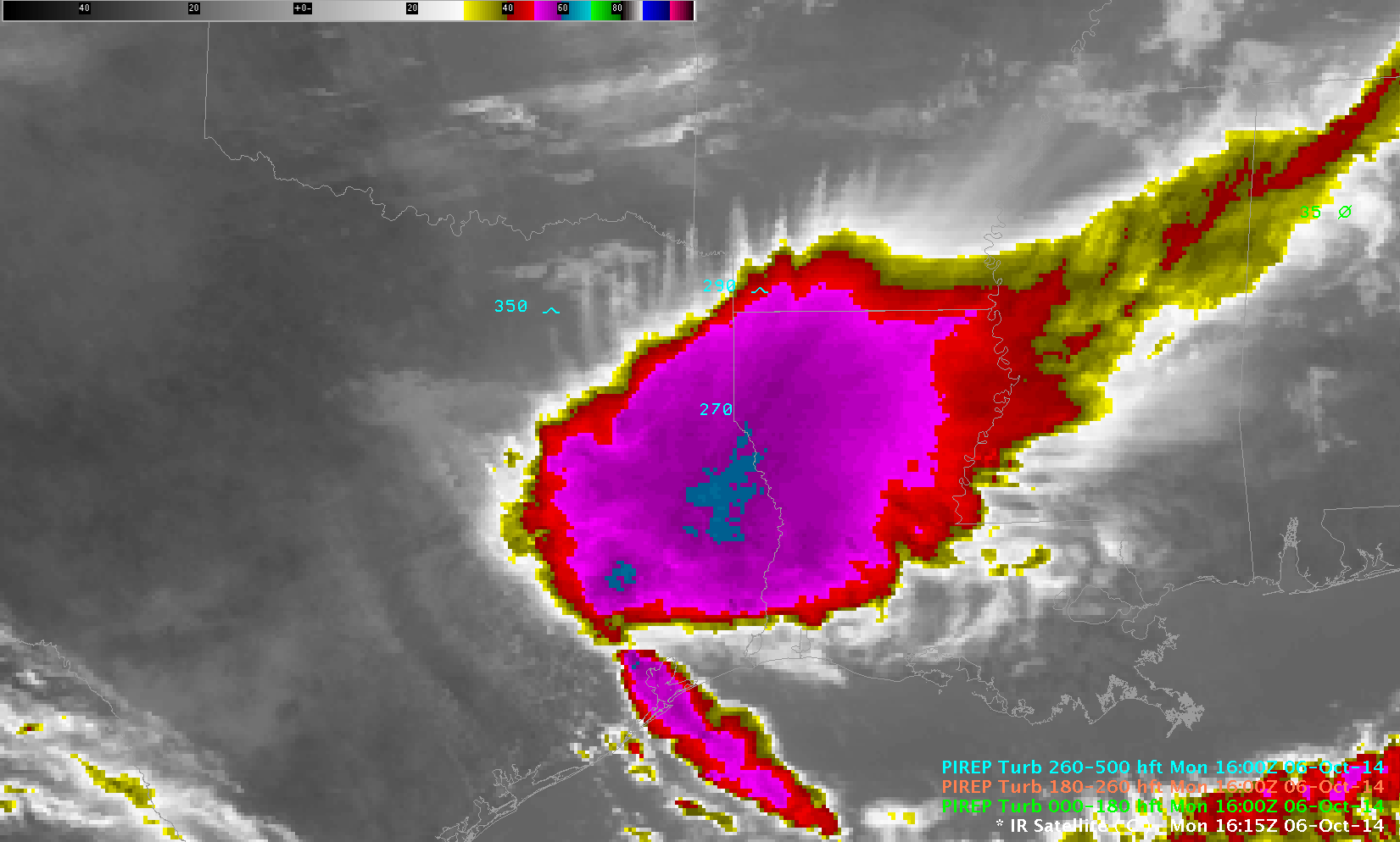
Mesoscale Convective Systems can exhibit signatures that suggest the presence of turbulence in the atmosphere. In the GOES-13 IR image above, parallel filaments or “transverse bands” of cirrus (extending approximately north-south) on the poleward side of the MCS suggest the presence of turbulence, and scattered pilot reports of Moderate Turbulence confirm that. Visible MODIS Imagery, below, also shows the transverse bands, as well as the outflow boundary arcing from Houston to the northwest and north.
An animation of hourly GOES-13 Visible imagery, below, shows the motion of the western portion of the outflow boundary as the decaying QLCS moved into the Gulf of Mexico.
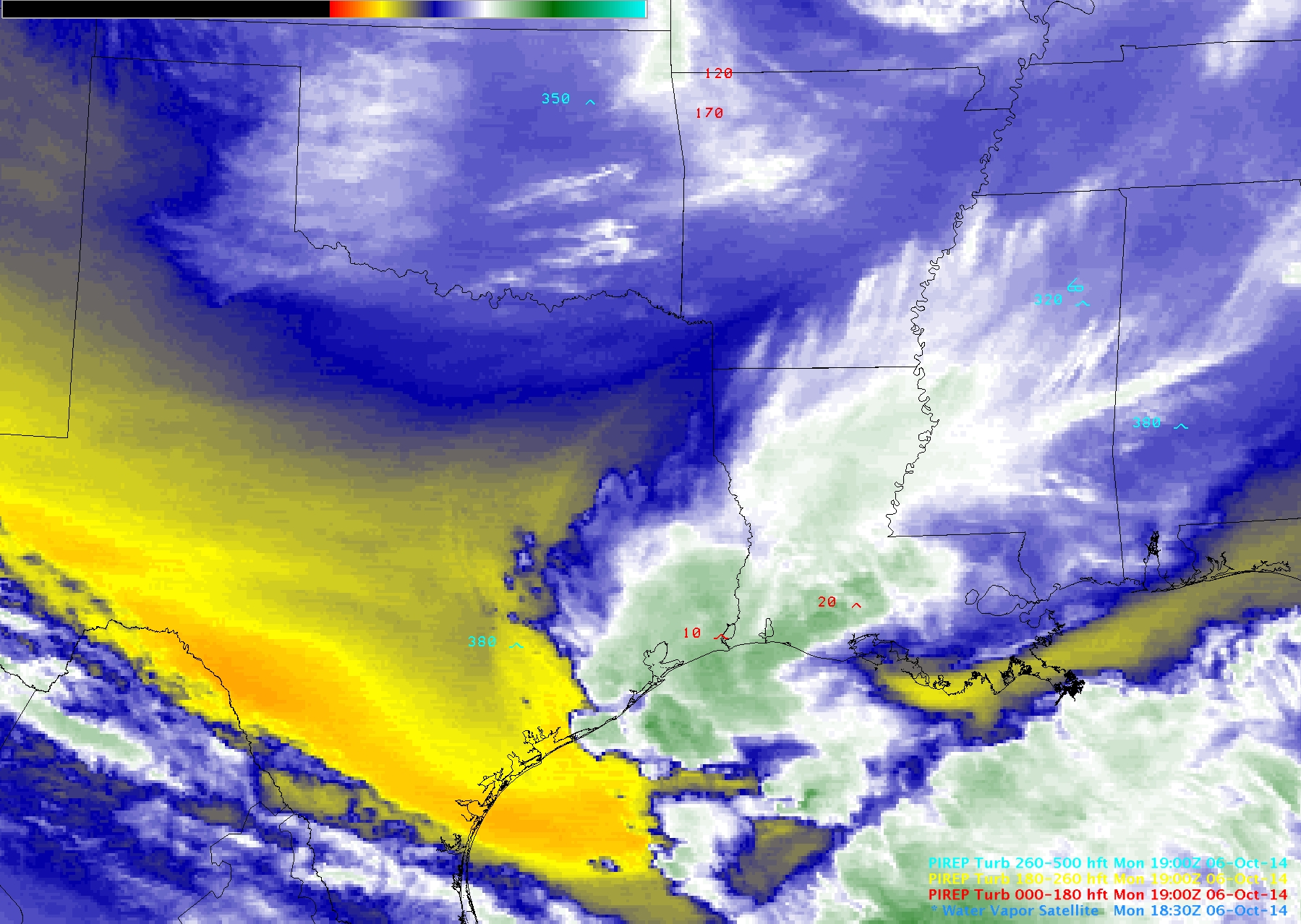
GOES-13 6.5 µm water vapor channel imagery, below, displayed a signature of subsidence immediately upstream of the dissipating MCS, in the form of an arc of warmer/drier (yellow to orange color enhancement) brightness temperatures that extended from the Texas coast into central Arkansas. One rapidly-developing convective cell which formed along the advancing outflow boundary was responsible for severe turbulence in eastern Texas; the subtle signal of the westward-propagating outflow boundary could also be followed on the water vapor imagery.


