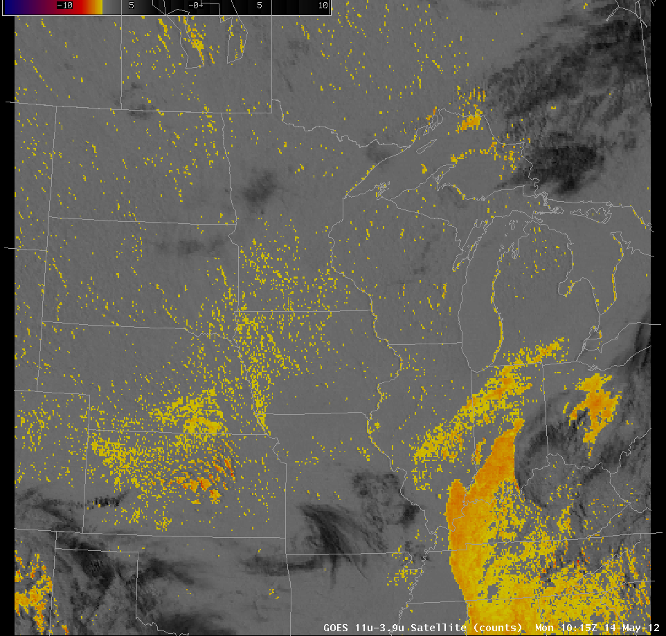
GOES-13 Imager Band Co-Registration
On the morning of May 14th, a clear morning, the GOES-13 Legacy “Fog Product” that exploits the brightness temperature differences observed by the GOES Imager at 3.9 µm and 10.7 µm, which differences arise because of wavelength-dependent emissivity differences in water clouds, showed fog first on the eastern shores of Lakes Huron and Michigan (at 1015 UTC), and then on the western shores of Lakes Huron and Michigan (at 1401 UTC, and afterwards). These returns occurred despite clear skies.
A similar effect occurred on the morning of May 15th. The image at 1015 UTC showed fog along the eastern side of the Lakes, and the image at 1255 UTC showed fog along the western side of the Lakes. (Note that more widespread mid-level clouds reduced the signal on this day). A POES Fog Product image from 1020 UTC on May 15th (link) did not show the fog signal along the shoreline.
The image toggle above shows highly magnified imagery over Lake Michigan at 1255 UTC on May 15 2012. There is an apparent 1-pixel shift between the 3.9 µm and the 10.7 µm imagery. If the start element of the image is shifted by 1 infrared pixel, then the toggle between the two images contains no shift. The legacy ‘Fog Product’ is therefore diagnosing fog because the 3.9 µm pixel is over water (cold) and the 10.7 µm pixel is over land (warm). When the 1-pixel shift is rectified, both pixels are either over water, or both over land.
Scientists at NESDIS are working to find the source of this difference.
===================================================================
Update, 17 November 2014
A software fix has been identified and tested. Link.


