This website works best with a newer web browser such as Chrome, Firefox, Safari or Microsoft Edge. Internet Explorer is not supported by this website.

Category: GOES-13

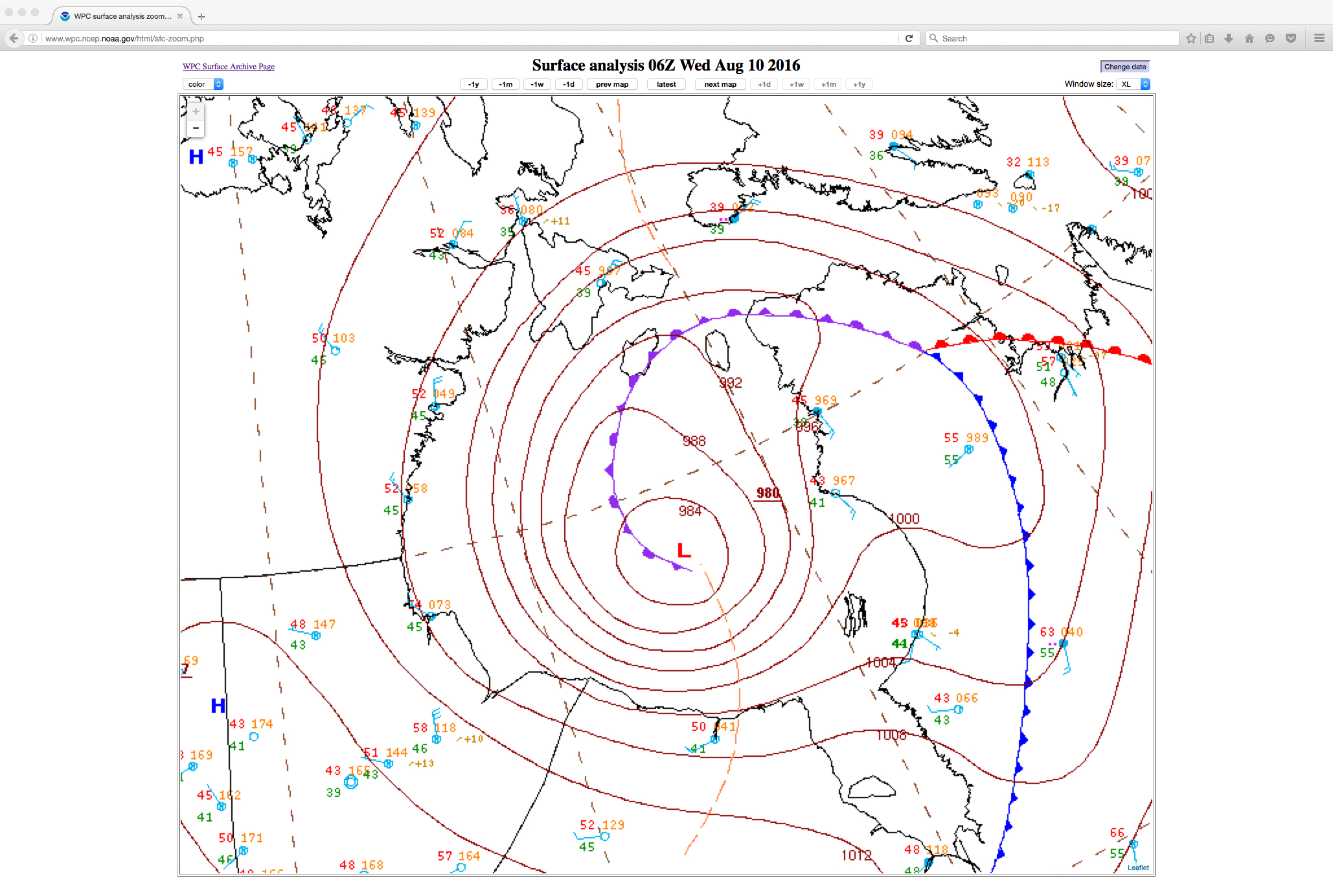
Deep cyclone over Hudson Bay

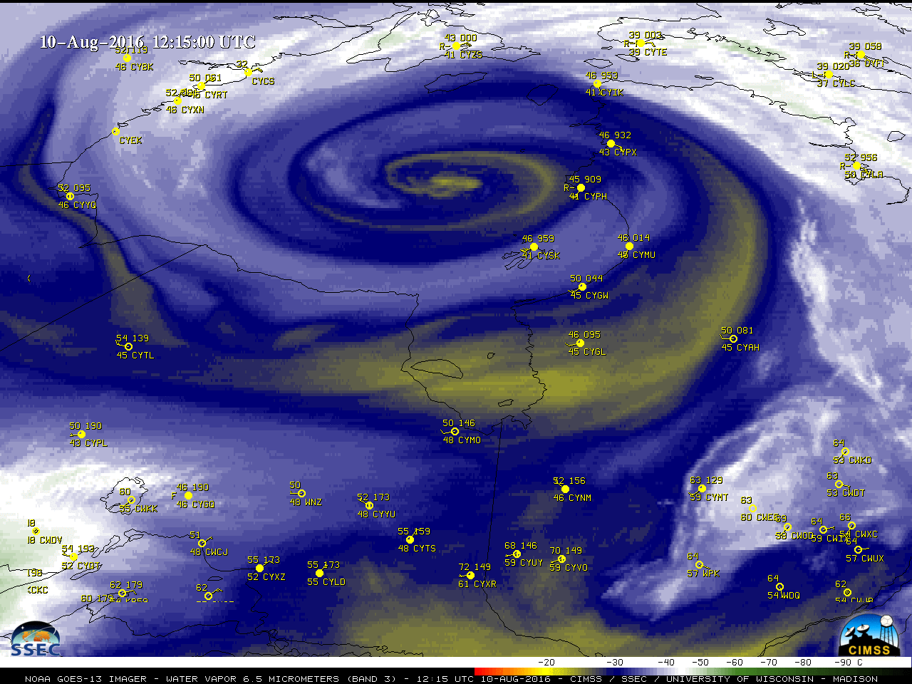
GOES-13 (GOES-East) Water Vapor (6.5 µm) images (above) showed the intensification of a strong cyclone over Hudson Bay, Canada during the 09 August – 10 August 2016 period; the cyclone deepened to a central pressure of 980 hPa (28.94″ of mercury) at 06 UTC on 10 August.Daily composites of Suomi NPP VIIRS true-color Red/Green/Blue... Read More

GOES-14 is out of Storage

 GOES-14 has again been reactivated, and is distributing data from its location over the Equator at 105 W. GOES-14 will be entering SRSO-R mode next week, starting on 9 August (link) and continuing through 26 August.Short animations of GOES-14 Visible (0.63 um) and Infrared Window (10.7 um) imagery are shown... Read More