GOES-14 is operating in SRSO-R Mode
![GOES-14 0.62 µm Visible images from 1230 to 1245 UTC on 9 August 2016 [click to play animation]](https://cimss.ssec.wisc.edu/satellite-blog/wp-content/uploads/sites/5/2016/08/GOES14_VIS_09AUG2016_anim_1230to1245.gif)
GOES-14 0.62 µm Visible images from 1230 to 1245 UTC on 9 August 2016 [click to play animation]
Shown below is a comparison of GOES-15 (GOES-West), GOES-14 and GOES-13 (GOES-East) Visible images covering the longer 1-hour period of 1230-1330 UTC, focusing on a area of thunderstorms over North Texas. During this time, there are 53 images from GOES-14, compared to 7 images from GOES-15 and 5 images from GOES-13 — note how the evolution of overshooting tops is very easy to follow using the 1-minute GOES-14 imagery.
![GOES-15 (left), GOES-14 (center and GOES-13 (right) Visible images [click to play animation]](https://cimss.ssec.wisc.edu/satellite-blog/wp-content/uploads/sites/5/2016/08/160809_goes15_goes14_goes13_visible_TX_convection_anim.gif)
GOES-15 (left), GOES-14 (center and GOES-13 (right) Visible images [click to play animation]
![GOES-14 Visible (0.62 µm) images [click to play animation]](http://fusedfog.ssec.wisc.edu/wp-content/uploads/2016/08/GOES14_09AUG_VIS_1204_1610_anim.gif)
GOES-14 Visible (0.62 µm) images [click to play animation]
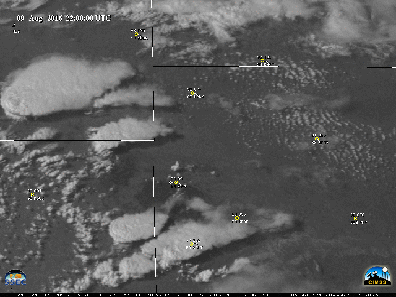
![GOES-14 Visible (0.62 µm) images, with surface reports and SPC storm reports of hail (yellow) and wind (cyan) [click to play MP4 animation]](https://cimss.ssec.wisc.edu/satellite-blog/wp-content/uploads/sites/5/2016/08/960x1280_GOES14_B1_GOES14_VIS_MT_ND_WY_SD_09AUG2016_2016223_005300_0001PANEL.GIF)
GOES-14 Visible (0.62 µm) images, with surface reports and SPC storm reports of hail (yellow) and wind (cyan) [click to play MP4 animation]
![GOES-13 (left), GOES-14 (center) and GOES-13 (right) 0.62 um Visible images [click to play MP4 animation]](https://cimss.ssec.wisc.edu/satellite-blog/wp-content/uploads/sites/5/2016/08/MT_SUPERCELL_1X3_ALL_958x425_B1_2315_2329_2315_0003PANELS.GIF)
GOES-13 (left), GOES-14 (center) and GOES-13 (right) 0.62 um Visible images [click to play MP4 animation]
![GOES-15 (left panels), GOES-14 (center panels) and GOES-13 (right panels) 0.62 m Visible and 3.9 µm Shortwave Infrared images [click to play animation]](https://cimss.ssec.wisc.edu/satellite-blog/wp-content/uploads/sites/5/2016/08/160809_goes15_goes14_goes13_visible_swir_NV_fire_anim.gif)
GOES-15 (left panels), GOES-14 (center panels) and GOES-13 (right panels) 0.62 m Visible (top) and 3.9 µm Shortwave Infrared (bottom) images [click to play animation]