Hurricane Sally makes landfall in Alabama
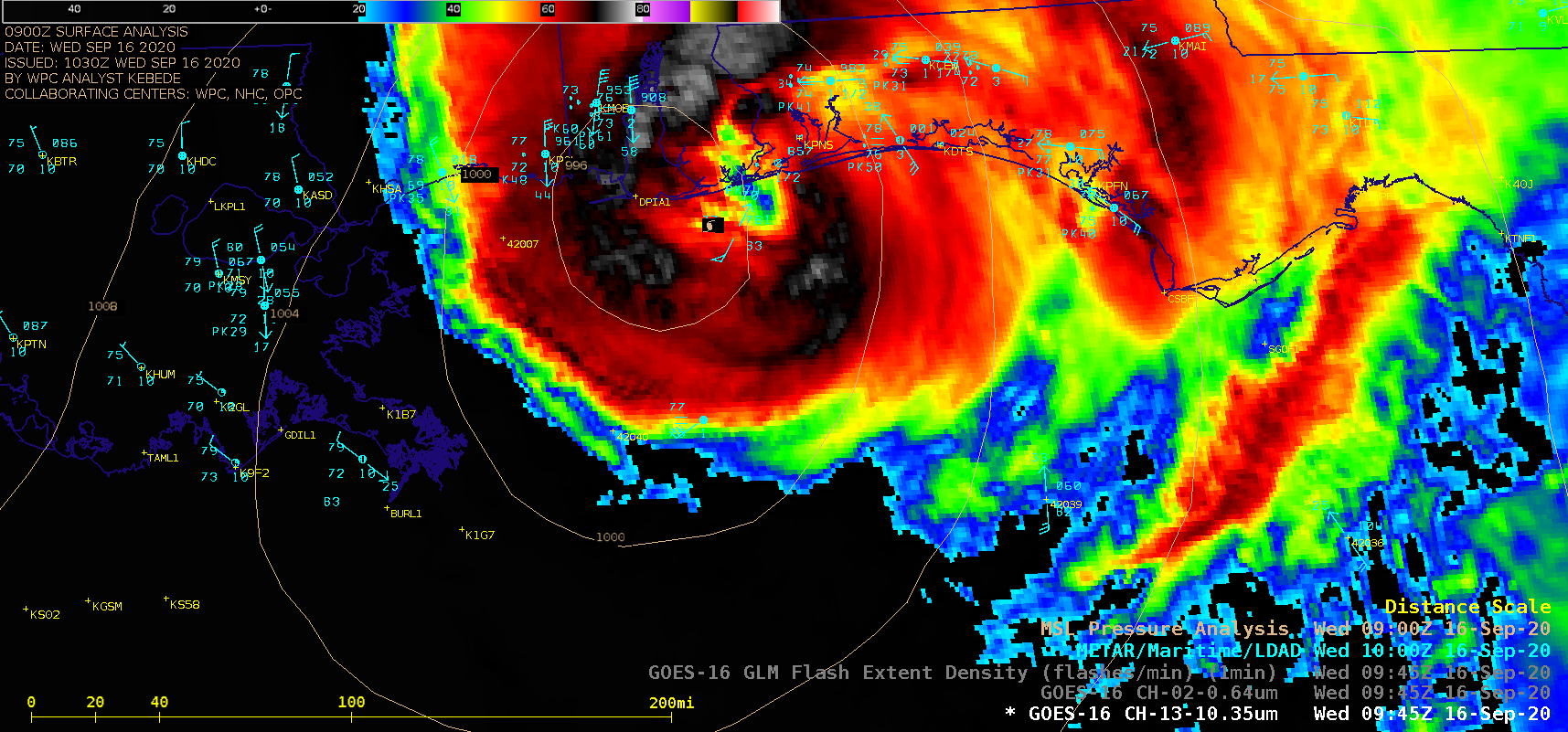
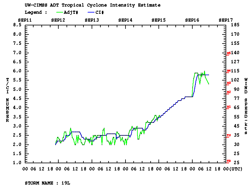
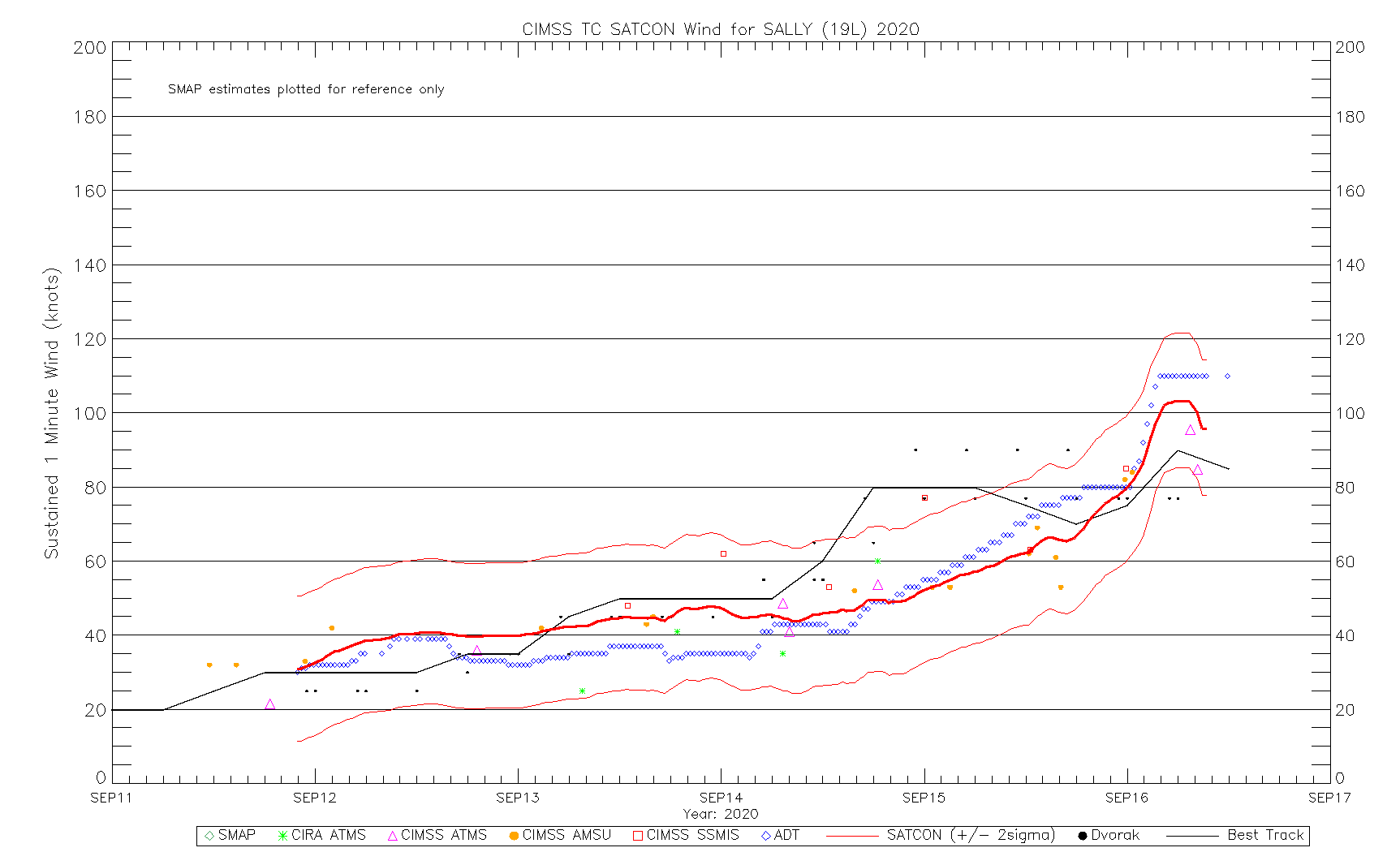
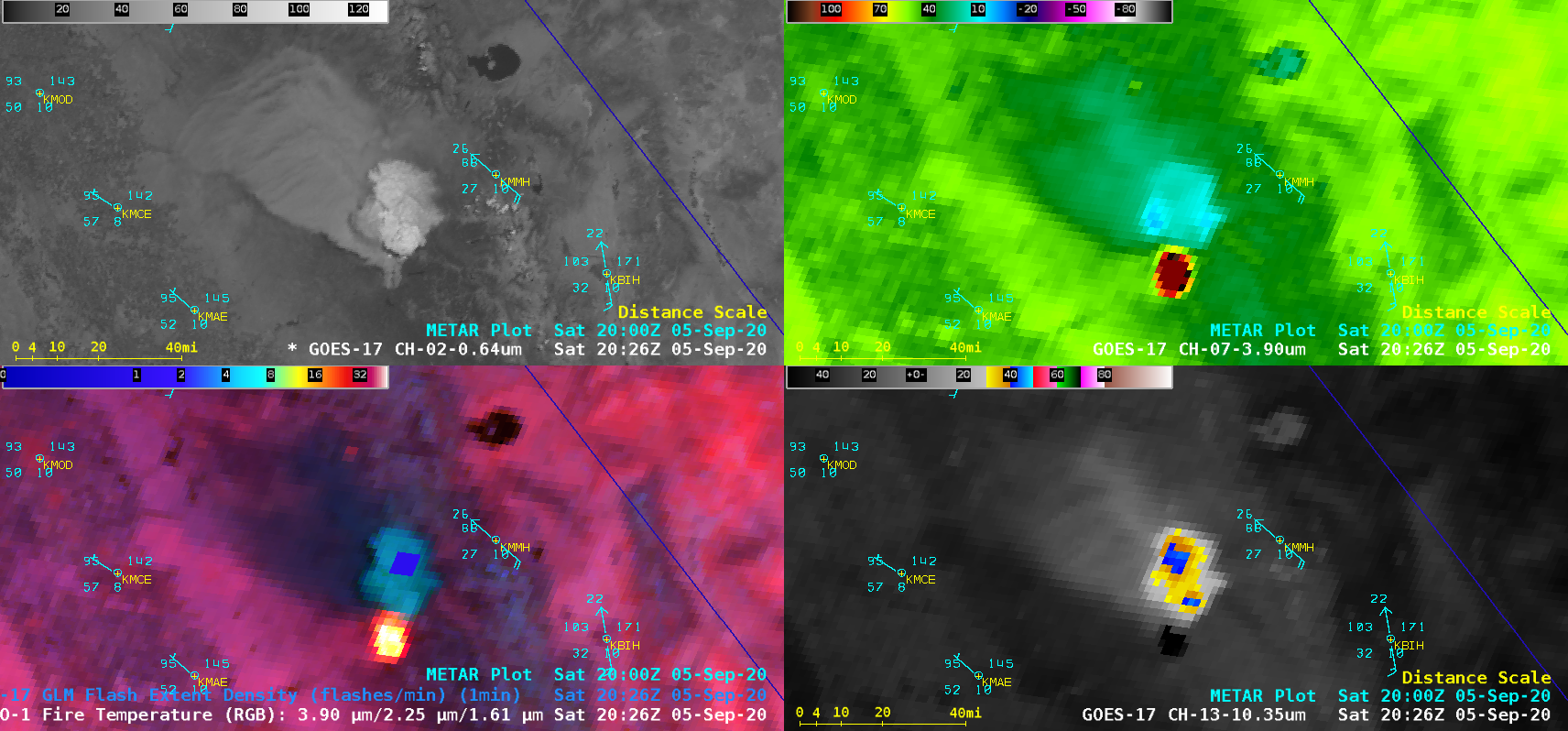
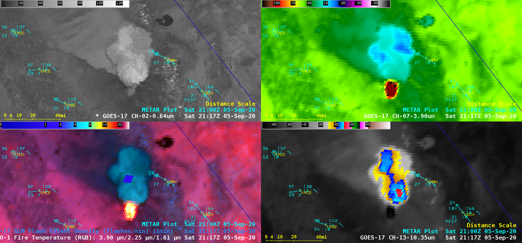
At 0500 UTC on 16 September 2020, Hurricane Sally rapidly intensified (ADT | SATCON) to a Category 2 storm, and soon thereafter made landfall near Gulf Shores, Alabama at 0945 UTC. During that time period, 1-minute GOES-16 Infrared imagery — with and without an overlay of GLM Flash Extent Density (above) — displayed... Read More
