Perryton, Texas tornado
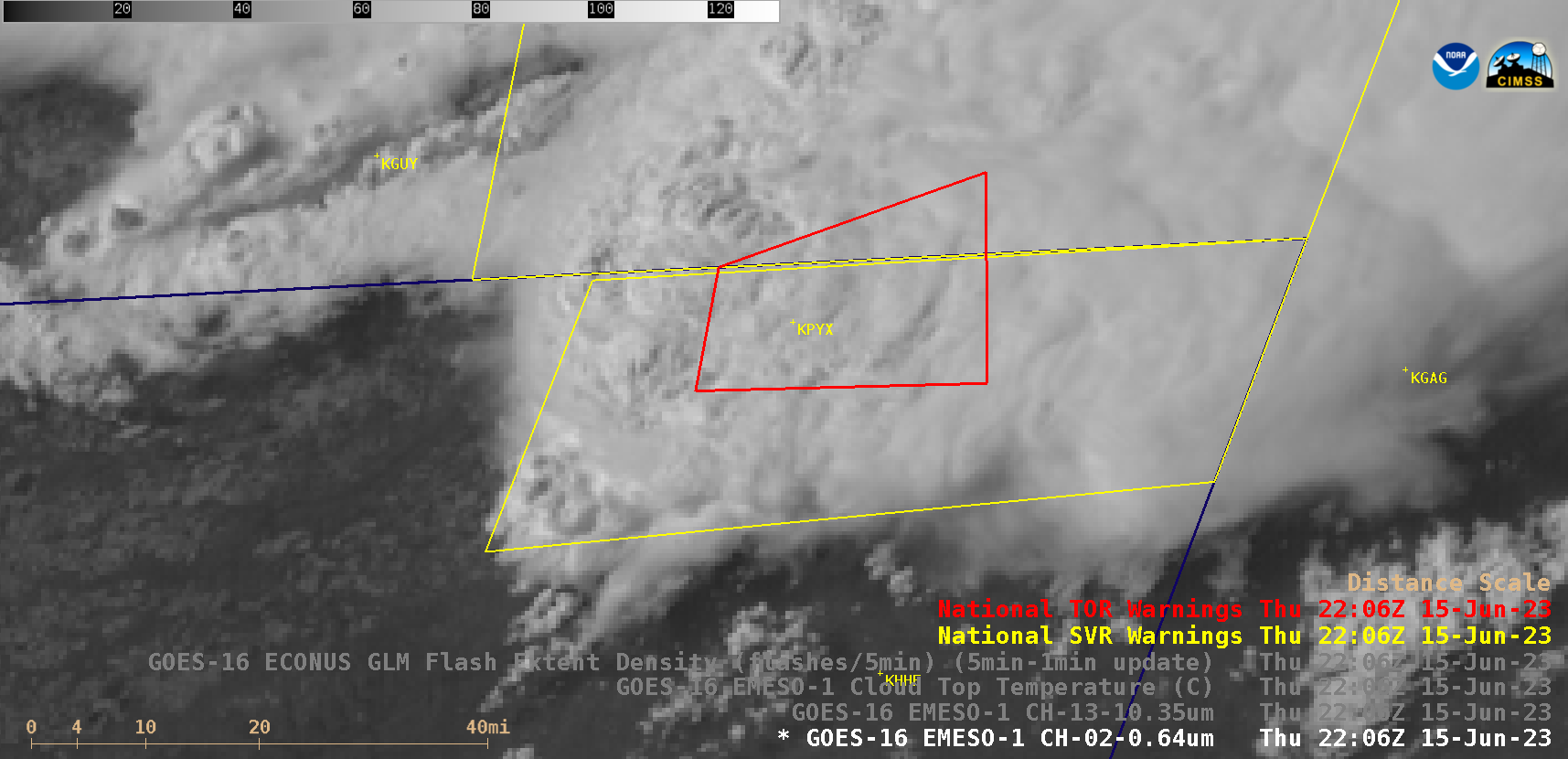
1-minute Mesoscale Domain Sector GOES-16 (GOES-East) “Red” Visible (0.64 µm) images (above) with/without an overlay of GLM Flash Extent Density (above) showed the development of a thunderstorm that produced the fatal EF3-rated tornado that moved through Perryton, Texas (located about 4 miles southwest of airport identifier KPYX) from 2206-2217 UTC on 15 June 2023. A modest amount of lightning activity was associated... Read More
