Heavy Rain and lightning over American Samoa
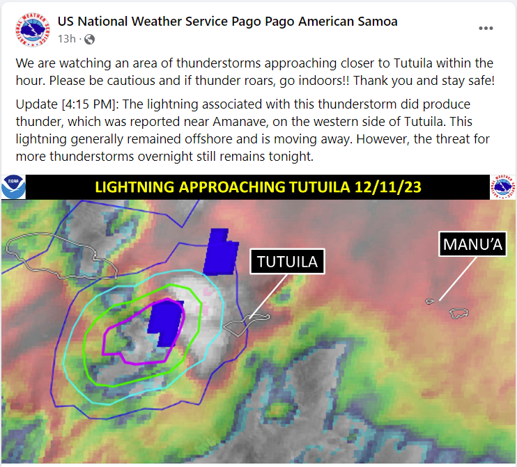
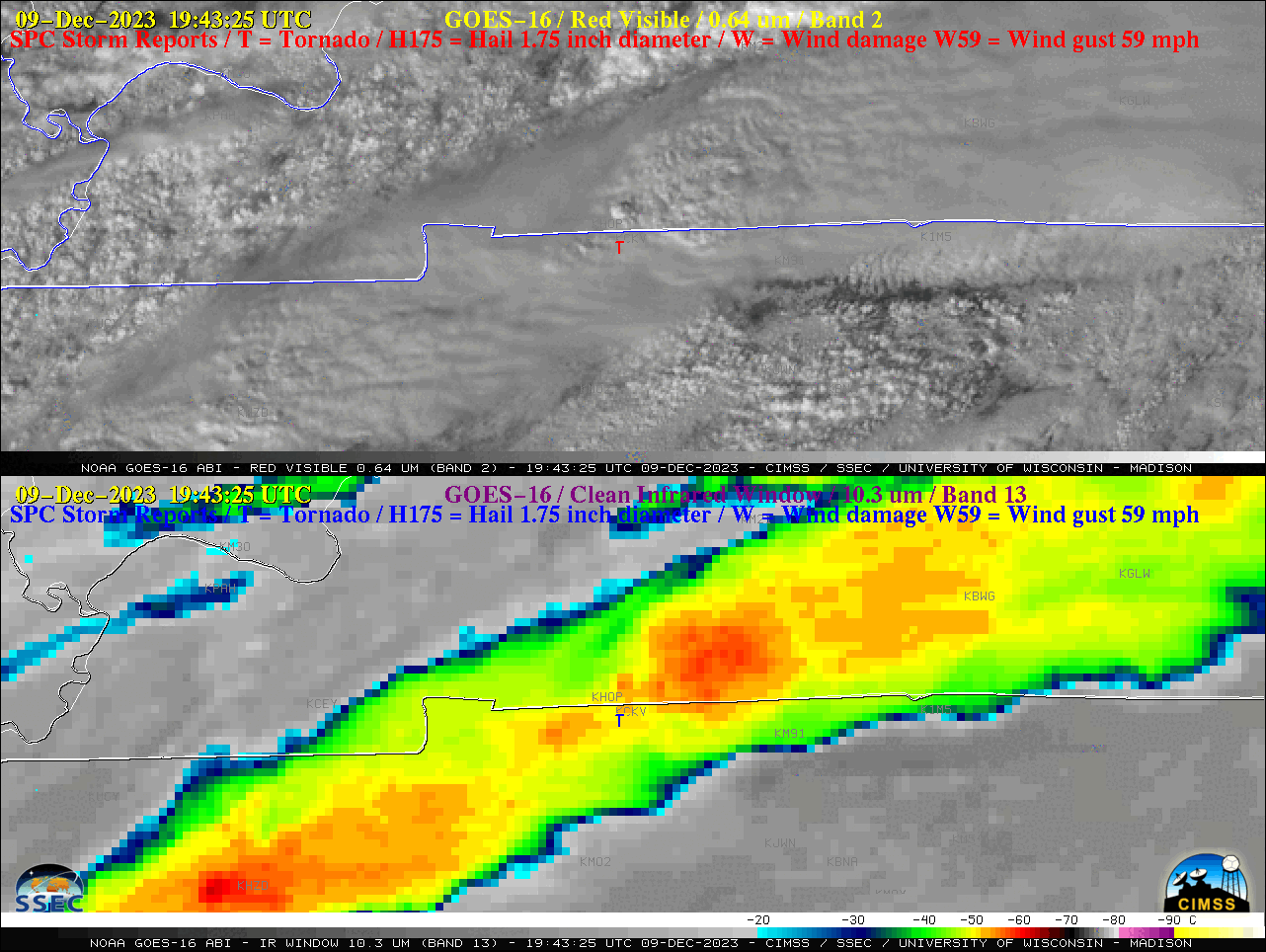
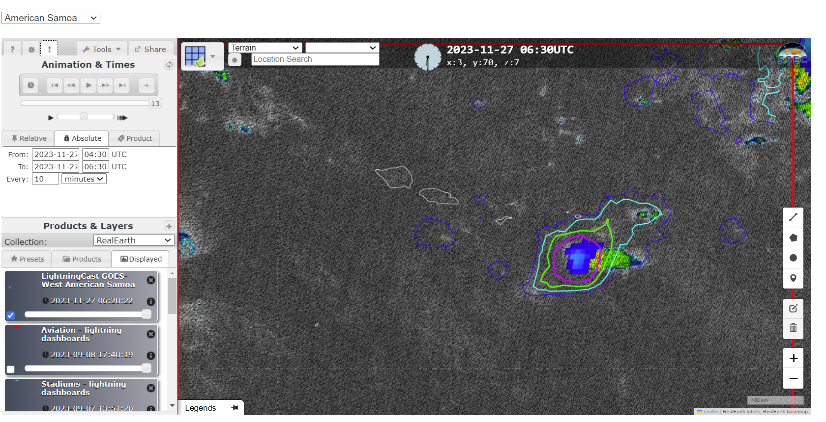
National Weather Service Pago Pago Facebook posts on 11 December describe an atmosphere primed for heavy rain and lightning, the latter Facebook also shown below. Band 13 animation, above, shows persistent deep convection over the Samoan Islands. The convection develops and drifts southward.MIMIC Total Precipitable Water over the south Pacific shows... Read More
