LightningCast probability with a High Plains blizzard
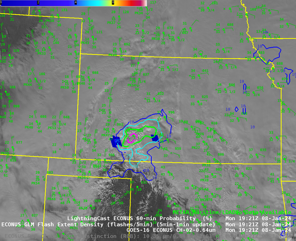
Blizzard warning were hoisted over the high plains of Kansas, Nebraska, New Mexico, Texas and Oklahoma for a strong storm on 8 January 2024 (image from the weather.gov website). The animation above shows visible imagery overlain with LightningCast probabilities centered over Kansas. Convection occurring over the cold aid will lead... Read More
