Lake Erie lake effect snow band produces thundersnow in western New York
GOES-16 Day Cloud Phase Distinction RGB images with an overlay of GLM Flash Extent Density, from 1757 UTC to 2015 UTC on 27 November [click to play animated GIF | MP4]
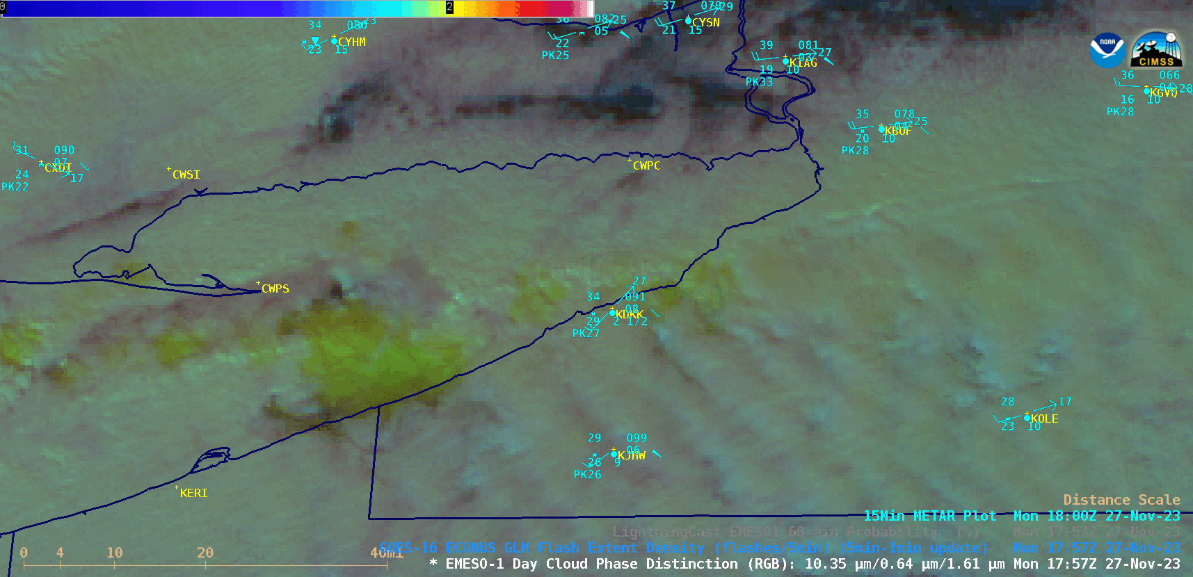
1-minute Mesoscale Domain Sector GOES-16 (GOES-East) Day Cloud Phase Distinction RGB images with an overlay of GLM Flash Extent Density (above) showed a glaciating (brighter shades of green) to glaciated (pale shades of yellow) lake effect snow (LES) band streaming inland off Lake Erie on 17 November 2023. There were 4 brief periods of lightning activity seen just south of the Buffalo, New York metro area. Note: since Flash Extent Density (FED) values were relatively low, the maximum value of the default FED colormap range was adjusted to 2.5 (to emphasize peaks within the low-FED areas).
A closer view (below) showed that the FED-indicated lightning activity was centered over the Southtowns (southern suburbs) of Boston — which had received up to 8.5 inches of snow by about 2300 UTC on 27 Novembver.
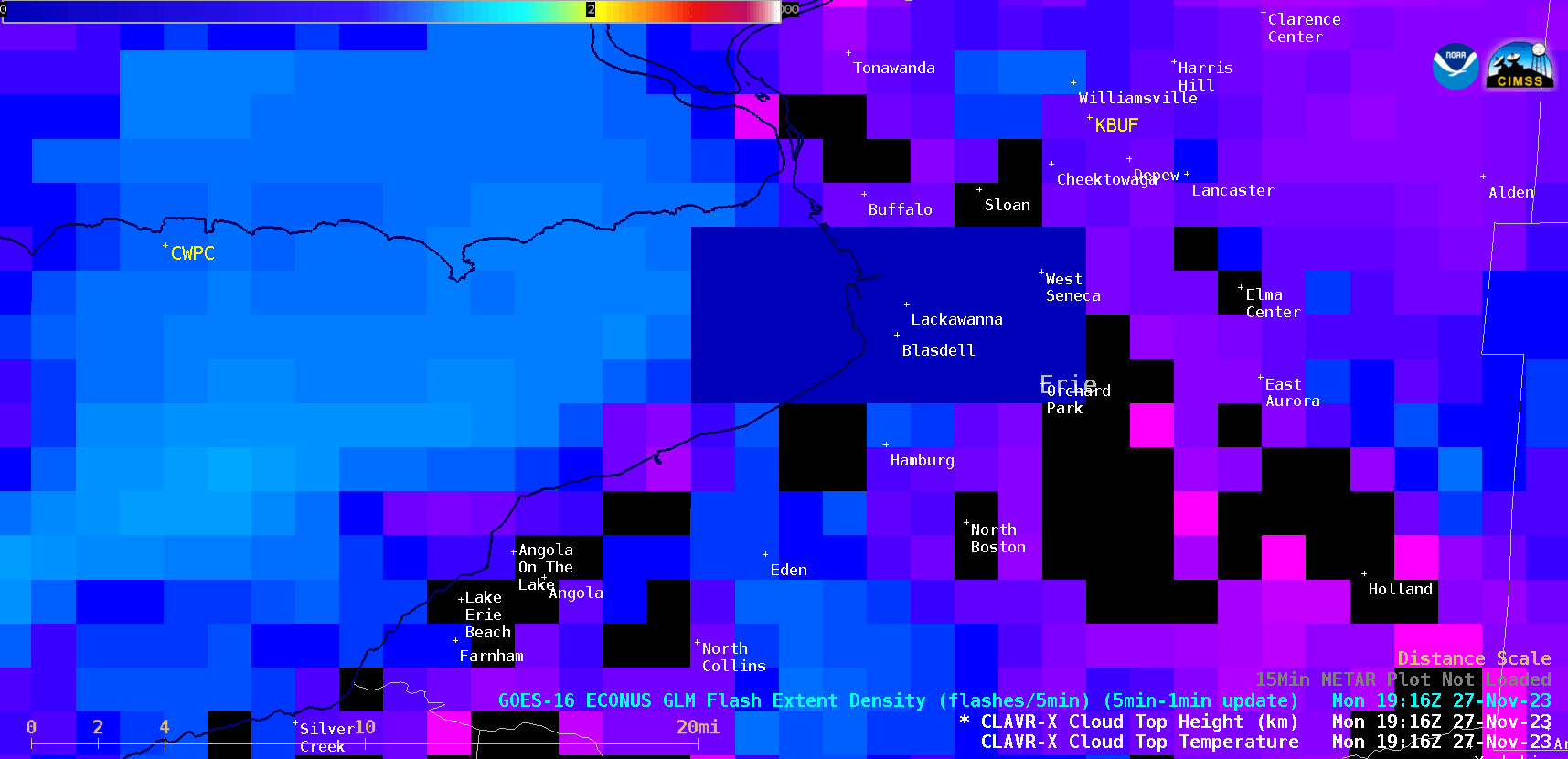
GOES-16 CLAVR-x Cloud Top Height images, with an overlay of GLM Flash Extent Density, at 1916/1926/1936/1946 UTC on 27 November [click to enlarge]
Cursor sampling of 2-km resolution GOES-16 CLAVR-x Cloud Top Temperature and Cloud Top Height derived products (below) indicated that the coldest cloud top temperatures within the lightning-producing LES band were in the -18 to -19°C range, with maximum cloud top heights in the 12000-13000 ft range.
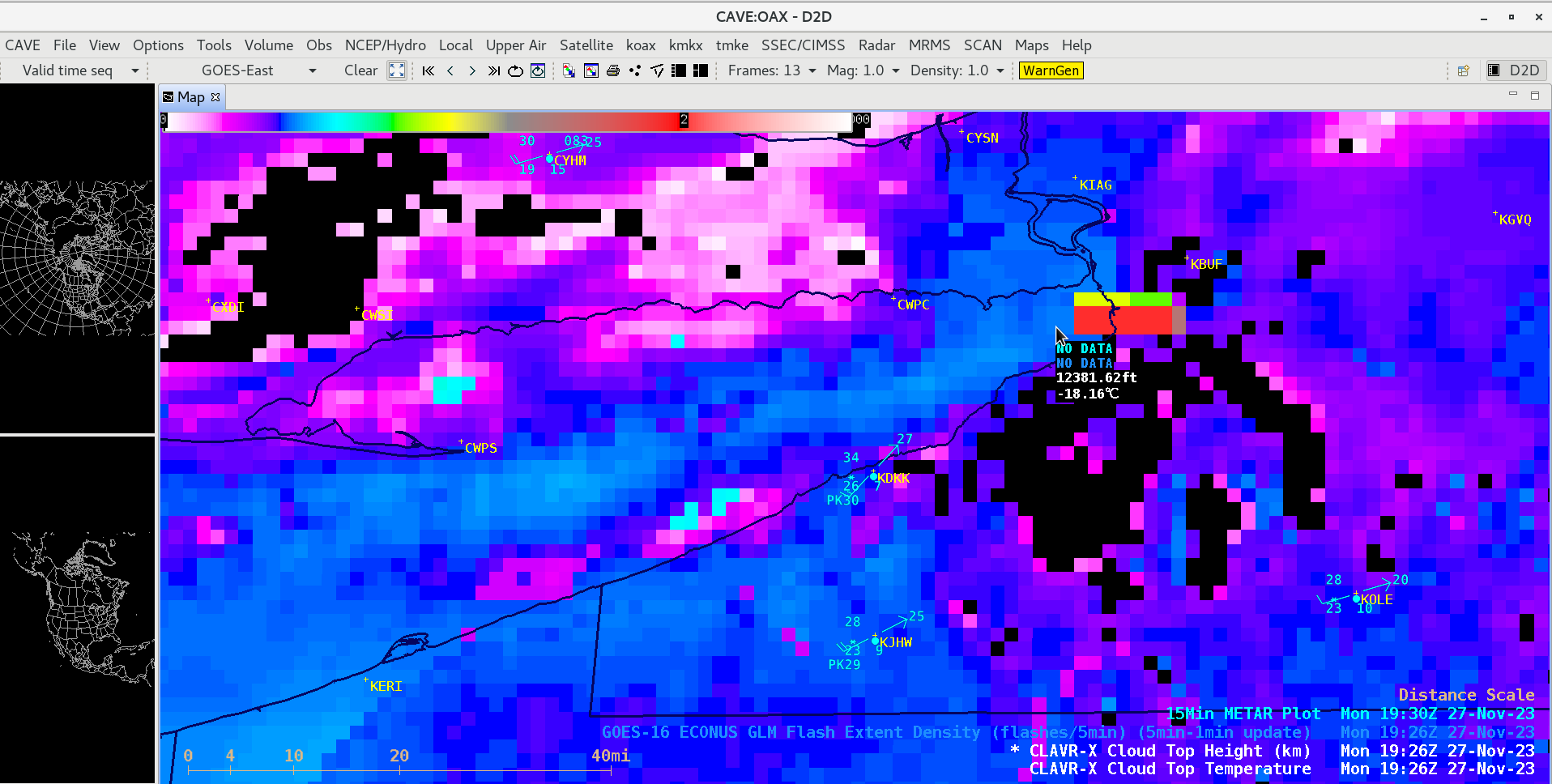
GOES-16 CLAVR-x Cloud Top Temperature derived product, with an overlay of CLAVR-x Cloud Top Height and GLM Flash Extent Density at 1926 UTC on 27 November [click to enlarge]
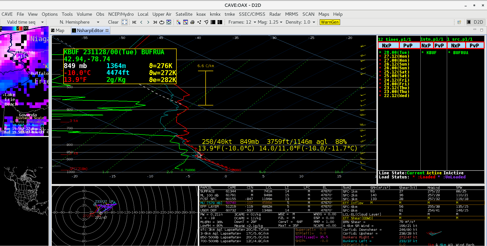
During the next several hours, the LES cloud band slowly migrated southward — GOES-16 Nighttime Microphysics RGB images with an overlay of GLM Flash Extent Density (below) suggested that the cloud tops were mixed phase (ice crystals and supercooled water droplets — shades of tan to light brown), which is a necessary condition for charge separation processes within the cloud that lead to lightning production. Another favorable thundersnow factor was a sufficiently high -10°C air temperature level of 1.1 km (reference), as seen in 0000 UTC Buffalo rawinsonde data.
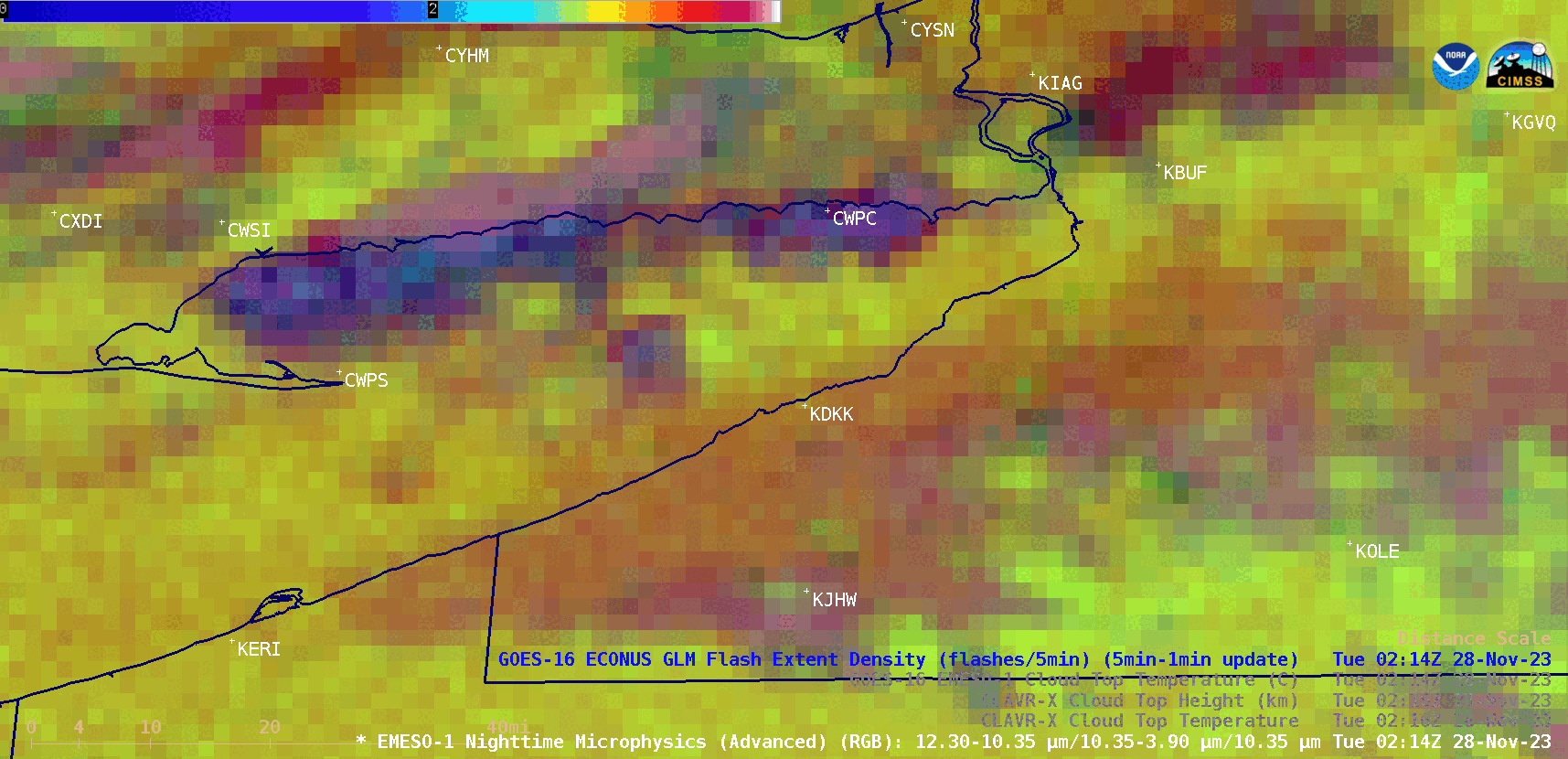
GOES-16 Nighttime Microphysics RGB images with an overlay of GLM Flash Extent Density, from 0214 UTC to 0315 UTC on 28 November [click to play animated GIF | MP4]
Beginning at 0253 UTC on 28 November, notable bursts of FED lightning activity were seen in the vicinity of Chautauqua County/Dunkirk Airport (KDKK) — which reported a thunderstorm (TS) that lasted from from 0257 UTC to 0312 UTC, and thundersnow (TSSN) at 0306 UTC (below). The surface visibility at that site dropped from 6 miles at 0310 UTC to 1-1/4 mile at 0320 UTC. Thanks to Rick DiMaio (Loyola University) for bringing these KDKK observations to our attention.
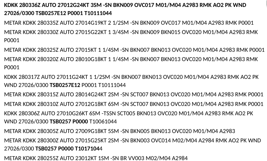
METAR reports from KDKK, with mentions of a thunderstorm TS in bold text (credit: Rick DiMaio, Loyola University)